
We had a break in our diving action after Davis Reef while we dodged what became Tropical Storm Laura. For that we holed up at Oleta River State Park in North Miami. As the remnant winds due to Laura were leaving the Keys we started back down the ICW to Biscayne Bay National Park on the Atlantic side of Elliot Key, which is the first of the Florida Keys. There are numerous wrecks along the Florida reef, which extends from Fowey Rocks Lighthouse down to the Marquesas Keys. Many are in water too deep for our hookah (or for me period!), but those on the Maritime Heritage Trail in Biscayne Bay National Park are all shallow, and I wanted to dive on some of those. We dove three of the six marked wrecks, plus we dove the corals at Fowey Rocks Lighthouse, which is also part of the maritime trail.
We first attempted to dive the Alicia which sank on Long Reef in 1905. (Long Reef refers to the section of the Florida Reef where the Maritime Heritage Trail wrecks are located.) We gave up after about 20 minutes due to the strong current and 3-5 foot surge that had not been forecast. We saw only a few pieces of debris, and I didn’t get any pictures from that dive worth posting.
The next day we dove three wrecks that were all within about 1.5 miles of each other. The conditions were perfect, so we had ample time to explore each wreck and I got lots of pictures and video from each. These are the fodder for this and my next two posts, one dive per post.
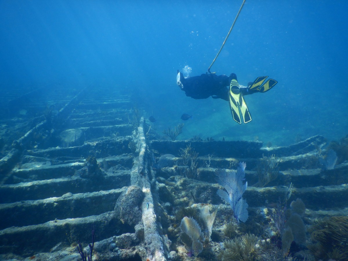
The Erl King was a 306 foot iron-hulled three-masted steamer built in Scotland in 1865. It ran aground on Long Reef in December 1891 en route from Swansea, England to New Orleans. Much of Erl King’s cargo and some of its machinery were salvaged at the time. The remains now lie in about 18 feet of water, including casts of the wooden barrels of dry concrete mix it had been carrying; the wood long gone, the concrete now solid. Before we picked up a dive mooring, Dave wanted to play with his sonar. He drove us around the area until the wreckage showed up on screen. It was really cool, because we saw it on screen, then looked over Lady’s side and saw that same wreckage through the calm ocean waters! We spent an hour exploring the wreckage and enjoying the fish, including a school that greeted us as we entered the water and saw us off as we exited later.
When I googled the wrecks for some history, I discovered this ArcGis storyboard of the Maritime Heritage Trail. For each wreck there is an interactive 3D model one can manipulate, with several key elements clickable for more information. This was how I was able to identify things like the mast step and disarticulated stern debris. I will be using this to help me accurately label the next two wreck dive video slideshows. Check it out if you get a chance and play around with it yourself.
I took a bunch of pictures and video. The videos capture the wreckage well, but the images let you pause more easily at individual spots with no video pause blur. So I’ve included both, which makes this slideshow longer than my others (~4.5 minutes) but, I hope, easier to process visually.
Enjoy!

I need to start compiling a list of places to see in the keys based on your blog!
LikeLiked by 1 person
You have put a lot of work into making these videos.
LikeLiked by 1 person