Exploring Antigua by Land & Sea

We left Barbuda at 8:00am on May 4th to return to Antigua. There was a strange vibration around our starboard motor, so for half the trip we ran just using the port motor. Once we got into the calm waters inside Boone Reef on the north side of Antigua, we started the starboard motor again, because the vibration was only happening when we were slewing to the left during a roll over a swell, and the water inside the reef was flat. Dave later discovered that the vibration is due to something minor related to how the external pieces abut each other.  It can wait to be fixed once we’re on the hard in St. Kitt’s.

We were anchored in Parham Bay, on the north shore, just before 4:00pm and shortly thereafter dinghied ashore to pick up a few items at the local market. We asked one of the fishermen where the market was and he gave us directions. It closed about 20 minutes before we got there. Bummer! There was supposed to be another market around the other side of town, but we decided not to walk that far lest it also be closed, being Sunday, after all. Plus, we were exhausted from our seven-hour cruise down from Barbuda, and it was hot. We’d come back in the morning. 

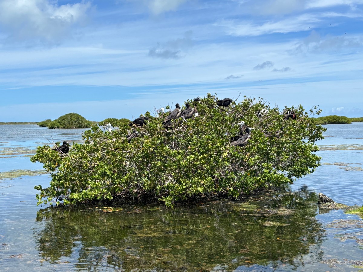
It was a good thing we decided not to seek out that second market Sunday evening, because when we went in search of it the next morning, it was not where Google Maps and our cruising guide (which also had the wrong market name) had it marked. We did find it, however, thanks to the directions of another local, and procured the handful of items we sought. We went back to Lady and moved about three miles east to anchor off Great Bird Island. It was a much prettier and quieter anchorage than Parham Bay, which hosted a boatyard and a power plant, the latter emitting a low, persistent, rumbling sound. In addition, we could see the bottom at Great Bird. After lunch, we snorkeled some bits of reef in the shallow water off Great Bird. It was both depressing and a bit hopeful. We anchored dinghy in sand, but her stern was floating over an immense stand of dead staghorn coral. So sad. Looking closely, however, I noticed that there is new staghorn growth coming off the ends of some of the old, dead base. These bits were 6” long or less, but it’s a sign of rebirth. Coral grows very slowly; perhaps in the not too distant future this reef will thrive again (she says, hopefully, not really believing the words she types). At other parts of this shallow reef, there were also some soft and encrusting corals, also signs of hope. 

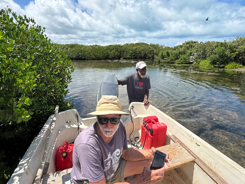
The following morning started with rain and solid overcast, but by early afternoon the rain had stopped and the sun was peeking out occasionally, so we decided to snorkel again. This time we took dinghy to Whelk Rock, about ¾ of a mile from Great Bird. This reef is immense! It was at spots breaking the surface and got down as much as 15-20 feet in other spots. The base coral structure was, again, dead, but there was a lot of regrowth of soft and encrusting corals, and there were some fish, the usual suspects. Again, this reef system must have been amazingly beautiful in the not too distant past. 😔

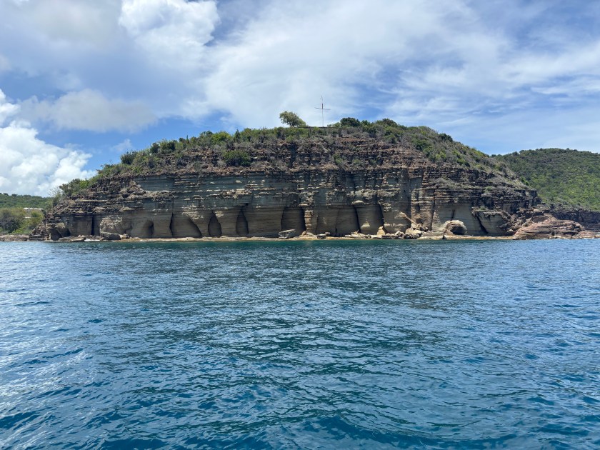
We’d had enough of mostly dead reefs, so the following morning we headed to the south coast to anchor in Freeman Bay, just outside of English Harbor, home of the historic Nelson’s Dockyard. Conditions were quite calm, so we were able to take the shorter route through a channel at the north end of the reef system, then cruised down the east coast of Antigua. It only took about three hours, so we were anchored in plenty of time to snorkel the Pillars of Hercules. The snorkeling, as expected, was pathetic, although we did see some good-sized fish, as well as scattered corals and sponges, the latter of which we had not seen on the other Antiguan and Barbudan reefs. The Pillars, however, are quite impressive. These limestone structures were carved out of the cliff by thousands of years of erosion by wind, rain and crashing waves. 

Pillars of Hercules

We swam directly from Lady to the Pillars and back. Once we dried off, we made ourselves presentable and went ashore to the Port Authority to pay the requisite fees for staying in this anchorage. Both English and neighboring Falmouth Harbors, plus the land immediately surrounding both, are part of the Nelson’s Dockyard National Park, thus the fees. We paid a one-time per person entry fee for the park, a daily per person garbage and environmental fee, and a per-foot/per night boat length anchoring fee. Our 5-day/4-night total for three people was under $100 US. Not too bad.

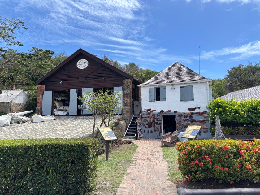
After paying our fees, we bopped around Nelson’s Dockyard a bit so Ian could see it. Then, we walked the short distance to Falmouth and found a restaurant for dinner. Just as we were leaving the restaurant, it started to sprinkle. By the time we got back to dinghy, tied up at Nelson’s Dockyard, it was raining. By the time we got back to Lady, we were soaked to the point where we had to wring out our clothes. Then we had to make room for our wet clothes and ourselves inside, which we managed. It could have been much worse, because there were thunderstorms around us, but they, and their associated lightning, stayed away as we passed the wet evening inside playing cards. 

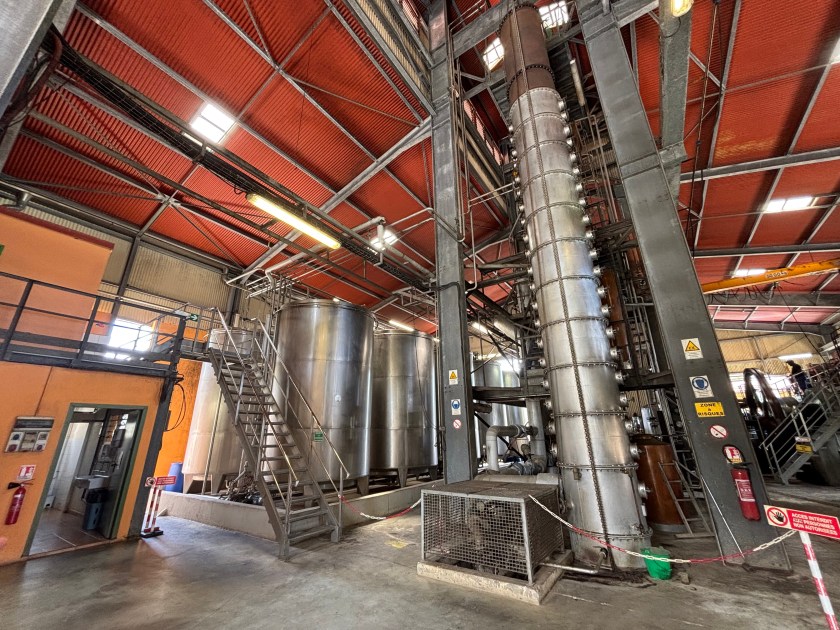
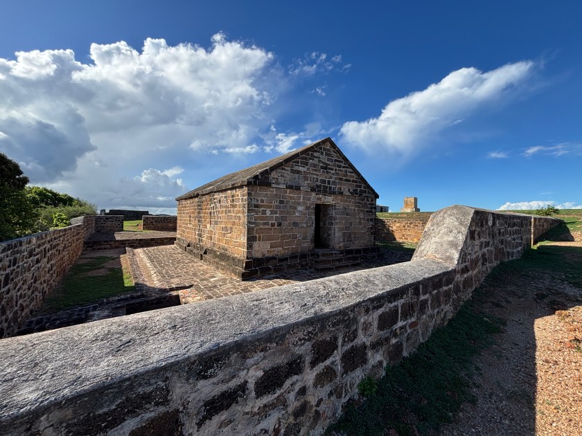
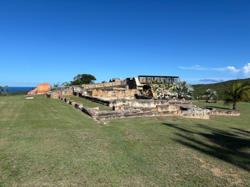
The Freeman Bay anchorage is small and very close to land, and therefore bugs, so we moved over to Falmouth Harbor the next morning, right after breakfast. There was a better breeze and we were further from land, but still only a short ride to a dinghy dock. Shortly after anchoring, we dinghied ashore to pick up our rental car, then we set off to tool around the island for the day. First we followed a largely coastal route across the south coast and up the west coast, stopping at a little place in the town of Five Islands for lunch. We inadvertently drove right through the busy heart of St. John’s after our attempts to circumnavigate it failed (thanks, Google Maps 🙄), then headed east/southeast stopping at Betty’s Hope Sugar Factory ruins to explore those. They had a concise, informative display about its history and that of the sugar industry on Antigua, and the remaining ruins are clustered nearby. It was worth the $2 US donation per person, even though we only got 30 minutes to tour it before they closed for the day. We continued back toward English Harbor to Shirley Heights Lookout for Reggae night, stopping to look at some of the Shirley Heights Fort ruins first. Dave and I had gone a few weeks earlier to their Sunday night music event, but didn’t eat because the line was hours long. This time, there were far fewer people and no line for the food, so we had a nice dinner, listed to the introductory steel drum band, and left before the Reggae even started. We were all tired, and our early departure got us back to Lady before it was fully dark. 

Betty’s Hope windmill and old gears (on the ground)
Block House at Shirley Heights

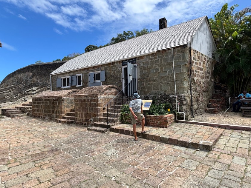
Yesterday we spent another day with the rental car exploring Antigua. We started by going to Clarence House which has served as home to British Navy Commissioners and later to Governors of the Leeward Islands. Sadly, they only do private tours on certain days, and Fridays was not one of them. So, we headed over to the Dow Interpretation Center to look at the limited remains of Fort Dow, and to watch the 15-minute audio-visual presentation about the history of Antigua and English Harbor. It was a good overview, but Dave and I had already learned the content when we visited the museum in St. John’s shortly after arriving here.

Fort Dow

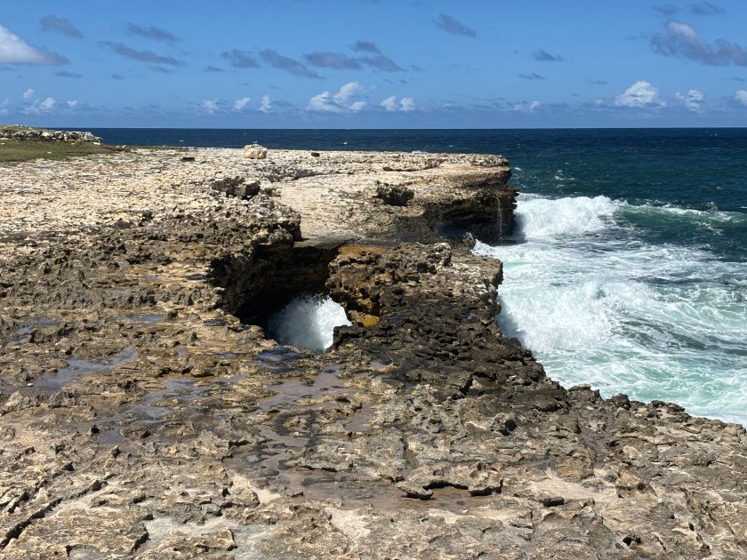
With our history lesson finished, we continued our driving exploration of the island by heading up to Devil’s Bridge National Park at the northeast corner of the island, stopping for lunch in Long Cove first. Devil’s Bridge is a low, natural limestone rock arch and surrounding blowholes, carved out by the crashing waves from the open Atlantic- nothing between it and Africa other than ocean. It was interesting enough. The seas weren’t that big, so the wave crashing was less impressive than I would imagine it is when the Trade Winds are higher. I took some photos, but our timing was bad for sun position, so they don’t really show the bridge well. Alas!

Devil’s Bridge

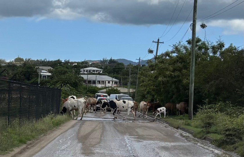
After Devil’s Bridge, we just tooled around the island a bit longer on the speed-bump and pothole-riddled roads. We attempted to reach Body Ponds Nature Park, but our attempts were foiled, at both its entrances, because Google Maps, at least on this island, does not distinguish between paved roads and unpaved/heavily rutted/almost washed out roads/cow paths. (Thanks again, Google Maps!) We gave up and headed back to Falmouth, stopping for a beer at a little craft beer brewery before heading back to Lady. (The boys report that the beer was “okay.”)

Antigua traffic jam 🙂

This morning we gassed up and returned the rental car after making a stop at Budget Marine for a couple of replacement blower fans and a cabin fan. We also popped over to Port Authority to see about renewing our cruising permit, which expires today. We learned that (a) cruising permits can only be renewed in Jolly Harbor, where we are not, and (b) if we stay anchored where we are until we leave the country, we don’t need to renew the permit at all. 

Ian leaves us tomorrow. We want to head to Montserrat for a few days before heading up to St. Kitt’s. We’ll probably choose option “b” from above, since we’ll probably head to Montserrat early this coming week.

My next post will either be from Montserrat or St. Kitt’s & Nevis. Until then, stay safe, and take care of each other!

Barbuda, on the other hand…

Barbuda is better. Much better!

We didn’t do much in Antigua after my last post on 4/26, other than prepare for the arrival of our friend, Ian. We moved back to Jolly Harbor, did a little provisioning and some boat chores. Ian arrived Sunday afternoon and we just talked the rest of the day, through dinner and until bed. The morning of the 29th we popped ashore so I could use some WiFi and see a doctor to make sure there was nothing wrong with my right ear, which had been off and on extremely itchy deep in the eustachian tube. Other than a little irritation, all was clear. Good. That afternoon we moved up to Dickenson Bay at the NW part of the island to stage for our jump to Barbuda the following morning. 

We hauled anchor around 8:00am the morning of 4/29 and had a comfortable 6-hour cruise up to Barbuda. Thus far, it’s been the most comfortable crossing we’ve had this season. We were anchored up near Codrington Lagoon by 2:00pm. 

Barbuda, with a population around 1600-2000, lies about 30 miles north of Antigua. Together with Antigua, they gained their independence from Great Britain in 1981. Barbudans didn’t necessarily want to be part and parcel of a single nation-state with Antigua, and their relationship is fraught, to say the least, especially since Hurricane Irma, but that’s a story I don’t know much about. The 62 square mile island’s length is oriented NW to SE. It is composed largely of limestone and volcanic rocks from a long-extinct volcanic arc. The highest point of land on the east side tops out at about 125 feet above sea level. The west side of the island is characterized by Codrington Lagoon, a saltwater lagoon about 6 miles long and about 1½ miles wide at its widest point. 

For most of its existence, the lagoon’s connection to the open ocean has been an inlet through the mangroves on the northwest corner of the island. It is otherwise separated from the open ocean by a long, narrow, sand spit. Codrington Lagoon is ecologically important for several reasons. First, it serves as the nesting grounds for the largest Magnificent Frigatebird colony in the world. It is also home to several other bird species, the rare Antiguan racer snake, and the smooth-headed iguana. It is a nursery for lobster, conch and fish that are important to the Barbudan economy. For example, they export lobster throughout the world. The lagoon and its sand spit also protect the island’s main settlement of Codrington from impacts of storm surge and hurricanes. In the past, two hurricanes (one the 1960s and the other in the 1990s, I believe) have breached this sand spit, but it repaired itself within two years or so. Hurricane Irma in 2107 breached this divider again, only instead of repairing itself over the past several years, the breach has become wider, reaching almost 2 miles! If this breach doesn’t repair itself, it will have lasting impacts on the island and its inhabitants, both human and non-human. (Cited from Smith Warner International.)

The morning after we arrived at Barbuda, we set out in dinghy at 8:30am to meet our guide for the Frigate Bird Sanctuary, a tour we had arranged before our arrival.  We met George Jeffrey at the Codrington fishing dock, and the three of us, plus two other cruisers set off with George to see the birds. The first stop he made was well outside of the sanctuary where George told us a bit about the sand spit breaches I mentioned before, plus a little about the current troubles between Barbuda and Antigua. Then he took us to a small sandbar where he stopped again. That sandbar, devoid of all but a handful of tiny new growth mangroves, is the former site of the sanctuary. In 1960 (maybe 1961?) a hurricane hit Barbuda. Before its arrival, the Frigatebirds flew off to evade the storm. Upon their return, they found their mangroves gone, so they just flocked to another section of mangroves a little further north, and they’ve been there ever since. Then it was time to meet the birds.

What an amazing sight! In a stretch of mangroves approximately ¼ x ¾ of a mile, are thousands upon thousands of birds (I’ve seen estimates ranging from 12,000-20,000). The mangroves were heavily laden with (mostly female) adults and chicks of various ages. They were squawking, but it wasn’t as loud as I’d expected. George got out of the boat and slowly maneuvered us through the shallow waters, through upsidedown jellyfish-infested waters (they don’t sting) around the mangroves so we could observe them closely. We spent about a half hour just watching the birds. They are the national bird of Antigua & Barbuda and are on the Barbudan flag. George told us a bit about them, and I looked up more information later, all of which I share below (and include the links I used so you can read more if you like). There are pictures at the end of this post.

Frigatebirds are agile aerialists, that can fly for days on end, but they don’t go into the water. Their feathers, in fact, are not waterproof; they would be unable to lift themselves back out of the water. They feed on small fish (locally, flying fish are a favorite) which they scoop from the water’s surface, or steal from other birds. Adults are about 3½ feet long (beak to tail) with a wingspan of about 7½ feet. They have a deeply forked tail. All adults have black feathers, but the females’ chests are white while the males sport a bright red throat pouch. That throat pouch is how they woo females during mating season, which generally runs from September-April (peaking in December), which explains why we saw chicks of varying ages. Once a female has chosen her mate, the two build a nest where the female deposits a single egg. Both parents share the work of incubating the egg, which lasts about 50 days, and then feeding the chick. The males take off after about three months. The chicks fledge at about five months. The female continues to feed the chick for another four months or so. The chicks are fuzzy white and grow into their black feathers over time, with their heads changing color last. We saw newer chicks of fluffy white with only a few small black feathers forming on their wings, and we also saw older chicks just waiting for their heads to go black. (Audubon)(Lonely Planet)(Wikipedia)

Codrington Lagoon, where this colony resides, became a National Park in 2004. One can only enter the sanctuary with a local guide. The National Park only charges $5 per person to enter the sanctuary. Our tour with George cost $60 for all five of us together, so $12 per person. If you’re ever in Barbuda, I highly recommend taking this tour. If you can’t get George, there are several other guides as well.

The day after our Frigatebird tour, May 1st, we hauled anchor late morning and moved Lady to a reef anchorage on the south side of Barbuda, settling in Gravenor Bay. We spent two nights there, and this morning we moved about a mile closer to Spanish point at the southeast end of the island. There is a lot of shallow patch reefs to explore in this area, and we’ve explored many of them over the past 3 days. These are not very healthy reefs, but they’re better than what we’ve seen in Antigua. They are certainly heavily storm damaged, as evidenced by the coral rubble, and they also suffer from what ails all the reefs we’ve snorkeled and dived on in the Caribbean- bleaching, disease, and overuse (by incautious tourists). Unlike our experiences in Antigua, however, there is more sign of recovery here. We did not see any sponges, but there were many corals. A large number of them were sea rods, but there was quite a variety of other corals as well, just in smaller numbers. There were the usual fish suspects, and we saw several southern stingrays and sea turtles, and Dave saw an eagle ray. It was nice to finally have some snorkeling worth doing, and it was encouraging to see the regrowth.

Either tomorrow or Monday we will head back to Antigua to do some snorkeling on the north side reefs. Then we may move south to Falmouth Harbor to do some snorkeling there and explore the island’s interior by car before Ian returns home. 

Until next time, stay safe and take care of each other!

First week in Antigua

We’ve been anchored in Jolly Harbor on the west coast since our arrival on April 10th. It’s a convenient location for several reasons. It’s a very well protected harbor, so quite calm. A short dinghy ride brings us to an excellent dinghy dock at the marina where there are a variety of services available- car & bike rentals, SIM cards and data plans for two carriers, a variety of yacht services, restaurants, etc. There is a well-stocked marine supplies store (Budget Marine), and an excellent supermarket (the Epicurean). There is also a bus stop, which allows us to get to other parts of the island without costly taxis. Car rentals are pretty cheap and make it even easier to see the whole island (the buses don’t go everywhere), but we’ll save that for when our friend Ian arrives. 

We spent some time with our new friends on Pulpo before they left on the 15th. They rented a car on Sunday and invited us to drive around the island with them before heading over to Shirley Heights (ruins of a British fort) for a weekly night of music. We found lunch at a great little roadside Lebanese place, then walked the sargassum-covered beach nearby. The music at Shirley Heights started just after 4pm with a steel drum band that played for a couple of hours. They were followed by a cover band that did a bunch of reggae and pop music. There is also a BBQ on Sundays, but the line was long the whole time. Also, Lobo (Pulpo’s owner) owned a restaurant in the past and he was not impressed with the pre-cooked food all sitting out at ambient temperature for hours. We decided to pass on dinner. Fortunately, our lunch had been late and substantial, so we weren’t hungry anyway. There had to have been about 500 people at this outdoor venue! The music was good, and so was the people-watching. We had Lobo and Dan over for a final dinner together Monday night. 

Tuesday after breakfast, we took the bus up to St. Johns, the capital of Antigua. All the bus routes go through St. Johns, where one can transfer to other buses at the main bus depot. It’s about 20-30 minutes, with stops, from Jolly Harbor to St. Johns. We walked through the Market, a bunch of shops selling a variety of kitsch and local art, as well as produce and other food. Then we went to the Museum of Antigua and Barbuda where we learned about the history of the island, a little about its geology, and a bit about its culture. It has a lot of information packed into a small space, the bottom floor of the former courthouse built in the 1800’s. It was a bit challenging, however, because the information was in print I found too small to read without leaning forward over the glass display cases set in front, upon which we were not supposed to lean. I actually ended up using the magnifier on my phone to read everything, which worked nicely. After the museum, we found good local food nearby, checked out some other souvenir shops, and purchased a painting mounted on burlap to add to our art collection of places we’ve visited. The bus got us back to Jolly Harbor early enough to relax before dinner.

On Thursday we took two buses to get to English Harbor on the south shore of Antigua so we could visit Nelson’s Dockyard. By car the drive would have been 45-60 minutes. Between waiting for buses and all the stops they make, the trip took us almost two hours. It was a good way to see other parts of the island, though, and far less expensive than a car rental or taxi. Our round trip cost the two of us together all of $10 US. We got a later start than originally planned, so it was already time for lunch when we arrived. Once our bellies fed, it was time to tour the Dockyard. 

A little history, first. There was a light British naval presence in English Harbor from 1725-1740. When the French started to ramp up their efforts to thwart British trade in the Caribbean, the British started to rely more heavily on the location and started construction on the dockyard, which back then was known as the Antigua Naval Dockyard. The peak of construction ran from 1780-1820. With Napoleon’s defeat at Waterloo in 1815, the Caribbean was quieter and the British military relied on it less. Still, they operated it until 1889 when it was closed and abandoned, then fell into disrepair. In the 1920s, the then Antiguan Governor’s efforts to raise funds to restore the yard fell short. Efforts were made again in the 1930s, including rebranding it Nelson’s Dockyard, and by 1961 it had been reopened as an historic site. In 1984, the Dockyard and 16 square miles of historical and natural sites around it was classified as a National Park. In 2016, Nelson’s Dockyard and Related Archaeological Sites was named a UNESCO World Heritage Site. If you want more detail, you can visit the National Parks Antigua page or its Wikipedia entry

Both English and Falmouth Harbors, plus a good chunk of land around them, are part of the Nelson’s Dockyard National Park. Nelson’t Dockyard is a working marina, and there are several other marina’s in Falmouth Harbor. Anchoring in either harbor requires paying a daily anchoring fee, a daily environmental fee, and a one-time entrance fee for the park which allows one to enter the land parts for the duration of their stay. When Ian is with us, we’ll likely take Indigo Lady down there for a few days, because there is some easily accessible snorkeling nearby. We checked with the Port Authority while we were visiting the Dockyard and three days will cost us all of about $100 US. I wouldn’t want to stay any longer though; it would add up quickly.

They’ve done a lovely job restoring the old buildings, which are now all inhabited by modern businesses that cater to yachties. There are shops and restaurants, of course, but other buildings are inhabited by the marina office, Customs & Immigration, the Port Authority, a Sail loft for sail repair, an art studio, a bakery (interestingly in the building that originally served as the dockyard’s bakery), the museum, and others. Each building has a placard outside describing its original function in the dockyard. The museum is housed in the Naval Officers & Clerk’s House. It provides good information about the history of the dockyard, life in the British Navy, information about Nelson’s career, and it also has a room dedicated to the ecology of the island. I found it to be an interesting mix of historical and modern, and it really is lovely. This week is the Antigua Classic Yacht Regatta, so there were some gorgeous (VERY expensive) classic sailing vessels in the marina when we were there. They had a race that morning, but it was over by the time we arrived. It was worth the bus trip down, and we were lucky that the return trip was shorter.

Sawmill shed (now a sail loft) & Shipwrights Cabin (now an art studio)
The Bakery (still a bakery)
Naval Officers & Clerk’s House (now the museum & gift shop)

There are a couple of other places we’d like to visit by bus from our base here in Jolly Harbor. However, it is now Easter Weekend, and Friday and Monday are public holidays, so most things are closed those two days, as well as on Sunday. The sugar factory ruins we want to visit by bus reopen on Tuesday. This leaves us with little to do over the long weekend. The snorkeling in this anchorage is pathetic. Visibility is poor and there’s little to see anyway. The Donkey Sanctuary is open on Saturdays and public holidays, so we may try to go there, assuming the buses are running. These “buses” are privately owned 12-15 passenger vans, so it’s up to each owner whether they run on any given day. We assume someone will be driving Saturday. There’s a wreck to snorkel about 2 miles north of here, so that’s another option. I’m sure we’ll find a way to keep ourselves busy.

That’s all for now. Until next time, stay safe and take care of each other!

Guadeloupe to Antigua, at last!

I last wrote on April 1st (posted the 5th) and we were still in Guadeloupe. 

We were in Guadeloupe another eight days and in that same anchorage for five of them. Honestly, we were a bit bored. We snorkeled another time and dove two more times. I mentioned last time that we had met a couple of American cruisers when we went ashore one day. They are on a sailing catamaran called Pulpo (Italian for octopus). That was the saving grace for our sanity. We told them to stop by if they wanted to see our solar electric system, since they were interested in it. A couple of days later, they did so. The tour of our system turned into a few hours of socializing with cheese, crackers, salami and apple as dinner once we realized it was too late for a real dinner and we were all hungry. 😂  A couple days after that, we invited them over for pizza and had another enjoyable, rambling conversation for several hours. 

We and Pulpo ended up both moving north to Deshaies on April 7th. They picked up a mooring ball. We tried to anchor, but dragged, and the anchoring section was pretty tight anyway, so we went north one more mile to Grand Anse and anchored in lovely sand. Just the change of scenery was mood-lifting, and we spent the rest of the day reading in our hammocks and enjoying the new view. 

The following day, we did some travel planning over breakfast and decided that conditions looked sufficient for moving on to Antigua two days later, on Thursday, August 10th. In the meantime, we had two days to explore. So we packed a dry bag with stuff we’d need ashore, donned our swimwear, masks, fins and snorkels, and swam ashore. The swell, though not bad at anchor, was too dangerous for landing dinghy ashore, she would have been swamped; so we swam instead.

Once ashore, we put our snorkeling gear in the mesh bag we’d packed, retrieved our glasses, hats and shoes, and headed for a little shack that rents kayaks for paddling around the mangrove. We rented a two-person kayak from a very friendly man who told us the mangrove has only existed for forty years and resulted from dredging for sand to build elsewhere on the island. He gave us the mangrove map and explained the various “stopping points” labeled on it. Then we set off. It was lovely! It was mostly an open mangrove lake, but there was one area where we could wend our way up the mangrove “river” several hundred feet, dodging mangrove roots and ducking under branches. It was soothing and mystical-feeling, and absolutely beautiful. There was another spot where we could pull the kayak onto a dry patch and then hike a short path into a 200-year old stand of very tall palm trees. Imagine the storms they’ve seen and survived! They were quite impressive. There was very little growing under them, since they block most of the sun. The ground was littered with fallen palm fronds, very big palm fronds. Occasionally there was a frond still attached to the piece that wrapped it to the palm’s trunk. This felt sort of like vinyl, which surprised us both. After about 20 minutes of gazing in awe, we went back to the kayak and continued around the mangrove lake to a shady spot under a sea grape tree where we sat for a while listening to the birds all around us. One little bird perched on a low branch just in front of us and serenaded us for a while. How sweet! Eventually our tummies started rumbling, so we returned the kayak and sought out lunch.

We ate at one of the many small restaurants lining the parking area of this popular beach destination. This beach area is more like White Lake State Park in NH, minus the camping. It’s not at all like the New England beaches. Yes, it’s a long sand beach, but between the sort of paved parking and the beach is a good-sized area of sand and palm trees, offering people a place to set up for the day in the shade. The restaurants, a couple of food trucks, and one little souvenir shop outline the parking area.  The restaurants are more like glorified shacks, covered but open at the front and often the sides. Lunch was yummy. 

The following day, Wednesday, we needed to get our clearance papers stamped at customs in Deshaies. Although we could have dinghied from Grand Anse, we wanted the ease of dropping mooring lines rather than hauling anchor when we got underway at 6:00am the next morning, plus we wanted to see Pulpo again. So we texted them to ask if there were any mooring balls open, to which they responded yes. As soon as we finished breakfast, we hauled anchor and ended up grabbing a recently vacated mooring right next to Pulpo. Yay! We each did our own thing that day. They went for a monster bike ride around the area. Dave and I stopped at Customs for that clearance stamp, grabbed croissants at the local bakery, then walked back toward Grand Anse via the main road through town and then along a shaded road/path. We walked a bit into the forest to an old battlement, now sporting one lonely old cannon, then we exited the trees onto the far south end of Grand Anse and walked over the sand back to the main swimming area, then out to the main road and back into town. Pulpo invited us over for dinner and we spent another lovely evening eating and chatting. They would also be heading to Antigua the next day, but didn’t need to leave as early as us, since they can sail faster than we can motor.

Our alarm went off at 5:00am on the 10th. We had a quick breakfast, then dropped the mooring lines as planned at 6:00am and were off to Antigua. It was a tolerable passage, but not enjoyable. It was rolly and salty (that means we got splashed with sea water). As anticipated, Pulpo caught up with us, then passed us, arriving at Jolly Harbor about an hour ahead of us. The only two enjoyable events on the crossing included the sighting of what we think may have been a sperm whale off in the distance. We could see it tail slapping the water. The other brief event was Dave hooking a marlin, which, unfortunately, he did not land. He got to see it tail walk just before it shook off the lure. Bummer! For the first half of the trip we used the generators, until the sun was high enough that we could switch to just solar and battery. It was fairly cloudy, but the sun peeked out just often enough, and we were making good speed at an average of 6 knots, that we arrived in the anchorage at Jolly Harbor with 35% left on each battery bank. Dave dinghied into Customs to clear us in and met Pulpo there. They had brought their big boat into one of the Customs docks. They followed him back and anchored near us. They came over that evening for tacos and games. 

It is so good to finally have a new place to explore! There are many anchorages all around this island, and we’ll have 5-6 weeks to explore them. Pulpo will be here for another week or so, before they have to start heading back south for hurricane season. Our friend Ian will be joining us at the end of this month. 

The next time I write, it will be about our time here in Antigua. For now, enjoy the short video of our tour through the mangroves.

Until next time, stay safe and take care of each other!

Two more weeks in Guadeloupe

From  Marie Galante we popped back west to Îles des Saintes for some more snorkeling. We thought about diving, but the hookah is loud and there are a lot of people snorkeling where we wanted to dive, so we just snorkeled. The visibility is very good, so snorkeling is just fine. We spent two nights at Îlet à Cabrit, our favorite snorkel spot in Guadeloupe, and one night at Pan du Sucre. The snorkeling at the latter was good, but not as good as Îlet à Cabrit. 

Hoping late March would provide an opportunity to head to Antigua, we decided to revisit the west coast of Guadeloupe, where we had spent six days back in late January/early February as we island hopped down to Dominica. On 3/22, we headed north to the anchorage about 1 nm south of Basse Terre, outside Marina de Rivière-Sens. Shortly after arriving, we dinghied into the marina and tied up to the wall so we could walk to Fort Delgrés. It was only a 20 minute walk, which turned out to be a good thing, because the fort was closed due to lack of water. Bummer! So back to the marina we went. It was hot, but at least there was a breeze, and most of the walk was along a pretty esplanade. 

The next morning we traveled the 10+ nm north to the anchorage at Plage de la Malendure. We’d been here for two of those six days in early February and knew then we wanted to return. Just after our arrival and lunch, we snorkeled right off Lady on the north end of the bay, which we had not done last time. It was soon obvious why so many people from the little beach in the NE corner of this bay snorkel up and down this stretch; there is so much to see! It’s almost as good as Îlet à Cabrit. There’s lots of rock rubble for structure, covered in a fair amount of coral, including soft corals like sea fans, plus there were a ton of sea plumes (also a soft coral), many sponges, and lots of fish. The closer we got to the NW point, the more barrel sponges we saw. We snorkeled here two more times over the next few days.

Also while in this anchorage, we snorkeled the south and east sides of Pigeon island again, which we had done in early February. This visit, however, we also snorkeled the north and west sides. There is a lovely wall with lots of coral, sponges and fish. We thought it would be hookah-worthy for a dive, but weren’t sure it was worth setting up hookah for just one dive. There is also a spot with dive mooring balls just north of the NW point of the Bay, aptly named Pointe de la Malendure. We dinghied over to it and snorkeled there. Great reef! Now there were two spots we thought were hookah-worthy, and we knew there was another spot with mooring balls another mile north of this one. That afternoon, we set up hookah. We did dive the site just north of Pointe de la Malendure and the site one mile north of that, but we opted not to dive the wall at Pigeon Island. Pigeon Island is very busy with tour boats all day long, taking divers and snorkelers. Trying to navigate all that with the noisy hookah and two 60-foot hoses just seemed rude. The other two sites are much less busy. When we dove the nearer dive site, there was only one other small boat with divers, who we never saw and was gone by the time we resurfaced. At the more northerly site we had the reef to ourselves. Both were very good dives, with the nearer one being a little more diverse in its flora and fauna. We were glad we set up hookah.

About 4:00pm on 3/29, a National Park Service boat pulled up to tell us we were in a no-anchoring zone, along with 3 other boats. They kindly explained the markers that our charts simply labeled as “special purpose buoys” (not a helpful label), and gave us a QR code for their Marine Park app that shows where one can and cannot anchor in all their marine park locations. Very helpful, once I translated the French 🙄. So we and the three other boats moved a little further south in the bay. Sadly, we are no longer right next to the good snorkeling, but we had our six days, so we can’t complain. Had we recognized the official park boundaries, we wouldn’t have anchored there in the first place. 

I’m writing this on April 1st (no joke) and we’re still anchored at Plage de la Malendure. Today is our 10th day here. It’s nice and all, but I am starting to get a bit bored. Yes, it is possible to be bored in paradise. We’d hoped for a weather window to head to Antigua, but that didn’t pan out. Then we thought maybe we’d go to the other marine park on the north side of the island between the “butterfly wings,” Grand Cul de Sac Marin, but that’s a lot of shallow reef navigating and there were supposed to be increasing winds and a big swell from a northerly direction, plus intermittent cloud cover which reduces the light needed to see the reef well. We don’t have local knowledge of the place, so it seemed unsafe to risk trying our hand up there. On top of that, it looks like we’re stuck on the west side of Guadeloupe at least through this coming Saturday.  

Now what? We’re being indecisive. We know we don’t want to risk the marine park on the north. There’s not much sense going back to Les Saintes, because (a) it’s a bit far in the wrong direction for going to Antigua, and (b) the conditions the next several days won’t be great to head there anyway. Ditto for the south coast of Grand Terre. That leaves us three main anchorages on this side of the island. As long as we’re being indecisive, we may as well stay put and get some stuff done.

Over that past two days, I made cookies, weeded through a bunch of photos and did a small load of laundry. We went ashore to grab a few items at the nearby grocery store and discovered a reasonably priced laundromat with a washer and dryer large enough to wash two complete sets of queen sheets, plus a mattress cover in one load. On Lady that would be five loads and take two days. Score! After our grocery run, we got our bedding and headed back to the laundromat. We had lunch at the nearby boulangerie during the wash cycle. During the dry cycle, Dave explored the hardware/homegoods store next door while I caught up on email. Back at dinghy, we met two American men, cruisers just setting off for a bike ride. We chatted with them for a bit. It was our first socializing since our cousins left March 5th 😳. I miss socializing with other cruisers. 

Now it’s April 1st and we still aren’t sure what we want to do with ourselves. We’re pretty certain we won’t stay in this anchorage the rest of the week. We’ve exhausted the activities we care about here. We had hoped to go to the zoo nearby, but there’s no good way to get there from here. It’s at least 1.5 hours walking each way. The bus schedule is limited and might give us at most an hour at the zoo, IF the buses are on time, which we’ve heard is an issue, and a taxi would double the cost of the excursion. Not sure the small zoo is worth it. This is an issue on this side of the island. The bus routes and schedules are limited and there are not many places accessible on foot from the anchorages. There are only two other anchorages on this side of the island that provide an opportunity to do anything ashore. If we head back south to the anchorage near Basse Terre, we may be able to rent a car and go see some sights. If we go north to Deshaies, we could rent an electric scooter, but I’m not sure how far we could range on that. At any rate, we’ll likely move someplace new tomorrow.

Mother Nature is having her April Fool’s joke today. She’s been sending us sunny moments punctuated by periods of rain. We’ve given up trying to sit in the cockpit or trying to keep the hatches fully open. We’re now inside with only our slider and the two small side hatches open. Good thing it’s not hot.

When this posts on April 5th, we’ll still be somewhere in Guadeloupe. Hopefully the post after that will be from Antigua, but we won’t hold our breath, and I suggest you don’t either. 

Until next time, stay safe and take care of each other.

Marie Galante

We had a comfortable 20 nm cruise from St. Francois to Marie Galante on Friday, March 14th. We anchored in Anse Canot (Anse = bay or cove), off Mays beach, in crystal clear turquoise water. We’d planned to go ashore to walk the beach after lunch, but just as we were finishing said meal, the starboard generator randomly started itself, more than once. Say what?! Several hours of trouble shooting ensued. The bottom line is that we have no idea why the generator did that, and the only thing that finally “fixed” it (at least for now) was shutting everything off for a while and restarting it. Basically, Dave rebooted the system. He was so frustrated. We spent the rest of the afternoon in our hammocks so Dave could decompress. Poor guy.

The following morning we did go ashore after breakfast. We beached dinghy, locked her to a tree and set off. We were heading for Plage du Vieux Fort to find a trail we’d read about in the cruising guide. The trail we found wasn’t “the” trail, but it was a lovely walk through the forest. At one point, it abutted the mangrove river, but on the side opposite what we’d been looking for. There was a small structure with educational signs (in French, of course) about various species of flora and fauna found in the area. There was also a little dock. Eventually, the trail dumped us out onto another road, but we opted to retrace our steps along the forest trail because it was a shorter distance to get back to our starting point. Once there, we continued a little further along the road along Plage du Vieux Fort and finally found what we’d been looking for, sort of. Turns out that the mangrove “trail” we thought we were looking for was really the mangrove river, but that was fine, because there were pedal boats we could rent for $9 euro per person for an hour. So we did that, and we slowly pedaled our way ¾ of a mile up the river until it was no longer navigable, then turned around and pedaled back, slowly. We even passed that educational building and dock we’d stopped at along our hike earlier. It was a lovely way to see the river and its surrounding area.

Pedal boat on Marais du Vieux Fort

Back at dinghy, I stayed with her while Dave went to unlock her from the tree. He returned with blood pouring down his face, dripping down his nose, and covering his glasses. I reached for the small med kit I always have on hand. All Dave wanted, however, was something to staunch the flow until we got back to Lady. I found some toilet paper and that did the trick. How did Dave gash his scalp, you may be wondering? The brim of the bucket hat Dave was wearing obscured his view of one of the low-hanging tree branches and he hit hard against it. Remarkably, the hat was not torn and stayed on, until Dave yanked it off his head, that is. Back at Lady he gave the 2 ½ inch gash a thorough cleaning with soap and water while sitting on the sugar scoop. It wasn’t deep, so no stitches needed. Good thing, too, because we would have had to move Lady down to the next anchorage to get to a town and hope a doctor was available on a Saturday on this small island. Instead, five wound closure strips later, the wound was sealed. Glad we have a comprehensive med kit onboard! For extra protection in bed at night, we added a gauze pad secured with two additional wound closure strips and Dave wore his thin dive beanie. Fortunately, scalps tend to heal quickly, so he was able to ditch the gauze and beanie after a couple of nights. The event rather subdued us for the rest of the afternoon, so we just swung in our hammocks. 

Dave’s boo boo. Lisa’a first time applying would closure strips.

The following morning we walked the long, lovely Mays beach, then hauled anchor and popped down to Baie St. Louis, 2 nm south. We stayed aboard all day so that I could do a bunch of laundry while Dave made water. We also did a lot of reading in between.

Monday morning, 3/17, we went ashore after breakfast to rent a scooter and ride around the island. Only there were no scooters to be had. Dang! Two phone calls later, I’d managed to reserve us a scooter for 8 AM the following morning. It is not easy navigating these sorts of things in another language, one I don’t know well, so I was cranky by the time it was done. We got pastry. That helped. Then it was time for a new plan. We decided to walk a mile to a farm we’d read about that has bees and makes their own honey, honey mead, honey punch (alcoholic), and honey soaps. En route we passed a gorgeous garden at a crossroads, in what appeared to be a mini park with a couple of benches outside the garden. Whoever is in charge of that garden is an artist! The blend of colors and textures of plants was amazing! 

As we neared the bee farm, it occurred to me that we probably couldn’t do the tour because it would be in French. I was correct. The farmer spoke a bit of English, however, enough for us to learn that they have 200 hives across the island, and that they were out of honey until 10 days hence. Bummer! We were able to taste the mead and punch, though, and bought a bottle of the punch and three bars of their soap. Then we returned to town and to Lady for a lazy afternoon.

Then it was scooter day! We picked up our scooter and were on our way by 8:30 AM, in large part because the young man who got us our scooter spoke a fair amount of English. We started out heading north for a scenic stop at Gueule Grand Gouffre, a natural arch in front of a 50-foot diameter chasm carved by the sea. Wooden barriers prevent one from getting too close, probably a good thing, but it was lovely. The bumpy “road” to it, not so lovely. 

Dave on the scooter
Gueule Grand Gouffre

We then continued around and down the east side of the island, stopping for a snack in Capesterre in the southeast. We were going to walk the beach a bit, but it was covered in sargassum, so we passed on that. Next, we backtracked and headed inland a bit to a rum distillery, Distillerie Bellevue. It’s been in production for a couple of hundred years at least, though it’s all modern now. Some of the old ruins are still on the grounds. They allow visitors into the distillery far enough that one can see all the equipment, and they have placards (in French) about the distilling process. We could even go up some steps to peek into the fermentation tanks. Then we had a free tasting and left with a bottle of their old rum. French Caribbean rum is distilled from sugar cane, not molasses, so it has a different taste, which we still enjoy. 

Inside Distillerie Bellevue

It had been a lovely ride to the distillery, and we took another scenic set of roads toward Grand Bourg, a town in the southwest, stopping first at the ruins of a rum distillery called Habitation Murat. We’re getting pretty good at getting the gist of the information on the French placards at these places. This distillery ran from 1660 to 1899! 

Sugar factory ruins at Habitation Murat

We had lunch in Grand Bourg, then dubbed our way back to St. Louis and returned our scooter by 3:30 pm. The scooter and the 1.2L of gas we used cost us $37 euros and change, and it was a fun way to see this lovely, largely rural island. 

After five days at Marie Galante, it was time to move on. More about Guadeloupe next time. Until then, stay safe and take care of each other.

South coast of Grand Terre, Guadeloupe

I write this on 3/28 and we’re still in Guadeloupe. That weather window I mentioned a couple of posts ago wasn’t much of a window, so we decided to stay put and to explore more here. My last lengthy post covered through March 5th, and 3½ weeks is a lot to catch you up on, so I’m not going to do it all at once. You’re welcome. 😉

Last time I wrote at length, we’d just seen my cousins off on March 5th, bidding them farewell in the mall parking lot while we tried to renew our data plan. No dice. The Orange plan I’d originally purchased never let me do anything via the app or by dialing the requisite numbers on the phone and the agent in the store at the mall couldn’t help me either. The Digicel store was closed. Good thing our T-mobile plan works here; that bought us more time. The trip wasn’t a complete bust, however. We discovered that there is a supermarket in the mall. We scoped it out and realized we could do some reprovisioning here another day. For now, we just walked back to Lady to rest. The following day we did laundry, made water, worked on reassembling the boat to pre-guest status, and I took stock of our provisions. It was a productive, yet still restful day.

Freshly rested, Friday was our day to reprovision and finally get data. We didn’t need a lot of provisions, so we decided to make two separate trips to two different markets to get what we needed. After breakfast we walked to Leader Price, a smaller supermarket only 20 minutes away by foot. There was also a fresh produce market along the same route. We took our wheeled cart, stopped at both locations and returned to Lady to unpack and eat lunch before setting out again in the afternoon, this time for the mall that had both a supermarket and a Digicel store. We opted to finally take the bus rather than walk the 45 minutes to the mall. Buses are more difficult to figure out when everything is in a different language and the driver doesn’t speak any English. Thanks to my limited knowledge of French and Google Translate, I was able to tell him where we wanted to go. Unfortunately, he must have forgotten about us, because next thing we know, we’re in Point à Pitre, having passed the mall. Ultimately, we got to the mall. Dave worked on completing our shopping while I got us a SIM card and data plan, then we caught the bus back to the town of Le Grosier where Indigo Lady was still anchored in the bay. It was open market day in the park where dinghy was docked, so we scoped that out for a bit. The market is awesome, with lots of produce for sale, as well as fragrant bulk spices and spice mixes, plus food stalls galore and local made crafts (as well as some kitsch). Finally, we returned to Lady for yet more unpacking and dinner.

There were still more errands to run on Saturday. We took the bus to the marina complex, just outside of Point à Pitre. This time I used the bus’s app to figure out which bus to get on, though I still checked with the driver when we boarded, and this time I let him know that I wouldn’t know when to request a stop. That worked. We arrived at the marina quickly, went in for our $10 worth of parts to fix our microwave/convection oven and came out with $250 worth of stuff. Happens every time we go into a marine supplies store. 😂  It was all stuff we’d planned on buying eventually anyway, and this was a very well-stocked store. Our microwave works again, and we have two shiny new dock lines and a few other things.

After a week anchored at Îlet du Grosier, we finally hauled anchor on 3/10 and set out for St. Francois, 16 nm east along the south coast of Grand Terre. We did not get that far. It was a bumpy ride and we were in no rush, so instead we stopped at Petit Havre after just 3 nm. This is a pretty little open anchorage protected only by the reef, which breaks the swell so that it’s bearable. Snorkeling was out of the question, however, because the surge on the reef was too big. We enjoyed watching a group of about 8 kiteboarders playing around in the shallows. Mostly we did laundry and a few other chores. Dave was just starting to prep dinner when he noticed the freezer thermostat was reading too high. An hour later, he had the faulty valves in the freezer cooling water circulating pump repaired and went back to fixing dinner. Jazz in the hammocks seemed appropriate for that evening. It was. ☺️

From Petit Havre, we jumped another 3 nm east to St. Anne. It was still a bit bumpy traveling eastward, and we figured we may as well visit all the south coast anchorages. This is another open anchorage protected only by the reef. Shortly after anchoring, we dropped dinghy and headed to the fishing harbor just north of us and tied her up there so we could explore. We walked about town and cruised through a few shops, including the Artisan Village right near the fishing harbor. St. Anne is popular with local tourists and has a busy, touristy downtown and beach. As one might expect, the closer to the beach one is, the more expensive the food is. So we walked inland a couple of streets and grabbed inexpensive, yet still enjoyable, baguette sandwiches at a spot frequented by locals rather than tourists. We got some homemade ice cream near the beach afterward and then returned to Lady. The highlight of this anchorage was the sailing school. Not long after our return to Lady, I heard Dave call from the tramp that the sailing school was out and about the anchorage. We spent the next 90 minutes watching and cheering on the 10-14 year olds zipping around the anchorage, navigating each other, the anchored boats, and the floating markers they were supposed to be racing around. Most of the boats had a single sail and single child aboard, but there were also three slightly larger boats with two sails and a crew of four kids. They excitedly waved as they passed us. The lead boat proudly flashed us the “we’re #1” sign as they passed. It was an enjoyable way to spend part of an afternoon. 

The following day we finally made it to St. Francois, 8 nm east of St. Anne. This is another open anchorage, but it was even better protected by a more extensive reef than the prior two anchorages. It was also expansive and shallow. We anchored in about 6.5 feet of water and it was almost flat calm. After lunch aboard, we dinghied to the marina where we left dinghy on a very nice dinghy dock, then we proceeded to walk about town. It’s a big marina full of mostly local boats, though they have some dock space for transient boats. The water, however, was nasty and smelled. No thank you; I’ll stay at anchor. There were many shops and restaurants around three sides of the marina, and it all kind of spilled into the main town and down toward the fishing harbor as well. We also discovered a supermarket near the marina. Score! 

The following morning we headed ashore about 8:30AM for breakfast and WiFi at a restaurant bordering the marina that we’d scoped out the day before. Yes, we have our own data, but we needed to update operating systems and apps, and backup our phones and iPads, and that uses too much data. So we spent a couple of hours (public WiFi is slow) doing the tech thing and enjoying a leisurely breakfast. After that, we walked down to Marché le Rotunde (the round market). The building is, well, round, and inside there are crafters set up at tables, and all around the exterior, but still under an extended roof, were stall upon stall of people selling local produce, honey, syrups, jams, juices, and very fragrant spices and spice mixes. Oh the wonderful aromas! Dave succumbed and bought a couple of small samples of spice mixes. I bought a yard of the locally made Madras fabric, which is brightly colored red, blue and yellow plaid that is traditionally used for costumes for Festival. Maybe I’ll make an apron out of it. Our next stop was a quick lunch of paninis at a street vendor, then we continued on to the Musée des Beaux Artes. It’s a small art gallery run by a small non-profit and only costs $5 euros to enter. It has a large number of artworks by artists with some sort of connection to Guadeloupe. It was well laid out, and most of the signs were in both French and English. Yay. We then popped into the supermarket to pick up a few things for dinner before returning to Lady for the evening.

Sculpture and paintings at Musée des Beaux Artes

As delightful an anchorage and as nice a town as St. Francois was, the conditions were perfect for cruising south to Marie Galante, so that’s what we did the morning of 3/14. I’ll tell you about that next time.

Until then, stay safe and take care of each other. 

Be our guest

Four of my cousins from Maine arrived late evening on 2/20. They had flown into Guadeloupe on the 19th and took the ferry the following afternoon from Point à Pitre to Roseau, Dominica. Dave took a taxi to drop off that Garmin display we had to return and to pick up the cousins at the ferry dock to get them back to Portsmouth and Prince Rupert Bay. They were onboard by 7:00pm and we turned right around for dinner ashore at the Purple Turtle restaurant. The service was SLOW, but the food was well worth the wait.

The following day was pretty low key. We took everyone ashore to get local currency and to pick up some fresh produce. We were planning to stay aboard the rest of the day until our friends on Sunny Girl showed up in the afternoon and asked who wanted to hike the Cabrits. Dave and I had already done it, but the cousins joined Kevin and Marsha. When they all returned, we had Kevin & Marsha stay for drinks and apps.

One tour Dave and I did not mind at all repeating was the Indian River tour, only this time, per the recommendation of Faustin Alexis, one of the PAYS guys, we did a 7:00AM tour. It turned into an 8:00AM tour because it rained at 7AM. Alexis picked us up as soon as the rain stopped and he gave us a lovely tour. We were early enough still that there were no cruise ship groups touring the river yet. Since the bush bar at the end of the tour route was closed in the morning, Alexis instead gave us a walking tour through the forest. It was worth getting up early to do the morning tour! We got back to Lady just before lunch and were deciding what to have when lunch came to us. A man and two women came up in a small boat selling chicken roti for $15 EC each (that’s $5.50 US). Easy, cheap and yummy! We spent a lazy afternoon aboard after that.

We had a 9:00AM tour with Alexis on Sunday 2/23. He took us first to the Syndicate Nature Trails and we walked one while he pointed out the flora and described its uses. His knowledge is vast. We then backtracked through Portsmouth to Calibishie where we had lunch before proceeding on to the Chocolate Factory. After that, Alexis took us back to Portsmouth via the northernmost road that passes through the old volcano crater and past the cold sulfur springs, complete with sulfur smell. Along the way, Alexis described his island to us. Born and raised here, he’s seen a lot of changes during his lifetime, most of the recent ones not necessarily good changes, especially since their economy has been depressed since the 1980s, and it worsened after Maria hit in 2017 and the 3000+ student medical school left the island for Barbados. We were back on Lady by 5:30pm after a fabulous, but long and tiring day. Lunch had been late and large, so we had a snack-y dinner and were all in bed by 9:00PM.

We were boat bound all day on the 24th because it rained off and on all day. The weather wasn’t much better on the 25th, but we had to go ashore, despite the rain, to do some final errands and clear out of the country so we could head to Guadeloupe. We were drenched! The rain mostly stopped by the time we returned to Lady and we dropped the mooring and set off for Les Saintes. The first part of the crossing was a bit bumpy until we cleared the northern tip of Dominica and Dave could alter our course to put the seas behind us. We made good time to Les Saintes, averaging 6.5 kts, and we were even lucky enough to get the last mooring ball in the anchorage at Bourg de Saintes at the island of Terre de Haut.

It was not raining in Les Saintes, and their mountains were not under clouds! (It rained to some degree every day we were in Dominica, for three weeks.) We spent our first full day walking about town, getting a mid-morning pastry treat and lunch later. In the afternoon, we snorkeled a wrecked ferry in the anchorage, close enough that we could swim to it right from Lady. The following day we returned ashore to hike up to Fort Napoleon. It was a hot uphill walk, but well worth it. The grounds are a lovely, well-maintained garden and the fort houses and excellent museum. The placards are all in French, but I got the gist of most of it. The walk back to town was faster and less sweaty, since gravity was in our favor, and we found delicious sandwiches before returning to Lady.

The last three days of our time in Les Saintes were spent on a mooring at the Îlet à Cabrit, 1nm west of Terre de Haut. This is a quiet, uninhabited island, though several day trippers showed up by small boat on the weekend. We explored the ruins of Fort Lorraine and of a hotel that never amounted to much, but mostly we snorkeled. The west end of the island has particularly good snorkeling, despite the sad state of reefs in general. There was an extensive grass bed, plus rubble and coral, many sponges and quite a variety of fish. Richard & Sharon even saw an octopus! The rest of us were jealous. Still, Dave and I saw several fish we’d never seen before, including a coney, a chain moray eel, a sharptail eel and a goldspotted eel. 

We spent the final two days with our cousins up in the anchorage at Îlet de Gosier on the south coast of Grand Terre (the right butterfly wing of Guadeloupe), about 3 miles east of Point à Pitre. The anchorage is off a little island named for the nearby mainland town of Le Gosier, just a short dinghy ride from the anchorage. Îlet du Gosier is a park that vacationers, mostly French, and locals frequent. A small ferry runs continuously, during daylight hours, between the island and the town dock in Le Gosier. We did dinghy to the little island to explore it and the numerous little beaches around it. Late afternoon we went ashore to walk about town and to have dinner.

The following day we walked over an hour to the marina near Point à Pitre to decide if we would go there the next morning to drop off the cousins to go to the airport. It turned out to be too risky, not knowing if a mooring ball would be open or where we might anchor. When we walked out of the marina office, however, Bob talked to a cab driver who was dropping off a fare, and she spoke English! So he arranged for her to pick us all up at 1:30 PM at the aquarium (our next stop) and to also pick them up in Le Gosier near the dock the next morning. Win! So we backtracked to the aquarium and enjoyed about 90 minutes there. It’s small, but well curated, emphasizing local fish and their environs. The aquarium has the only sea turtle rescue in the eastern Caribbean. We grabbed drinks at the bar/restaurant outside the aquarium while we waited for the cab driver. Once we were back in Le Gosier, we sought out a late lunch. It was so late, in fact, that we opted to pick up baguettes, cheese and hard meats for an appetizer-like dinner later on Lady.

The morning of March 5th dawned bright and sunny. We had breakfast together, then the cousins started packing up to return home and otherwise soak in the warm atmosphere before they had to meet the taxi at noon. We joined them in the taxi and ultimately bid them adieu in the parking lot of a mall, where they graciously had us dropped off so we could sort out more data, since the data on our local SIM had been used up.

And this is where I shall leave you for now. I will tell you that I am writing this on March 22nd and Dave & I are still in Guadeloupe, eyeing a potential weather window late next week to move on to Antigua. Next time I will tell you more about our time in Guadeloupe. Until then, stay safe and take care of each other!

Swimming with a wild dolphin

A couple of posts back I promised to tell you more about Dave and I swimming with a wild dolphin. I’m finally making good on that promise. 

We were in Prince Rupert Bay, Dominica. One day before the Salty Dawg Rendezvous even started, Dave noticed a fin in the water a fair distance behind our boat, then he noticed a dinghy hanging out near the fin, and two swimmers in the water. Using our binoculars, we realized there was a dolphin playing with the two swimmers. This went on for about 30 minutes before the dolphin disappeared and the swimmers returned to their boat. We later learned from one of the PAYS guys that there was a dolphin that had been frequenting the bay for the past two years, frequently playing with swimmers.

The day after my cousins arrived, one of them noted a dolphin not far from our boat. Dave got in the water, but the dolphin disappeared, so Dave came back. Then we saw the dolphin reappear with a group of swimmers off to our starboard. This time we both got in the water and swam over to join the group. 

It was amazing! The dolphin swam from swimmer to swimmer for about 20 minutes, sometimes just cruising by, sometimes pausing for a moment. It appeared to enjoy belly rubs, as it would often swim up and turn its belly toward a person. Dave got a brief ride holding its dorsal fin once. We both got to run our hands along its side a few times. It felt almost like cool, hard rubber. Despite its close passes by the humans, it never hit anyone with tail or flipper; it has an amazing sense of its surroundings. When it got tired of the play, it simply swam away.

Best wildlife encounter ever!

I did remember to grab my underwater camera before jumping in, but we were more focused on interacting with the dolphin than capturing photos and video, but we got a few good shots. Enjoy the stills and the video of the first drive by the dolphin gave me.

Until next time, stay safe and take care of each other!

Dave should enter this in a photo contest!
Wish we knew who the woman is so we could send this to her.

Dominica- part 3

When we last left our heroes, they were seeking a good night’s sleep after two long tour days in Dominica (see my post from 3/12/25 if you missed that). They got that good night’s sleep and were ready for the rest of the rendezvous. Let’s rejoin them on Day 4.

Day 4- A glorious down day

Sunday is the day of rest, right? So, the PAYS folks built that into our itinerary. Can I get an amen!

We had a lazy breakfast that morning and did a little laundry. (We were running out of undies. Is that TMI? Sorry!). Our new friends, Jim & Barbara on Complexity, came over to see our solar-electric systems and to just visit for a bit. Early that afternoon, Dave and I went ashore for some Mexican Train Dominoes. We thought we’d play a round or two and go back to the boat early. What we didn’t realize is that cruisers take their Mexican Train very seriously, and this was a thirteen-round commitment. So, we committed, had a great time, and got to meet and spend time with some other Dawgs we hadn’t yet. Before we knew it, it was almost 6pm. We had just enough time to return to Lady, take quick showers, and return for the Sunday night BBQ. We even stayed to dance to a couple of songs before heading back for bed. We enjoyed our down day.

Day 5- Fort Shirley Historical Tour and Indian River Tour

In the morning we had a guided tour of Fort Shirley, which is in the Cabrits National Park. Our guide was Dr. Lennox Honeychurch, who was born and raised in Dominica and whose family goes back a ways here (some of those European settlers). He is the reason the fort has been renovated and became a National Park in 1986. He is very knowledgeable and a great storyteller. Our short, 2-3 hour tour turned into a 4+ hour tour, but it was excellent! 

Fort Shirley was started by the British in 1765, in an old volcanic crater. They cut down every tree on the Cabrit mountains; have to see the enemy coming, after all. The fort was added onto by the French, who held it briefly, then finished by the British after that. It was abandoned in 1854 but remained British-owned until they turned over ownership to the Dominican Government in 1901. A handful of the central buildings were restored by Dr. Honeychurch’s crew starting in 1982, the rest are being reclaimed by the forest that had been razed to build it. Full circle. 

The fort was part of a network of defenses along the Lesser Antilles. For you Lord of the Rings fans, there’s that scene in Return of the King where Gondor calls for aid by lighting a series of beacons along the mountains. One fire is started, and when seen by the sentries on the next mountain, they light their fire, etc. The network of Lesser Antilles defenses was like that, only they used flags. The fort’s position was fortuitous. Due to the prevailing wind and sea conditions, it was nearly impossible to pull into the bay without being within range of the guns at the fort. For those rare instances when it might be pulled off, there was a smaller battery of cannons on the southern shore of the bay.

We hiked up East Cabrit, viewing additional ruins along the way, those left to the forest. Dr. Honeychurch was just talking about how they’re always finding stuff on the ground, like grape shot and such, when Dave looked down and picked up what turned out to be the trigger lock for a musket. Wowza! He presented it to a very grateful Dr. Honeychurch, who later cleaned it up and brought it to the final rendezvous dinner to thank Dave in front of everyone and let him get a picture with it all nice and clean.

Not only did Fort Shirley play a role in the war between the British and French, it also played a roll in changing the size of the island of Dominica. The Cabrits, twin mountains volcanically formed, used to be a separate island from Dominica, separated by a stretch of water with volcanic rock below the surface. When the British denuded the Cabrits for the fort, and also an expanse of land opposite on the mainland for farming and sugar cane, years of runoff deposited enough soil over the submerged volcanic rock to join the Cabrits to the mainland. This low-lying area is mostly marshland and until recently was also part of the National Park, as was Douglas Bay abutting it. Sadly, Douglas Bay and the marshlands were removed from the National Park area this past June and the land sold for the construction of a marina that, according to Dr. Honeychurch, is destined to fail because of the underlying volcanic rock and the sea swell that enters that bay. Of course, the land is not owned by a Dominican but rather some wealthy dude from some other country. 😠

We got back to the PAYS pavilion with only about 30 minutes to eat lunch and prepare for the 3:00 pm Indian River tour, but PAYS graciously moved the start time to 3:30. Phew! The three of us going on that next tour raced back to our boats, sucked down lunch and made it back to PAYS in record time.

A bunch of us loaded into five boats and headed for the Indian River. We quickly took a left up a side branch that took us to the set of Calypso’s hut from Pirates of the Caribbean 2. The set was built by locals for the movie and left to them afterward for tourism purposes. You can’t go inside, but it’s neat to see from the water. Then we turned around for the main river again. Only rowing is allowed along the river, starting just before that side branch to the movie set. Our rower was Kelvin, who told us a lot about the history, flora and fauna of the river. We saw rock crabs and doctor crabs, egrets, three types of herons, kingfishers, and even jacko parrots in flight. Hurricane Maria in 2017 changed the river. Many of the old-growth trees, that used to form an enclosed overhead archway across the river, were blown down, opening most of the river to direct sunlight. Hopefully, over time, that natural archway will reform. The hurricane also made the river shallower when landslides and runoff filled it in. The tour goes about a mile up the main river, stopping at the Bush Bar, owned by one of the Indian River Tour operators/PAYS member. It was a lovely trip, so peaceful, with only the sounds of nature, the splash of the oars, and the soft talking of us tourists. We spoke in quiet tones for the most part; it just seemed appropriate for the setting. It was a glorious way to spend the afternoon. 

That night’s dinner was lionfish, courtesy of the local fishermen and a few Salty Dawgs who opted for the lionfish dive that morning. Lionfish, though beautiful, is an invasive species to the Eastern Caribbean and Atlantic Ocean, with no predators other than humans. Their appetite for reef fish is voracious and they reproduce quickly, an unfortunate combination. Fortunately, they’re easy to spear, the poisonous spines are not difficult to remove (I’m told), and they are good eating. Our lionfish fillets were accompanied by breadfruit salad, green salad, and baked banana. It was another delicious meal! It was also movie night, featuring… Can you guess? Pirates of the Caribbean 2! We didn’t make it through the whole movie, but we did see the part with Calypso’s hut. 😁

Day 6- Nature Island Water World Tour

As the name implies, we visited several water features this day. We started with Titou Gorge, another Pirates 2filming site. We swam through the gorge a short distance to some falls, though I didn’t make it all the way; the current was much too strong. I was able to lean around the corner of rock from the quiet side and snap a picture of the falls, though. We had lunch nearby, then continued to Trafalgar Falls, an easy walk to a pair of lovely waterfalls. We then went to the Roseau Valley Hot Spring Baths. Dave and I were expecting natural springs, but what we found was a series of cement pools with the hot spring water piped into them on a private owner’s land. The charge to use the pools was $10 US each. The water was warm, but not hot tub hot. Still, it was nice, because it had been raining on us off and on all day, and the water at the Gorge had been chilly, so the springs warmed us up a bit. It was nice to try once, but I wouldn’t go back to those “hot springs” again. The tour was supposed to include going to Champagne Beach to snorkel the underwater fumaroles. Two of the vans, ours included, were tired of getting in and out of the water and decided not to go. Besides the snorkeling conditions weren’t great for seeing much. Instead, our driver took us home via the Roseau botanical garden and some lovely views.

Dinner was the regular Wednesday night BBQ of chicken, rice and salad. However, this evening we were treated to a Mardi Gras performance by a local youth organization. Their homemade costumes and their sheer joy of the dance was infectious. They got many of us dancing as well. 

Day 7- Community Service

This was a day for the Dawgs to give back to the community. There were three volunteer activities to choose from. Dave & I joined the painting group. About 7 of us painted the two main exterior walls of a building that houses a nonprofit that teaches women sewing and craft skills so they can make a living with them. We painted between bouts of light rain. We didn’t quite finish, because the ladder we needed for the higher parts showed up a little late. Four of us went back the following morning to finish, though. 

The evening brought the final, farewell appreciation dinner. This one was funded by PAYS and catered by one of their female members. Dinner was delicious! There were a couple of speakers there who thanked us for our attendance and interest in Dominica, and hoped we would return. Then there was music and dancing, which we did indulge in for a while. This was our final event together, so it was bittersweet. Many would leave within the next two days to continue their cruising north or south. We thoroughly enjoyed the rendezvous and hope we will be able to attend next year’s. We certainly hope to encounter our new friends as we continue to explore the Eastern Caribbean over the next few years.

My cousins would join us the following day and we would continue to explore Dominica for a few days together, before we all headed to Guadeloupe. I will tell you about our two weeks together next time. 

Until then, stay safe and take care of each other!