Bye Bye BVI, Hello St. Martin

Happy Mother’s Day to all you mom’s out there!

Sorry for the 2 week delay in posting. The day of my last post was also the day our friend Ian arrived, so I haven’t been in the mood to write blog posts. 

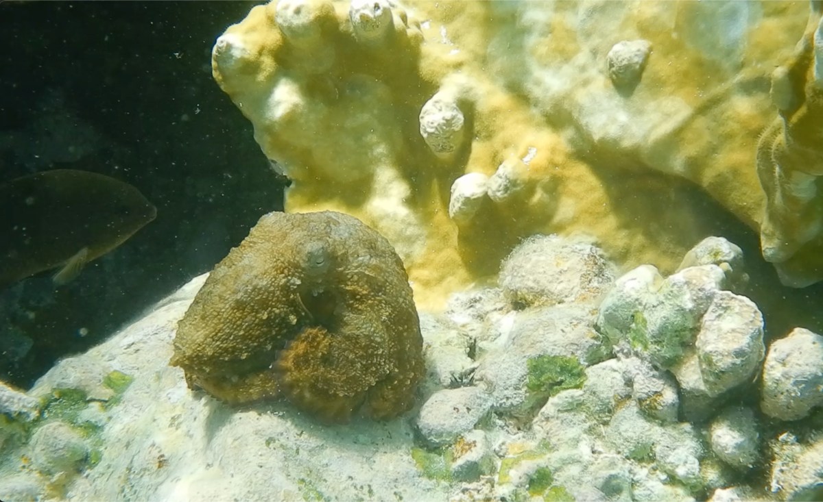
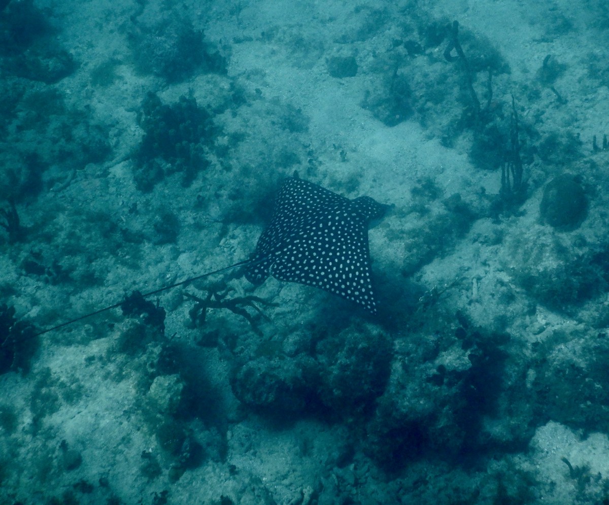
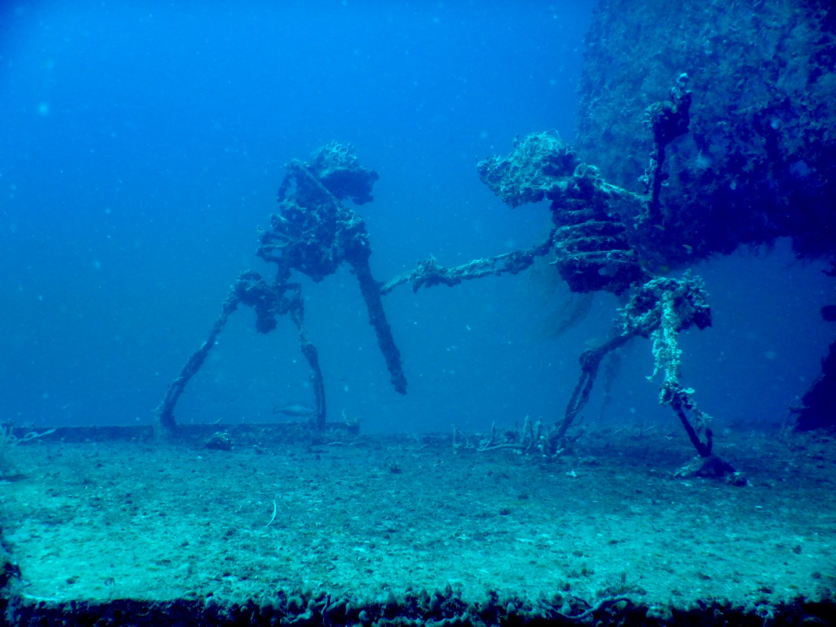
We had a lovely time with Ian. We spent a lot of our BVI time relaxing onboard and did a little diving and snorkeling as well, plus had several meals ashore (most, courtesy of Ian). The weather (both atmospheric and sea) wasn’t cooperative for good diving or snorkeling, but we got some in anyway. The dive-able days followed days of wind or rain, which stirs up the water and decreases visibility. Still, we all love dubbing around in the water whenever we can. We ended up back in Benures Bay on Norman Island a couple of times. One time we launched hookah and dove the eastern point of the bay, something Dave & I had not done on our prior stops there. There was a lot of turtle grass strewn with boulders that had some healthy coral and sponges growing on them, and plenty of fish. It’s fun to look for little fish among the grass and in the boulder crevices. As a bonus, that side of the bay had good visibility. Always nice to be in the water.

We were eyeing a weather window for the weekend of May 4th to cross to St. Martin. Ian assisted us in our preparations by helping us clean our hulls. It sure goes faster with three people and the hookah. Earlier in the week I had posted in the USVI and BVI Cruisers Facebook groups, asking if anyone was heading to St. Martin on the same weather window. Wild Rose responded; they’d been thinking of making the same type of post. Indigo Lady worked her way over to Spanish Town on Virgin Gorda and cleared out of the country just before lunch Saturday. Then we moved up to Gorda Sound on the northeast end of Virgin Gorda and laid a track out through the reef, which we were going to have to navigate at night, before backtracking and anchoring next to Wild Rose on the west side of Prickly Pear. They dinghied over to meet us in the afternoon and we planned our departure time and radio check-ins. Then we each set about our night crossing preparations and napping. 

Indigo Lady and Wild Rose hauled anchor around 12:00 AM Sunday. Wild Rose opted to go around the north side of Virgin Gorda while we passed through the reef following the track line we’d laid earlier. In hindsight, we wouldn’t go out through the reef again at night. It is a very well buoyed channel, and the buoys are lit, but they also flash at different times. It was distracting. We successfully got through the reef and out to the open ocean just as Wild Rose was coming around the corner. They hailed us shortly thereafter to let us know that there were fish pots around and they had narrowly missed one. Yikes! We kept as watchful an eye as one can in the dark. I’ll spare you the suspense; we each had a close call, but neither of us snagged a fish pot. Phew! 

The crossing was quite rolly/bumpy, but there wasn’t a lot of slamming, for which I was thankful. Other than fish pots and rolling, which smoothed out a bit as we neared St. Martin, it was an uneventful crossing. I enjoyed starting out at midnight knowing we were cruising into daylight, and it was comforting having another boat with us. We were anchored in Marigot Bay (French side of St. Martin) around 3:30 PM Sunday afternoon, 15.5 hours from anchor up to anchor down. Wild Rose was anchored shortly after us. We’d arrived too late to clear into the country that day, so we ran up our yellow Q-flag, tidied up the boat and rested. Monday morning we met up with Wild Rose to clear into the country, then we went to a fabulous breakfast spot they’d found on the Dutch side last time they were here- Zee Best. It was delicious! We chatted for quite a while, taking the chance to get to know each other a little better. Eventually we each headed off to tend to our own things. Hopefully we’ll hook up with them again before they continue their trek south to Grenada for hurricane season.

Shortly after our arrival in St. Martin, we had another “small world” experience. I received a text from our friends Roxanne and Craig on Seas the Moment. It was a picture of Lady at anchor in Marigot Bay. They are here, too! We met them in Bimini, Bahamas in 2021 and have run into them each cruising season since. We arranged to have dinner together at a restaurant in Marigot. Joining us would be Tom on Imiloa. We met Tom in Charlotte Amalie in January. Turns out Roxanne and Craig know Tom because he was the broker who helped them buy their first catamaran years ago, which was a Voyage 440 just like Indigo Lady. Tom, himself, had also owned a Voyage 440 in the past. We enjoyed a lovely dinner and a lot of conversation. Again, we will hopefully hook up again before they each head off to their hurricane season locations.

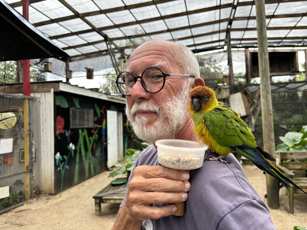
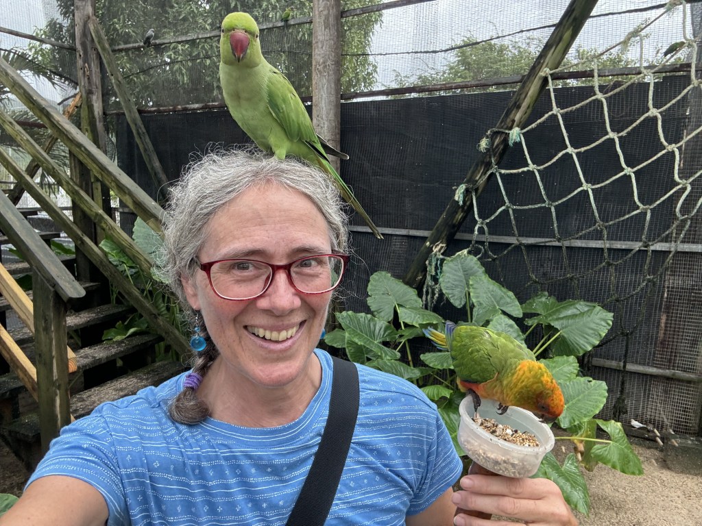
One day, we rented a car so Dave, Ian and I could drive around the island, which doesn’t take very long. It was a very rainy day, so touring by car was better than sitting on the boat playing ‘hatchlisthenics’ (jumping up to repeatedly close, and later reopen, the hatches). It was a lovely drive until we hit traffic in Philipsburg, the capital of Dutch St. Maarten, and in Simpson Bay (cruise ship port. It was crazy! We managed to find a fabulous lunch spot slightly off the beaten path with a parking spot to boot. Score! The circumnavigation of the island took us less time than we’d anticipated, so we had time to kill. We visited the Parotte Ville Bird Sanctuary where we fed the birds as they landed on our arms and heads. It was worth the $10/person. After a failed attempt to have drinks at a local brewery (closed!) we ended up at the Dinghy Dock Sailors Bar, then poked around in Budget Marine where we finally found security chain for dinghy at a reasonable price. (Dinghies are frequently stolen in the Caribbean, so we lock her to the docks we park her on during the day and hoist her into her lift each night back at Lady. We wanted to replace our thin cable and lock with a more substantial chain.) After our wonderful dinner that night with Roxanne, Craig, and Tom, we unloaded our purchases at the dinghy dock where Dave had to bail out shin-deep water. Told you it rained a lot. Thankfully, Ian found a 5 gallon bucket nearby, which expedited the task. We parked the rental and returned to Lady.

After we returned the rental car the next morning, we hauled anchor and headed up to Creole Rock for a snorkel. The leeward side (away from wind & seas) was uninspiring, and it was too rough on the windward side to swim around to that side. Alas! We crossed the channel to anchor in Grand Case Bay where we had a less than satisfactory BBQ dinner. Well, my chicken was fine, but the boys’ pork chops & ribs were tough and not very flavorful. The rice and beans were dry. Sometimes things just don’t pan out the way one hopes. We did spend a quiet, calm night in the lovely anchorage, though. After breakfast on Friday we hauled anchor and popped down to Friars Bay for a snorkel. Again, not scenic, but there were lots of boulders and canyons between them to poke around in and we had a lovely, long swim. From there we passed Marigot Bay to check out Baie Rouge (Red Bay) seeking ‘The Arch’ and ‘David’s (aka Devil’s) Hole.’ Red Bay would make a lovely day anchorage, but there was too much surge this day to safely snorkel The Arch and Devil’s Hole. Dave and I will try to come back another time before we leave. We turned Lady around and headed back to anchor in Marigot Bay. We had a lovely final dinner ashore at a restaurant on the French side of the Lagoon, again, courtesy of Ian. (Thanks for all the meals ashore, Ian!) Ian enjoyed St. Martin enough that he’s thinking of taking his wife, Linda, here for a vacation.

Yesterday morning we all went ashore for a light breakfast and then Dave & I walked Ian to the taxi stand and bid him farewell. We then walked around Marigot Market, an open square market with many tent stalls set up. Most sell tourist kitsch made in India or China, but hidden among the kitsch are some real local delights. We purchased, from the artist herself, an African face made of painted coconut fiber on wood. It will look very nice in our living room back home. We continued on to walk through the farmers/fish market, picking up some local produce, and we enjoyed a live performance from a well-known local band called Remo and the Barbwire Band. We returned to Lady for lunch and an afternoon of relaxation.

As I conclude writing this, I’ve just finished the 6th and final load of laundry. Dave has spent the day making water, attaching our new security chain and lock to dinghy, and troubleshooting our leaky holding tank (still no solution, but he thinks he’s getting closer). It’s hot and humid. Thank goodness for the breeze! We will take a dip in the ocean to cool off, then likely retire to our hammocks for the rest of the afternoon.

I’m not sure if my next post will backtrack to some stuff we did in the USVI that I haven’t written about yet, or if I’ll continue writing about our time here in St. Martin. It will depend on my mood this week. Until then, stay safe and take care of each other!

USVI Dives 2024

I have finally caught up with my dive photos from our time in the USVI. I managed to get my count down from about 250-300 photos/videos clips to 56 photos and 10 video clips. I’m going to attempt to stop taking so many underwater pictures. How many photos of barracuda does one need, really? I’m going to try to focus creatures of which I don’t yet have pictures. Sure, that’s gonna work. 😂 There are some sea creatures I enjoy so much that I can’t help but take just one more photo. (I’m looking at you, porcupinefish.)

I don’t have a fancy underwater camera, so the camera doesn’t always capture the way things looked to my eyes. I use Photos and iMovie to edit the lighting aspects of my images to get them closer to how I saw them. Nothing fancy; I don’t want to misrepresent the reality.

I spend quite a bit of time trying to identify the creatures I capture in photos; I like to know what I’m looking at. Take my identifications with a grain of salt, though; I’m not an expert. We have a good set of identification books onboard by Humann & DeLoach, but sometimes my pictures don’t jive with the books’ pictures and descriptions, in which case I can only attach a general level identification- sponge, parrotfish, etc. I’m especially bad at identifying specific sponges and corals, so when I name those in a slideshow, you may just see “pretty orange sponge” as a label. Those who know me personally, know that I used to be a biology teacher, but I’m not going to bore you with taxonomy. I will, however, say that sponges and corals are animals; perhaps not everyone knows that. Now you do. 

In this post I have divided my underwater finds into two separate slideshows- “scenery” and “creatures.” Just enjoy the scenery; I didn’t label anything in that one. The “creatures” slideshow names the organisms and organizes them into “not fish” and “fish.” No label beyond the name of a fish indicates that it’s an adult. Some reef fish young don’t look like the adult version, however. You may see me include in my labels: Juv (juvenile) or Int (intermediate) if the picture is not of an adult. For parrotfishes and wrasses, IP (Initial Phase), indicates an adult, while TP (terminal phase) identifies a sexually mature adult male. You can, of course, ignore the labels and just enjoy the pretty pictures.

We’re in the BVI for another couple of weeks and have a friend coming to visit a week from today. (Looking forward to having you aboard again, Ian!) At some point I’ll sort through my BVI dive photos, but since we’re not done diving here yet, that won’t happen for a while. Don’t worry, I have other things to write about.

Until next time, enjoy the USVI dive pics, stay safe, and take care of each other!

From our dives at Sprat Point on the south end of Water Island, at Buck Island off St. Thomas, and at Cow & Calf.
From the same dives as mentioned in the caption of the Scenery video.

Riding out big winds in the BVI

Our final night in the USVI was spent on a NPS mooring in Waterlemon Bay on the north side of St. John. The morning of 4/6 we had a final USVI snorkel around Waterlemon Cay where I saw my first octopus in the wild!  As usual, I was dubbing along quite a bit behind Dave, when I looked over at him to see him waving me over, his eyes fixed on a small coral head. I kicked over quickly and followed his finger to… a rock? The rock twitched, and it had an eye. It was a small octopus about 6-8” from head to tentacle tip. It was not happy that we were watching it, so it moved under the coral, where the fish it had replaced showed its displeasure by repeatedly nipping at it. The octopus went back to the coral’s surface, then swam on to another piece of coral. It was so exciting! After our snorkel, we set off to clear into the BVI at West End, all of 1.5 nm away. That done, we had lunch, then headed over to Benures Bay on the north side of Norman Island, a place we’d anchored when my folks were with us last month. We had a couple of days of calm seas ahead of us and we wanted to make the most of them by doing some diving. The first location was around the western side of Norman Island.

We hauled anchor right after breakfast the next morning and headed around the corner to the west side of Norman Island before it got crowded. It’s a popular spot. There were two things we wanted to do, a reef dive and a cave snorkel. We picked up a mooring ball between the two, loaded our dive equipment into dinghy, and grabbed one of the dive moorings at Angelfish Reef on the SW corner of Norman Island. At first, I was unimpressed. The reef is in a sad state, but once we got around the point to the south, there was much better coral structure, which means lots of nooks and crannies for fish. There were also a fair amount of sponges and corals. The highlights of the dive were the large eagle ray that passed within a few feet of us, and a 4’, ~80 lb snapper that emerged from a rock overhang. We believe it was a Culebra snapper. It was huge!

After our dive, we returned to Lady, grabbed a quick snack, and offloaded our dive-specific gear. Then we headed to the dinghy tether at the caves. There were three caves to explore. They do not go inward very far, and the water inside is not deep. We could easily stand in each. Most of the fish were schooling just outside the entrance to each cave, but two of them had schools of glassy sweepers inside. The cave farthest north was the deepest and required a dive light; it got dark pretty quickly in there. Dave illuminated the school of glassy sweepers, but, alas, none of my photos of them came out. Fortunately, I had video of them from an earlier dive; I just hadn’t yet identified them.

Dive and cave snorkel complete, our next stop was Deadman’s Bay on the eastern end of the north side of Peter Island. We went by way of Dead Chest, a rocky little island just outside of said bay, to scope out its three purported dive sites. The mooring ball for the western dive site was missing, but we found one on the north side and two on the south side. After a quiet night anchored in Deadman’s Bay, we popped across to the south side of Dead Chest with Lady and picked up one of those two moorings. The reef right below us was unimpressive, but Dave followed an easterly ridge and we found the good stuff. I haven’t sorted through those pictures yet. I’m backlogged on my BVI dive pictures. Back aboard Lady we had lunch, then set off for the anchorage we had selected to ride out the big winds that were forecast.

The big winds were predicted from the NE-ENE for several days, so we needed a place protected from those directions. Our other criteria were that it have cell signal so we could tend to some business, and so I wouldn’t lose my 3+ year streak on Duolingo, and we wanted to be able to anchor rather than pay $45-$55/night for a mooring ball. Many of the anchorages here in the BVI have been filled with mooring balls, greatly reducing the space available to anchor. It’s peak season here, too, so there are many boats vying for the same anchorages. We opted for the south side of Peter Island, which is not frequented by many charterers or liveaboards, and settled in at South Bay. We were there five nights, Monday-Friday. In hind sight, we probably could have spent Monday & Tuesday night elsewhere, done another dive or two, and been fine. The big winds didn’t really kick in until overnight Wednesday. Then it was very windy, overcast and rainy most of Thursday & Friday. Hind sight is always 20:20. Such is life. 

We weren’t completely idle while in South Bay. Tuesday, the day after we arrived, we hauled anchor and popped over to Key Bay and the wreck of the Willy T2. We’d already dived on the wreck, but we wanted to spend time on the extensive reef arms between which it is sandwiched. We returned to South Bay afterward. We cleaned our hulls. Dave made water, and he replaced the starboard engine room fan and a bilge switch that had failed, which he discovered when he went down to replace the fan. He also replaced the dying fan in our cabin. I did laundry and some baking and spent many hours sorting through and editing dive photos from the USVI.

This morning we decided to head elsewhere. We went around the west end of Peter Island and up into Drake’s Passage and found it manageable until we got past the east end of Peter where it’s more exposed to the open ocean. The seas were bigger there and it got a bit bumpy. We aborted our attempt to check out Cooper Island and turned toward the east end of Tortola and Buck Island, which was supposed to be a pretty sheltered, shallow anchorage. We dropped anchor in 10’ of water inside three other boats anchored there. It is indeed pretty sheltered here, just a little wrap around swell from the SE point of Buck Island, but not bad in a catamaran. We went ashore for a bit of a walk; it had been 4 days since we’d set foot on land and we wanted to stretch our legs. Dinghying back to our boat, we swung by our neighbor’s catamaran. They were about to head over the shallows into Fat Hogs Bay to go to the Riteway market, so we followed along. Fresh produce- yay!

Not sure where we’ll be off to next. The wind and seas will decide that. I ran out of energy to put together a slide show of dive pictures for you, so for now, enjoy the short video of that octopus we saw.

Until next time. Stay safe, and take care of each other!

While we were waiting…

This cruising season has felt like a lot of waiting. We’re used to waiting for weather windows, of which we fortunately don’t need many this year, but this season has been about a different kind of waiting. While we waited for a weather window to get from St. Kitt’s to the USVI, we were simultaneously waiting for our new battery cells to arrive in St. Thomas. Once they were in the USVI, we waited for winds and waves in the harbor to die down enough to be able to get the batteries onboard safely. Then we waited for my folks to arrive. We waited for our new freezer to arrive. We waited for the Salty Dawgs meetup in the BVI to start. Just as the meetup was starting, we learned that our current boat insurance provider would be dropping Caribbean coverage. That launched us into four weeks of waiting for a new policy to pan out, which included waiting for various responses to our numerous emails requesting policy and survey quotes, waiting for the day of the insurance survey we eventually booked, and waiting for the survey report to be finished (the latter happened quickly). Then we waited for the final insurance approval, which, thankfully, also arrived quickly. Yes, we have a new insurance policy that will commence as soon as our current one expires. Yay! Now we’re just waiting for wire transfer information to pay them, but that’s the icing on the insurance cake at this point. 

While we were waiting for insurance to pan out, it also meant waiting to determine the rest of our cruising plan before heading to wherever we would haul out the boat for hurricane season. This also meant waiting to book said haul out facility, as well as the lodging we’ll need during the boat closeup process. We are extremely lucky that our new policy allows us to keep our boat in St. Kitt’s again for hurricane season, so we don’t have to alter our original cruising plan. Hooray! This isn’t a cruising season where we’ve had to make a lot of miles, so we have had the luxury of being able to wait comfortably, and we have been enjoying ourselves. There are far worse places to be waiting.

There are some advantages to all this waiting. Since we’ve been staying close to good cell coverage areas in order to deal with insurance, we’ve been near easily accessible on shore WiFi where I’ve been able to do some data-intensive online stuff over WiFi rather than using our data. We’ve done a lot of snorkeling. We reconnected with cruising friends we made last year. A little over a week ago, we spent several lovely days in Brewer’s Bay where we made some new cruising friends, including Connor, Blake (@captain_blake_sparrow on IG) and Dan (Adventureman Dan on FB and IG). We’ve also had some of the best diving since Puerto Rico last April; three awesome dives in two days!

With the insurance monkey off our backs, we will continue our explorations, hopefully only with the typical waiting for the right weather conditions 🤞. Our current plan is to head to the BVIs for a few weeks, and from there to St. Martin for a few weeks before returning to St. Kitt’s. As always while cruising, we’ll see how that goes.

It will take me a while to sort through the dive pictures, but I’ll get to them eventually. For now, enjoy this slideshow compilation of our various snorkel excursions thus far. Until next time, stay safe and take care of each other!

The Wreck of the Willy T2

Last week, I promised you something fun. Here it is. 

The William Thornton Floating Bar & Restaurant has been an attraction in the BVIs since 1989, reachable only by boat. It is anchored in The Bight of Norman Island and serves lunch and dinner daily. It’s reputed to be quite the party spot at night, where many a cruiser and charterer jumps into the water from the top deck and drinks (sometimes simultaneously) until they peter out. The original “Willy T,” as it is affectionately known, was a wooden schooner named for the Jost Van Dyke-born architect, William Thornton, who designed the original U.S. Capitol. Sadly, it sank on its mooring sometime in 1996 when it sprung a leak in the night. An attempt was made to move it to become a reef, but the currents tore it apart. Its steel-hulled replacement, the Willy T2, was a decommissioned tanker that the owners fitted out for their needs. Alas, Willy T 2 was destroyed by hurricane Irma in 2017. The owners purchased a replacement in 2018 and had it renovated to look much like the Willie T2, and after a brief stint anchored in Great Harbor at Peter Island next door to Norman, it returned to its home in The Bight. Yes, we had lunch there with my folks one day, but that’s not the fun part. Keep reading.

What does one do with the wreck of a floating restaurant that is languishing on the shores of Norman Island? If you’re the non-profit organization Beyond the Reef, you dress it up with some pirates, sink it, and install dive moorings so people can tie up their boats and enjoy a dive on this piece of art. (Dave says that now makes it a Wet Willy 😁.) Beyond the Reef successfully sank the Willy T2 in August of 2019 between two reef heads in Key Bay on the south side of Peter Island. All they ask is a $5 donation/person (honor system), which they donate to a local children’s swim program. You can learn more about Beyond the Reef and its other underwater artistic installations here

We anchored in the lovely Key Bay anchorage area, donned our dive gear, and towed our hookah out by dinghy to one of the dive moorings. In the water we went, about 55’-60’ down, the extent of our hoses. Due to our hose limitations, we could only enjoy the exterior of the vessel and the surrounding seabed, but enjoy it we did. It was a hoot! If you have the time, check out Beyond the Reef’s photos of the Willy T 2 build and sinking so you can compare those to the pictures I took for the slide show below. Which is where I am leaving you today.

Enjoy the slides of the Wreck of the Willy TB2. Until next time, stay safe, and take care of each other!

Puerto Rico, part 6- Spanish Virgin Islands

The Spanish Virgin Islands (SVIs) are part of the commonwealth of Puerto Rico and are located off its east coast. The two main islands are Vieques, the largest, and Culebra. There are several smaller islands that are also included as part of the SVIs. Over the course of eight days, the three buddy boats visited four of the SVIs, starting with Vieques. But first, some history.

A little history

If you want the pre-Columbian, or Spanish history, you can check out the Wikipedia links below. I’m starting with the U.S. gaining control of these islands, along with Puerto Rico, at the end of the Spanish-American War in 1898. In 1903, The U.S. established a naval reserve on Culebra for the South Atlantic fleet. In 1911, the U.S. reduced the size of its forces there (because we started leasing Guantanamo in Cuba) and started using it for training maneuvers and later gunnery and bombing practice. In 1975, due to protests by residents of Culebra, these practices stopped and moved to Vieques. In 1941, the U.S, purchased or seized nearly 80% of the land of Vieques as an extension to the Roosevelt Roads Naval Station on mainland PR. It became a bombing range of live munitions for more than 60 years, including depleted uranium bombs starting in the 1970s. Yes, while several thousand people still inhabited the island. Military exercises, munitions testing, and firing range practice continued until protestors in 1999 managed to get the military to cease, but only until April of 2001. Further protests finally resulted in the Navy withdrawing entirely from Vieques in May of 2003. At that time, much of the island was named a National Wildlife Refuge, and the island was placed on the National Priorities List for hazardous waste cleanup. No idea how much “cleanup” has actually occurred. Parts of the wildlife refuge are open to the public, but some are closed due to contamination and unexploded ordinances. [More Culebra history in Wikipedia][More Vieques history in Wikipedia]

Our time in the SVIs

On April 28th, we and our two buddy boats, Caretta and Wild Horses, made the 45 nm trip from Salinas to the Green Beach anchorage on the NW end of Vieques. It was a fine cruise, but even a calm eight-hour cruise is tiring. Dave and Barry each caught a cero (painted mackerel), so they were quite pleased. Fresh fish! After Ocean was taken ashore, we all gathered on Wild Horses for drinks and to plan our next stop. It was early to bed for most of us that night.

The next day, Saturday the 29th was overcast and sprinkling. Just as Dave and Barry were getting into the dinghy for a 9am snorkel, the skies opened up! Oh well, they were going to get wet anyway, so off they went. They found so-so snorkeling, but not at the official Department of Natural Resources (DRNA) mooring ball, but rather at the opposite end of the anchorage. [See my aside about the quality of our snorkeling experiences this season, below.] Fortunately, we’d planned a late morning departure for our three-hour trip to Cayo Icacos, because the rain didn’t let up until after 10am. When it did stop, we all hauled anchor and arrived shortly thereafter into the weekend fray that is Cayo Icacos. This is the largest island of the Cordillera chain off the NE point of Puerto Rico and it’s a popular weekend hangout spot for locals and for day-charterers on vacation. It was hopping! Fortunately, it cleared out around sunset both nights we stayed and we were the only three boats at anchor both nights. Then it was peaceful and lovely. While there, we walked the beach, had a fish taco potluck (courtesy of the fresh mackerels), had another disappointing snorkel at a DRNA dive mooring, then a less than disappointing snorkel near Cayo Ratones where dive boats don’t go. The coral was still mostly dead, but there was more multi-leveled structure and many more, varied fish.

From Cayo Icacos, we and Caretta moved to Lana Cove at Cayo Luis de Pena off the west coast of Culebra while Wild Horses continued on to Ensenada Honda. Mike had pulled his back that morning wrangling the dinghy onto the beach to walk Ocean, and he needed a couple of days of dock landings to nurse it (and that worked). We dove and Caretta snorkeled the south end of the reef in the anchorage. It was the healthiest we’d seen yet, though it is probably slowly dying. Who knows, maybe it’s slowly coming back to life. At any rate, there was quite a bit of pretty, live hard and soft corals and a ton of fish. Well worth breaking out the hookah equipment! We had a lovely, quiet night at anchor. The next morning, Dave & Barry dove the other end of the anchorage, which they said was even better. After cleaning up, we moved the boats a few miles north to the area of Carlos Rosarino Beach, above Punta Grande, on the west coast of Culebra. Our friends on Seas the Moment had messaged us that they had had a great dive from one of the DRNA mooring balls on a reef wall that went from 5-45 feet. It did not disappoint! The four of us used our hookah and dove off from Indigo Lady. It was even better than the spot at Luis de Pena and we were down for about 50 minutes. After cleanup and lunch, we hauled anchor to join Mike, Victoria and Ocean in Ensenada Honda, arriving by mid afternoon. We all went for dinner ashore at the Dinghy Dock Restaurant. 

Ensenada Honda is the bay on the east side of Dewey, the only town on the island of Culebra. On our first full day there together, everyone piled into Indigo Lady and we cruised up to the north anchorage of Culebrita off the east coast of Culebra. We hiked up to the light house ruins from which you can see the USVIs, then over to “The Baths” on the other side of the island. “The Baths” are a natural pool fed by surge from the ocean. It was a bit crowded when we got there, but we soaked in it for a bit before heading back to the beach and then back to Lady for the return trip to Ensenada Honda. The next day we rented two golf carts and took off for world-renowned Flamenco Beach where we basked in the refreshing water and gawked at the graffitied U.S. WWII tanks left there decades ago. Then we found lunch and then tooled around the island from end to end before returning the golf carts. Our last day at Dewey, everyone piled back into Indigo Lady and we all went back to that awesome spot at Punta Grande so Mike & Victoria could enjoy a snorkel there, which they did, each taking turns onboard to entertain Ocean by throwing one of her toys in the water for her to retrieve. Dave, Barry, Andrea and I got on the hookah and dove the wall again. Still awesome! We were back at Dewey by 4pm, in time to shower and rest a bit, before heading to the Dinghy Dock Restaurant for dinner. 

It was a lovely time in Culebra, and that stop concluded our time in Puerto Rico. We all needed to move on. So, on Saturday, May 6th, we again hauled anchor and headed for the US Virgin Islands, which I will tell you about next time. Until then, stay safe and take care of each other!

[Aside: Despite what the tour companies and DRNA say in their ads or pamphlets, if tour boats go there, it will likely not be a “pretty” snorkel site. Yes, you may see fish, even many colorful ones, and if you’ve never snorkeled a healthy reef before, this may be fine for you. I have snorkeled and dived healthy reefs, and the majority of those we’ve seen so far this season are not pretty. The coral is mostly dead. It’s depressing. Still, we keep hoping and diving/snorkeling.]

Rocky Dundas/Fowl Cay to Little Farmers Cay

My post on Saturday ended with my birthday at the Fowl Cay anchorage across the cut from Rocky Dundas. I’ll pick up from there and get you to our last stop before we headed to George Town. This one is not quite as long as Saturday’s.

On February 1st we made the short jump south to Staniel Cay. We walked about the island shortly after our arrival and picked up some fresh produce at each of the two little markets there, and some rum at the laundromat/liquor store. The town is smaller than Great Harbor Cay, with only a little over 100 permanent residents. It’s a welcoming island that includes one marina, the Staniel Cay Yacht Club. Our primary reason for stopping here, however, was to snorkel Thunderball Grotto. This underwater cave was so named because it was used in the 1965 James Bond movie Thunderball, starring Sean Connery (which we watched the night before). It has also appeared in Never Say Never Again (another Bond movie) and in Splash with Tom Hanks and Daryl Hannah. We were anchored about a football field’s distance from the cave, so it was a short dinghy ride the next morning. We arrived about an hour before low tide and the water was low enough already that we didn’t have to swim underwater to clear the ledge, we just swam right in. We arrived there with only two other dinghies and entered the water faster than they did, which gave us 5+ minutes to ourselves, a rare treat at this popular tourist spot. Besides it movie fame, it was fun to be inside. This one was bigger than those at Rocky Dundas, and there were schools of sargent majors, jacks, grunts, etc. inside. People tend to feed the fish here, so it’s no wonder they all hang about and greet the snorkelers. We did not feed the fish. We gawked both above and below water, and poked around the underwater nooks and crannies until the cave got crowed with people. Then we swam out and explored the reef around the island to the other side. On the opposite side we found the always below water rear entrance to the cave. We didn’t brave that, though, because I don’t trust my ability to hold my breath long enough yet, or to stay far enough below water while holding my breath to not hit my head. By the time we got back to Lady there were about a dozen dinghies and a couple of high-powered tourist boats full of people there to explore the caves. Guess we got there at the right time. 

After we returned from Thunderball Grotto, we had lunch then hauled anchor and moved a few miles south to Black Point on Great Guana Cay. This was a quick stopover, but we didn’t want to miss the world-famous Lorraine’s Café and the chance to meet Lorraine herself. Cruisers rave about Lorraine and all she does for the cruising community, plus she serves as a station host for the Seven Seas Cruising Association. We did get to have a quick chat with her on the deck of her newly opened restaurant called The High Tide, that has a lovely view of the harbor. We bought a loaf of regular coconut bread and a loaf of cinnamon coconut bread from her mother, whose house sits right between the new restaurant and the original (and yes, still open) Lorraine’s Café. We took a walk through the tiny town, then returned to The High Tide for conch fritters and rum punch before returning to Lady. That night as we were preparing dinner we got to watch a few small, local built boats practicing for the Little Farmers Cay Regatta that started the following day. Can those folks sail! It was impressive to watch, and we were glad for that brief opportunity, because we would miss the actuall regatta itself.

The next day we went ashore to have lunch at Lorraine’s Café and realized, too late, why most cruisers mention going for dinner rather than lunch. During the day, tour boats with 20-30 people apiece show up for a buffet at Lorraine’s. They come one after another starting around 11:30 am. We waited almost 90 minutes for our food to come out to the deck because of the hordes of people inside. Lesson learned. I very much enjoyed my conch burger, though. We still got back to Lady in time to haul anchor and head for the north anchorage at Little Farmers Cay. We didn’t have time to stay for the regatta, we just wanted to shave 10 miles off of our trek to George Town the following day. We spent a lovely evening at anchor there, listening to the distant regatta party music at the marina on the other side of the island. 

The following morning, Saturday, February 4th, we got up before dawn, had our cups of coffee, and hauled anchor just before sunrise for George Town. That is where I will pick up with my next post.

Until then, stay safe and take care of each other!

Warderick Wells to Rocky Dundas/Fowl Cay

Get cozy and grab a drink and a snack, because I’m covering a lot of water. I was going to take you all the way to George Town in this post, but that would have been way too long. Instead, I’m doing something I rarely do; I’m posting today and again on Wednesday to get you to George Town, which we will have already left by the time these two posts get you there. Still, it will keep you only about a week behind our actual location. Here we go…

In my last post we had just arrived at Warderick Wells, which is where the Exuma Cays Land & Sea Park headquarters are located. We had planned to stay only two nights, but we were boat bound our first full day there due to winds in the high 20s gusting to the low 30s with off and on rain all day, so we stayed one more night, which allowed us to walk ashore in a couple of places the next day, and also to snorkel Emerald Rock. The morning after the big winds, Dave and I hiked up the famous Boo Boo Hill and poked around for a bit. We did not contribute to the pile of boat names on drift wood at the peak because we are lame and forgot to make a sign <sigh>. Dave & I did some mediocre snorkeling at Emerald Rock after lunch. We’d had higher expectations of the snorkeling in the park, but conditions relegated us to just Emerald Rock. There were several very tiny patches of reef that together may have had a slightly larger footprint than Indigo Lady. There were a bunch of the usual suspects (fish) one expects on small, shallow reefs, but nothing as large as a barracuda, let alone a shark. I guess the really good snorkeling/diving was in the cuts between islands that we just couldn’t time correctly during our very short stay. After our dive, Dave, Mom and I dinghied down to Rendezvous Beach and took a short trial to poke around some very old, almost no longer existent plantation ruins before heading back to Lady for drinks and dinner. The snorkeling may not have met our expectations, but the views of and from Warderick Wells are amazing! It was a lovely setting. 

I enjoy the sound of water lapping against the hull and the feel of the gentle rock of the boat as I fall asleep. Our last night on the Warderick Wells mooring ball was not that. It was dizzying and loud. While we were playing cards before bed, we watched the anchor lights in the mooring field whiz past us one way and then the other as we swung like we were on a Tilt-A-Whirl. Those who remember that amusement park ride know what I’m talking about; the rest of you can google a video of it. I hope you don’t get motion sick. As we retired to bed, the wind and current were opposing each other and we kept coming up tight *in front of* the mooring ball with it banging between our hulls, then the lines would relax, and then repeat coming up tight. The banging of the ball between the hulls plus the sound of our bridle lines tensioning repeatedly was enhanced in our echo-chamber cabin. It was very noisy until the tide changed and I could finally get to sleep.

We left Warderick Wells to anchor between Soldier and Little Halls Pond Cays so we could snorkel what is called the “sea aquarium.” We really wanted my folks to be able to do this, which meant taking Lady over there because they can’t get back into dinghy from the water. The dive moorings are designed for dinghies and tour boats smaller than Lady. So we picked up a mooring and got my folks in the water while Dave stayed at the helm to keep tension off the mooring line and keep us off the nearby rocks. I kept watch on the mooring and my folks. The wind and current were opposing each other, which is tetchy enough, but suddenly one of them overpowered the other and our bow started being pushed toward the very nearby rocks. I struggled to drop the mooring ball from our stern and shouted to my folks to stay put. Thank goodness Dave has the lifetime of boating experience he does, because he managed to maneuver us such that only the last part of the starboard sugar scoop scraped a small point of rock. It left us with a 4-6” gash in the fiberglass outer layer of the cored hull, substantially above water line. It has been temporarily patched with flex seal and is awaiting a proper repair of glassing and gel coat which we’ll probably do when we have her hauled at the end of the season. We circled around and picked up my folks who had thoroughly enjoyed seeing all the fish and coral on their brief dip. We returned to our anchor spot and then Dave and I dinghied over for our turn snorkeling the “sea aquarium.” It really is a lovely spot with tons of fish and healthy coral. We got cold pretty quickly, though, so it was a pretty brief snorkel. We surmised later that we probably got chilled so quickly because we were both coming down from the adrenaline rush of saving Indigo Lady from total destruction!

On to something more pleasant…

We spent my birthday anchored at Fowl Cay, on the south side of Conch Cut, which is the southern boundary of the Land & Sea Park. The southernmost island in the park is called Rocky Dundas with caves one can snorkel into under the ledge at low tide, which we did at the low tide on the morning of my birthday. There were three other dinghies there, and the caves aren’t very big, so we enjoyed the coral and fish outside the entrances as we waited our turn. The caves were really cool! You just swim in, get your feet under you, stand up and gawk for a few minutes at the stalactites and stalagamites. There were two caves. The more southerly one we could actually get up onto a dry (at low tide) rock shelf to stand and look around stably. The northerly cave had more surge so we stood but struggled to keep our feet. It was pretty spectacular. 

After lunch all four of us dinghied to the small reef about a football field’s distance from Lady at the northwest corner of the anchorage. It was a pretty little reef with quite a bit of healthy coral and a bunch of fish, and it was out of the current. I even saw a small nurse shark and a large barracuda. We have a ladder we attach to dinghy’s stern to aid our getting back into dinghy from the water. We weren’t sure my folks would be able to use it, since there is very little room between it and the motor, and one still needs to stay balanced on the ladder while using one’s upper body to gently pull oneself over the transom. So we came prepared to tow them back to Lady with lines and a couple of floaties we keep onboard. Mom actually managed the ladder, but it was too tight a space for Dad, so we towed him back, which he enjoyed. Back aboard Lady, we enjoyed fruity rum drinks, a pasta dinner, courtesy of Mom, followed by cards and a chocolate banana bread I had made earlier. It was a great birthday!

The slide show below starts with Shroud Cay, which I mentioned briefly in my January 28th post, but since it’s part of the Exuma Cays Land & Sea Park, the pictures ended up here. The picture at the top of the post is a reef shark that greeted us when we arrived at Warderick Wells.

The next installment of our route to George Town will post this coming Wedenesday the 22nd

Until then, enjoy the show below, stay safe and take care of each other!

Diving around New Providence

In case you didn’t know, Nassau is the capitol of the Bahamas and it is on the island of New Providence. Some of you may be more familiar with Paradise Island, location of the Atlantis resort. That island is connected to New Providence by a bridge, though in the past it was not and therefore accessible only by boat. Okay, that’s enough of a geography/history lesson.

I’ve already written about our stay at New Providence (January 28th post), but I promised some pictures of our dives. So here’s some diving eye candy for you, and I just bought myself another week without having to think too deeply about what to write in this blog of mine. I will, however, tell you that we’ve covered a lot of water since New Providence. As this posts, we are in George Town, Exumas, waiting on a weather window to continue our trek southeast.

Enjoy the slide show, and until next time, stay safe and take care of each other!

Nassau to Warderick Wells

Sorry for the delay, but last weekend was very busy with no time for blogging. Let me catch you up. It’s a good thing I keep a journal while onboard, because I’d never be able to catch you up otherwise.

We set out for Nassau about 8am on the Sunday, the 15th. Seas were bigger than predicted at the start, but mostly following, so it was only a little bumpy but nice and sunny. About 1/3 of the way through the trip we lost at least one wave direction and the ride smoothed out. Both generators worked as programmed, which was nice. We arrived in Nassau Harbor, New Providence around 2pm and were anchored in the East Channel (technically not the harbor) by 2:30pm. Got some additional provisions ashore, secured a marina slip for the following weekend, then had dinner at the Poop Deck. I was craving a burger, which is rare for me and usually only when we’re onboard, go figure. The Poop Deck’s burger did not disappoint.

Monday we exited the harbor’s west end and headed further south along New Providence to anchor in West Bay and later Old Fort Bay (between West Bay and the harbor). We dinghied to the beach at Clifton Heritage National Park for a walk and chatted with some other cruisers who gave us some intel about George Town, Exuma and a lead on a marina in Puerto Rico where we might leave Lady for this hurricane season. Score!

We spent the next few days diving. We dove the “sculpture garden,” such as it was. There were several half domes with holes in them seemingly marking the way to a 5-foot sculpture of what appeared to be a merman, then more of those half domes leading to the largest underwater sculpture in the Bahamas, Ocean Atlantis, at about 20-feet or so. Sadly, the reef near the dive mooring had fish, but the coral was mostly dead. We also dove two wrecks. The Anthony Bell was a 90’ Bahamian tugboat that was intentionally scuttled to create a reef dive site. A few hundred feet away lay the Willaurie, a 140’ Danish-built barge (1907) that sank naturally not long after the Anthony Bell was scuttled, sometime in the late 1980’s. Their bottoms rested in about 50’ of water but they extended upward to about 35’. I stayed up near their tops while the boys explored them more closely. We were able to anchor Indigo Lady in sand on the north side of Goulding Cay to dive the reef there. Again, mostly dead coral, which is depressing to see, but lots of fish. At one point I was swarmed by a school of tangs that were so close I couldn’t even get pictures. That made me giggle.

Friday morning we set out to find the purported shallow reef near the beach in Old Fort Bay, but all we saw from the surface was more dead coral. So we returned to Lady, hauled anchor and headed back to Nassau’s East Channel to anchor for Ian’s last night aboard. Saturday after breakfast we hauled anchor and pulled into a slip at the Nassau Harbor Club Marina. I spent the morning cleaning the cabin and remaking the bed for my folks’ arrival that evening while Dave saw Ian off for his taxi to the airport. 

Then the provisioning began. Dave and I made three separate trips to the nearby market and were just starting to stow the final load when we heard my folks calling out their arrival, around 5:30pm. And who was escorting them? Our friend Paul whom we’d met back in August 2020 at Fort Pierce City Marina. He noticed my folks looking around and offered to help. They told him they were looking for Indigo Lady, which surprised the heck out of him! It was nice to catch up with him a little over the next day as we continued our provisioning tasks. Earlier that same day, Dave ran into the husband of a former colleague of ours, just a couple of slips down from, who had just arrived from the Chesapeake Bay, single handing. Small world! Sunday was even busier than Saturday. I did two loads of laundry at the marina plus we made two more provisioning trips, the last of which was to the market about a mile away. That one required a cab ride back- too heavy a load to haul! Once it was all stowed it was definitely time for fruity rum drinks, then back to the Poop Deck for dinner.

Monday the 23rd we dropped the dock lines and had a lovely passage to Allan’s Cay in the northern Exumas. Unfortunately, it was too bumpy to dive at the dive moorings, so we just anchored and went for a swim. Tuesday we dinghied to the little beach inside SW Allan’s Cay to show my folks the iguanas, then later moved Lady to the north Highbourne Cay anchorage for a less rolly night. Wednesday brought us further south to Long Cay with the hope of diving from Lady on those dive moorings, but again it was too bumpy. Instead, we anchored and did a little dinghy excursion stopping at a little beach for my folks to practice snorkeling because it has been three years since they’ve done it. Thursday we moved down to Shroud Cay, the first big island in the Exuma Cays Land & Sea Park and picked up a mooring. We did a dinghy excursion partway across one of the mangrove creeks. There was a surprising lack of sea life; we saw only three sea turtles and a couple of needlefish, but it was lovely scenery on a lovely day.  On the way back we pulled dinghy up onto a little beach and played in the current and relaxed in the water before returning to Lady. Yesterday we arrived at Warderick Wells, the headquarters of the Land & Sea Park. We picked up the mooring and went ashore to pay and to get maps of the snorkeling sites and hiking trails, then dinghied around a bit to get the lay of the land.

I’m typing this Saturday morning as we wait for the rain to stop so we can go ashore for a walk. Hopefully the water will be calm enough this afternoon for Dave & I to snorkel one of the reefs.

I haven’t had time to sort through my photos, so enjoy the one of Ocean Atlantis at the top of this post, and when I get to it, I’ll put together a little slide show and post that .

Until then, stay safe and take care of each other!