The Northern Exumas

As promised, my post about our time in the northern Exumas. 

We left Rock Sound Harbor at 6:30 am on May 27th and headed for the northern Exumas where we would stay until June 18th. We enjoyed our explorations of Eleuthera, but it was time to switch gears from town-based anchorages and shore excursions to lesser inhabited islands with more snorkeling and diving. 

We spent the first 12 days in the north anchorage at Highborne Cay. This is a private island with a marina and private rentals. If you’re not a guest of either of those, you are not allowed to be ashore, other than to visit the marina’s store or restaurant. The store we visited twice for a few minor food items. The rest of the time we spent on boats or in the water.

During this first stint at Highborne Cay we did a lot of diving and snorkeling the area corals, either timing them around slack tide to avoid the strong current, or tethering hookah to dingy and drifting along the corals together. We rode out the outer wind fields and rains of Tropical Storm Alex. We did boat chores, read, played games, swung in the hammocks, listened to music, watched movies, did some baking. We met Dustin and Laura on SV Elpis. More kindred spirits. We shared conversation, food, drinks, and Tropical Storm Alex with them before we had to bid them farewell as they started their return to the US. (If you’re reading this, Laura & Dustin, thanks for the company and the flour!)

Eventually we moved 7 nm south to Long Cay to explore the corals there. The first night, a couple of liveaboard diving catamarans showed up but were gone in the morning. Dave noticed that they had not anchored, but had instead picked up moorings. So we used these to tether dingy while we dove- very convenient. There was great coral with a variety of structure and lots of fish, thoroughly enjoyable! One day it rained during slack high tide, so instead we did a low tide drift snorkel with dingy along some small coral heads between Long and Oyster Cays, then we did the same thing almost the entire length of Long Cay. There was no current along Long Cay, so we ended up pulling dingy along with us. It was a fabulous mile-long snorkel with pretty coral and fish.

The Bahamas Land and Sea Facebook group has been invaluable to us over the past three seasons cruising here. So when I learned that the creator and lead administrator of the group, Addison Chan, was also in the northern Exumas, I messaged him to see if we could meet up. He and his wife Pat were in Norman’s Cay, so the following day we traveled the 4.2 nm south to Norman’s Cay. He’s working on a digital cruising guide and spends time each cruising season taking soundings of anchorages and shallow passages for the book. We met up on the west side of Norman’s, but they were heading over to the east side anchorage, so we followed them over. They had sounded it the day before, so we were relieved to know that our charts showing we were in 2 feet of water were not accurate! (The lowest we saw was 5.8’.) They invited us over for sundowners and snacks, so we got to enjoy a couple of hours with them onboard Three Penny Opera (their boat). What a great, welcoming couple! We had a wonderful visit.

The next morning we checked out the coral by dingy and determined conditions weren’t worth snorkeling. We knew we would not stay another night in this busy anchorage, so we headed back to Lady to decide where to go next. On our way, we stopped by our neighbor, SV Mako, to say hello. Corbin and Andrea welcomed us aboard to chat. Turns out their boat was partially disabled during a wicked squall following TS Alex. They had to put out a mayday call and were rescued by a power boat from Norman’s who heard their call. The damage included the loss of one of three blades from their feather prop (which means they can replace just the blade and not the whole propellor). They had already been having trouble with their steering and needed a new chain for that. This rendered them incapable of motoring or sailing well unless conditions were just right. We offered to accompany them back to Highborne Cay, prepared to tow them if they got into trouble, which, fortunately, they did not. Once we saw them safely anchored, we invited them for dinner and had a lovely evening together. They returned the favor the next night, and the day before we left the area, we got to have drinks with them one last time. They are in the process of sorting out getting parts ordered and shipped to Nassau. They will find the right day to sail to Nassau to meet the parts and make their repairs. It’s only about 35 nm to Nassau from Highborne area, across shallows, so in a pinch they could easily drop anchor and call for assistance. It’s a very busy area for boats, so help would arrive quickly. We wish them well!

Back at Highborne we met up again with Sea Dragon! That’s the family we had met and spent some time with in Rock Sound. It was great to catch up with them again! Dean and Cohen came over for a visit a couple of days later (the girls couldn’t make it). We chatted it up for a couple of hours and Dave had Cohen set up a daisy chain of sluggos for hand trolling in the deep water on their way back to the US. He really, really wants to catch a big fish! They set off for Bimini a couple of days later, and we were up to hail them on the radio and wish them a good trip. Hopefully our paths will cross again soon.

We spent our last couple of days in this area anchored on the west side of Allens Cay to check out a couple of reefs that Dave’s friend Ian had given us the lat/long for. These sites have mooring buoys, which always makes it easier to dive. We found the first mooring ball, launched hookah, got in and found an amazing reef full of fish. About 10-15 minutes into the dive, the hookah quit. The bearing in the compressor piston rod seized up, again. Dave had done his best to lubricate it twice before (it’s sealed), but it really needs replacing. No more diving this trip. So we put hookah back in dingy and went up to the north end of Long Rock Cay and did a half mile drift snorkel with dingy. It wasn’t spectacular coral, but we were impressed with the number and variety of fish we saw. There were tons of parrotfish, triggerfish, queen and French angelfish, small grouper, etc. I also practiced my free diving. At least I can get down and stay down for about a minute, but I have a long way to go. It was a great way to spend a couple of hours. We did something similar the next day on the west side of Allens Cay, but it wasn’t nearly as interesting. 

We could no longer dive, we had snorkeled the interesting coral, and the weekend promised to be good cruising conditions. So we decided to head for Nassau (on New Providence) the next day, Saturday the 18th, and on to the Berries Sunday. We had two excellent cruising days. Nassau Harbor was a bit jolting after three weeks in the quiet of the northern Exumas, and we anchored off Junkanoo Beach- party central. Fortunately, the beach party wound down before we went to bed. We had planned to do some reconnaissance in Nassau for provisioning next year, but it was too darned hot with too little breeze, and there was a really big, dark storm cloud looming over the island. So we took a quick dip to cool down, swung in the hammocks and listened to the storm rage on land (never got to us), then dingied to Señor Frogs for dinner. We were off for the Berries at 6:15 the next morning.

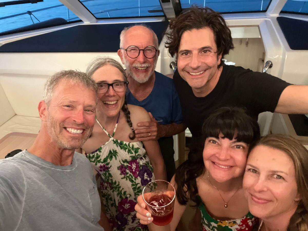
So that wraps up our trip, aside of the final week of closing up the boat. Normally I’d include a diving slide show from all the underwater photos I took, but those take a long time to create, so I’ll post that sometime in July. For now, you get a collage of pictures at the top of the post. I’m taking off from blogging the next couple of weeks as we work to close up Lady and transition back to life in New England. Until then, stay safe and take care of each other.

Back to Spanish Wells

We left the Glass Window anchorage on May 3rd and retraced our steps through Current Cut back to the Spanish Wells area where we would stay through May 12th. We returned to this area for several reasons. First of all, Peter, whom we’d met just before my folks left, was returning to the area with some friends and we wanted to spend some time with them snorkeling the reefs near Gun Point because, and this is reason #2, the seas were going to be calm enough to snorkel these Atlantic-side reefs. The third reason was that we had ordered a part for our failed starboard generator and were waiting for it to arrive.

Our first night back in the area we anchored off a small island called Meek’s Patch, located between St. George’s Cay (Spanish Wells is the town on that island) and North Eleuthera. Peter and crew arrived just after us and we spent the afternoon and evening onboard getting to know his friends Michael, Nila and Wendy. We had a great time and they fed us freshly caught mahi! Who knows how long we would have stayed chatting if the thunderstorm hadn’t threatened and sent us scurrying back to our boat. It ultimately amounted to only a sprinkle.

Over the following five days we did some snorkeling together, took Nila to Preacher’s Cave with us, and shared dinner with First Edition four more times. It was usually them providing us with freshly caught fish from that day’s spearfishing. We contributed potato salad once. On our final night together, I made a chicken stew in our slow cooker and we brought it to their boat. After dinner we got to spend a mosquito-free night hanging out in the bow on Peter’s big boat bean bags, chatting the hours away. As always, it was a bittersweet farewell with the promise of seeing each other next season. We know we’ll connect with Peter at least, because he’s usually stationed in Georgetown and we will be heading there next season. Dave & I were up the morning they started their trek back to Georgetown, so we got to bid them fair winds and following seas with air hugs one more time. 

I mentioned Preacher’s Cave. The reef on the north side of North Eleuthera that wraps around toward Harbor Island to the east is called Devil’s Backbone. Many ships have wrecked there. In 1684, a group of British from Bermuda set out seeking religious freedom in the Bahamas. Their ship wrecked on the reef. Everyone survived and they slogged their way ashore and found refuge for many months in this cave and the surrounding area. One of their members salvaged their boat (or maybe it was their equivalent of a tender) and sailed to the Carolinas area of the US, got provisions and made it back safely to the Cave. These folks eventually created a settlement in the area. I find cruising challenging enough in this modern era; I can’t imagine leaving one’s home for foreign, unsettled areas like they did!

When we weren’t hanging out with the First Edition crew, Dave and I did some solo snorkeling, renewed our cruising permit at the Spanish Wells Customs office, got one of our propane tanks refilled, got some groceries and more liquor, used the WiFi at Wrecker’s (restaurant at Yacht Haven Marina) for Dave’s STEM Guitar meeting when the cell service went down on the island one afternoon, listened to a couple of Bruin’s playoff games, and I rested my back. I did a little too much snorkeling and my back was horrible for about 3 days (had to resort to taking Flexeril). Once First Edition left, we moved to an anchorage on the south side of Russell Island just outside the entrance to the Spanish Wells harbor (about a ½ mile dingy ride into the public dock). We were there for four days1h5 v doing boat chores, running errands ashore when necessary, had a lot of hammock time, ran into some friends we met in Bimini last season, and were constantly checking on the status of our generator part. It finally arrived the afternoon of the 12th! We picked it up, ran some final errands, returned to Lady and hauled anchor around 3:30 to head back to the anchorage above Current Cut. Anchored by 5:30pm and Dave installed the new part. It did not solve the problem. Damn! A whole bag of Doritoes and a movie in the hammocks as consolation. The next morning, Friday the 13th, we headed to Hatchet Bay. 

That wraps up Spanish Wells, and since I’ve already written about Hatchet Bay, my next post will probably pick up with the stop after that, which was Alabaster Bay, unless something else comes to mind. Until then, stay safe and take care of each other.

Egg Island, Queen’s Bath and Glass Window Bridge

I’m bombarding you with posts this season! I’ve been in the mood and have had the time. It’s a good use of passage-making time. Most of our passages have been 2-3 hours with an occasional longer one. Today we are cruising from South Palmetto Point to Rock Sound Harbor, about 23 nm and 6 hours. It’s a good time to get ahead.

I’m going to back up to late April/early May when we were still in the Spanish Wells area. If you’ve been following us this season, you know my folks left on April 26th to return home. After we saw them off, we dropped the dock lines at Yacht Haven Marina and cruised to the Atlantic side of Egg Island to do some snorkeling because the seas were actually calm on the ‘outside.’ We snorkeled a couple of times on our own. After our second day of snorkeling we stopped by a new catamaran in the anchorage, SV Breathe, and chatted with Jason & Monica for a bit, arranging to join them for appetizers and sundowners on their boat later in the day. We did do that, and had a great time with them and their buddy boat friends, Cindy & Ron on @SV Reef’n It! 

The next day we all snorkeled together. There was a bit more swell and lower visibility, but we still saw some great stuff. Jason takes amazing underwater photos; check out his web page or Facebook page @BreatheSailDive. That evening we had them all over to Indigo Lady for appetizers and drinks and a tour of our boat. They were also able to give us some intel about things to see and do on our way along Eleuthera, which has paid off in spades. We exchanged social media contacts so we could stay in touch, and they headed back to their boats a little after 8pm. Cruisers lament- meet cool people and then have to part ways (I’m sure I’ve said that before). They were heading off for the Abacos the following morning. Sigh. Hopefully our paths will cross next season.

On the last day of April, we moved to anchor off Current Settlement on the southern end of North Eleuthera. This put us in position to pass through Current Cut, between North Eleuthera and Current Island, with the proper tide because it can have a wicked current a boat like ours doesn’t want to go against. We walked through the tiny settlement to sit outside their library, closed that day, to use their WiFi. We were still having data issues at the time, so we took any chance at free WiFi we could get. 

Passing through the cut the next morning was smooth, but the cruise to the Glass Window anchorage was a bit bumpy; not horrible, just not comfortable. It was a nice, calm anchorage though and we arrived in time for lunch followed by a walk ashore. We landed the dingy on the beach and followed a short trail to Queens Hwy to find we were directly across from one of the natural wonders we wanted to see- Queen’s Bath. This is a large area of basically very large tide pools carved out of the limestone from years of bashing by the sea. One can only go down into the baths at low tide and as long as the waves aren’t still crashing and spraying. We got the low tide, but the sea was quite active and we didn’t have the best footwear to climb down anyway, so we appreciated the beauty and awesome power of nature from the top. 

We next walked a little further north to Glass Window Bridge. This is a very narrow isthmus just north of Gregory Town and east of Lower Bogue where you can see simultaneously the Atlantic on one side and the Bight of Eleuthera on the other. The Atlantic side sports 80-foot cliffs. In the 1800s it was topped by a rocky ledge (Winslow Homer painted this), which has long since been destroyed by hurricanes. The succession of manmade bridges haven’t fared much better over time. There is no reef to break the waves from the Atlantic side, so storms at sea often create waves that funnel themselves into the narrow Atlantic-side cliffs throwing up waves that wash over the bridge to the Bight of Eleuthera on the other side. Over the years they have occasionally taken an unsuspecting car and/or person over with them (here’s one such story). We were fortunate to see it on a calm day, so we could safely walk across it to take pictures from both sides. My pictures don’t do it justice.

After Glass Window we started our walk back to dingy but decided to go a little past it to see if we could find the restaurant/bar rumored to be nearby. Half a mile later we were sitting at Daddy Joe’s enjoying conch fritters and mac ‘n cheese sticks, along with a drink called a Kerpunkle, which we learned is Bahamian slang for shit-faced. Aptly named, because the drink was strong with rum. Yum! Our ‘snack’ was large and late in the afternoon, so dinner on board was cheese and crackers and fruit.

We’d planned to go back to Queen’s Bath the next day, but dingy needed a patch repair and we wanted to give it a solid 24 hours to set before using it again. So we stayed aboard all day. I made English muffins and did three loads of laundry while Dave patched dingy and did some other stuff. We lazed away the afternoon in the hammocks. The following day, May 3, we moved back through Current Cut to the Spanish Wells side. More about that in my next post. For now, enjoy this video slideshow of the sights described here, stay safe and take care of each other.

Sweetings Pond

Our final excursion at Hatchet Bay was to Sweetings Pond, location of the proposed Seahorse National Park. It is a land-locked pond up to 45’ deep in some places, connected to the ocean somehow underground. It has a diverse array of sealife, minus the predators, which makes it an important refuge for the resident species, especially the seahorses. I found a 2020 Discover article about it that you can read if you like. It’s encouraging to know that the Bahamians are planning to protect this sensitive area and its life, while still allowing eco-sensitive use of it.

Thank you to SV Breath and SV Reef’n It for the intel on how to find this place and what to expect when we got there. There is no signage for Sweetings Pond on the main road and they gave us landmarks to look for. They also told us about the snorkeling rules we couldn’t have known about otherwise until it was too late and we were on site.

We walked the 1.5 miles to the pond, read the rules, then carefully got in. It was not the best day to snorkel due to the solid overcast, but it was still quite enjoyable. We spent about 40 minutes tooling around along the edges where it was shallowest, about 10’ (Dave went a little deeper). We saw one seahorse. Technically, Dave saw it. Despite his shining the dive light on it and pointing at it, I couldn’t discern it as a seahorse separate from the plant life it was hiding in. Alas! We did see numerous fish like we’ve seen diving some of the reefs; bivalves with bright orange, feathery mantles; fast-moving brittle stars; lovely, white nudibranchs; large crabs hiding under the overhangs; good-sized gastropods. A very worthwhile trip!

Every once in a while, we’d poke our heads above the surface to track the dark clouds that had been fairly far off when we started. They got closer, kicking up the wind and creating a bit of chop on the surface, the darker clouds reducing visibility. We got out of the water, put all our wet gear in the canvas bag we brought, stowed anything we wanted to keep dry in the drybag, donned our coverup gear, and then it started raining just as we set off back toward town. We knew this was a possibility when we set out on this adventure and decided that getting caught in the rain before or after snorkeling wasn’t a bad thing. In fact, we appreciated the free fresh-water rinse. Two very kind people stopped to ask if we wanted a ride, but we declined. No sense soaking their car when it was a fairly short walk. It only rained for about half of the walk back and started again just as we reached the dingy, a sprinkle really. We rinsed our gear and the rain got heavier, so I stayed out to hang our salty clothing and sandy towels and got my hair good and rinsed of the salt. 

When I was done, I dried off, changed and Dave made us hot cocoa with dark rum, which we enjoyed while munching on banana bread and playing cribbage. It rained most of the rest of the evening, so we spent it inside playing cribbage, listening to the news, eating yummy pizza, and watching a movie.

I got a handful of decent pictures and put them in this slide show. I struggle with free-diving, so my photos are all from the surface, which limits what I can capture. Enjoy, stay safe, and take care of each other.

Diving in the Abacos: Part 1- Fowl Cay National Park

General Overview of Our Dives

While in the Abacos from late May through mid July of 2021, we dove 10 times on 5 different reef systems. Two were small reefs inside the Sea of Abaco, that’s between Great Abaco Island and the small barrier islands to its east. The other three reefs were on the Atlantic side of those barrier islands, but we always dove the leeward sides (facing the barrier islands) because the conditions on the Atlantic side were either too choppy, or there was no place for us to anchor Indigo Lady and it was too far to dingy.

I always enjoy being under the sea watching the fish school along the coral heads, but this series of dives seemed more desolate than our Florida Keys dives back in August of 2020. I went back through the videos from our Florida Keys dives and finally realized what had been missing in the Abacos- fish! Okay, we saw fish in the Abacos, as you’ll see in the video, but we saw far fewer fish, less variety, and rarely any large fish or sharks. I would say the coral was about in the same condition both in the Abacos and Florida Keys, though perhaps a little worse off in the Abacos. I suspect Hurricane Dorian (early September 2019) had something to do with that. Still, there were fish to see, and I do find it peaceful to watch them from inside the fish tank, so to speak.

Fowl Cay National Park

The video that follows is a compilation of five dives done in Fowl Cay National Park over three days in June (two in early June, one in late June). The picture at the top of this post shows the area we explored.

The park was established in 2009. It used to have around twenty dive moorings one could pick up (with a small boat, not Lady’s size), but Hurricane Dorian removed many of them. There were about 6-8 left, or reinstalled, on the Grouper Alley/Flywheel Bay side, labeled in purple on the picture above. We dingied to these from Indigo Lady, which was anchored on the inside of the north end of Fowl Cay. When we dove the Twin Reefs/Tombstone area, labeled in green, we anchored Indigo Lady in a tongue of sand near the anchor mark in the picture and launched hookah from her sugar scoops (the stern steps).

Now settle back and listen to me breathe through my regulator as you as you enjoy the giant fishbowl of Fowl Cay National Park.

An interesting Fourth of July

I hope everyone enjoyed their Independence Day celebrations. We didn’t do anything here to celebrate, unless you count making burgers for dinner. Our “interesting” 4th of July had nothing to do with the holiday itself. Keep reading.

On the morning of the 4th we awoke to no breeze in White Sound, a harbor at Green Turtle Cay, and a bunch of mosquitoes hanging out on the screen door, fortunately on the outside. So right after breakfast we hauled anchor and headed for the anchorage on the NW end of Manjack Cay for hopefully fewer bugs and at least a little breeze. We were not disappointed.

We arrived at the anchorage around 10:30 AM to find two enormous catamarans rafted together at anchor; one 70 feet long, the other 82feet! It wasn’t 5 minutes after we set our anchor when we heard what we thought was a call for help. We saw splashing in the water between us and the shore and grabbed the binoculars to make sure it wasn’t people playing around. It wasn’t. The water wasn’t turning red either, so it wasn’t a shark attack, thank goodness. Perhaps I should clarify that last sentence. Tour boats feed sharks and rays in this anchorage, so I needed to know if I should grab the med kit. It wasn’t necessary. We saw a young man’s sit-atop kayak sinking underneath him. He was stranded, and panicky, probably because he knew there are sharks in the area. Nobody onboard the catamarans he came from seemed in a rush to help their own friend. They didn’t even attempt to drop their dinghy. One guy did, slowly, get ready to head over in another kayak. Really, people? So we dropped our dinghy and beat the kayak over. We got the young man into our dingy and towed the sunken kayak back to his boat. Interestingly, he asked how he could have handled the situation differently. We assured him there was nothing he could have done to prevent the kayak from sinking; it had developed a leak and the airspace just filled with water. We did suggest having a life vest with him if he’s not a strong swimmer, and to not thrash around if he’s concerned about sharks. 

After the rescue, we gathered our snorkeling gear and dinghied to mid-beach to snorkel from there. The SW corner of this anchorage is where tour boats feed the stingrays and sharks. I’m a bit of a wuss when it comes to sharks, so I wanted to start where there likely weren’t any. There were two small power boats in that corner, but they weren’t feeding the sea life, just hanging out on the fourth of July and swimming. We worked our way over there and did in fact see several rays, a couple of nurse sharks, a couple of small reef sharks, a sea turtle and a bunch of the same fish we’ve seen everywhere in the Abacos. More and more small power boats started showing up making it too dangerous for us to continue snorkeling, so we swam back to our dinghy and went back to Indigo Lady. 

We had ourselves a leisurely morning the next day and finally suited up for another snorkel just after lunch. This time we headed straight for the SW corner. There were no tour boats feeding the sea life and we had no intention of doing so ourselves. Turns out intention is irrelevant. As soon as we got within 20 feet of the beach, motor still running, the rays moved in. The mere presence of our dinghy was like ringing the dinner bell. There were half a dozen or more good sized rays skating in the shallows, in inches of water. As soon as we waded to our ankles they swam to and over our feet. A couple of 3-foot reef sharks showed up too but stayed 15 or so feet off the beach. I wasn’t excited about trying to get my snorkel gear on as I was being harassed by rays, so I let Dave get in first and draw them off. I’m so brave. Eventually I got in and we were treated to another lovely snorkel. The rays mostly lost interest in us once we were in the water with them. The reef sharks kept well away from us. A 6-foot nurse shark covered in remoras swam close by, followed by a smaller 4-foot one. Realizing we had no food, they lost interest quickly. At one point Dave stopped swimming and I saw a 6-foot reef shark swim past him about 10-20 feet in front. It leisurely disappeared into the dark beyond and we did not see it again. We also saw a fairly large sea turtle that Dave swam with for a bit. Getting back into dinghy was challenging. As soon as we were standing in the shallows again, there were the rays looking for food. We had to carefully work around them to get dinghy back into the water without stepping on them. I was afraid they’d get too close to the motor when we started it, but it all worked out. 

On our way back to Lady, we stopped at a smaller charter catamaran that had pulled into the anchorage earlier in the day. We chatted with the couple for a bit until it started to rain. We got back to Lady just in time to avail ourselves of the free fresh water to rinse off ourselves and our snorkel gear. There were clouds as far as the eye could see, so we had ourselves a little snack and decided to spend the rest of the afternoon watching movies. It was about 3:30pm. 

All day up until now, we’d seen rain cells passing to the east heading in a northerly direction. That means all the anchored boats were pointing southward, the direction the weather was coming from. As we were heading back to Lady from our snorkel we realized all the boats were pointing north, but the rain appeared to have come from the south. Curious. We didn’t think much more about it until the wind started blowing 25-30 kts kicking up 3-5 foot waves…from the north. Then the anchor drag alarm went off. Dang! We knew our anchor wasn’t buried well, but it was in what appeared to be a sand patch and it was south of a lip of mud and weed. Had the predicted SSE wind directions played out, we would have blown back on our anchor south to north, firmly rooting it in that mud & weed. Instead, we were blown north to south which just dislodged the anchor from what was apparently sand over rock. Rocna anchors usually reset if they drag, but we dragged 150 feet or more and our Rocna just skipped along the bottom. We decided it was unlikely we would be able to reset the anchor successfully with this wind and sea direction and this bottom, so we just pulled it up and headed south toward another anchorage 2 miles away, protected from the North. It was a pretty quick trip because once we rounded the point of the anchorage, the north winds and seas were at our backs giving us a push. Less than 90 minutes later we were anchored snugly in our new location. We opted for leftovers rather than cooking, and finally settled into our movie.

We would spend four wonderful days and nights in this anchorage and surrounding area, but I’ll write about that next week.

Until then, stay safe and take care of each other.

Diving the “Coral Gardens”

Sorry I didn’t post last weekend as promised. We were too busy enjoying ourselves. I believe I promised you a description of our first real dive here. 

I don’t know who named this area “Coral Gardens.” I suspect it was a local dive shop. At any rate, it was definitely worth backtracking to dive here. We knew there were dive moorings for small boats, so we couldn’t take Lady over. Instead we loaded the hookah system and our gear into dingy and made the 1.5 mile run to the dive site. The site is across from one of the cuts between barrier islands out to the Atlantic side and there was some swell coming in. Fortunately, a wet dingy ride doesn’t matter when one is going diving. There was nobody else there when we arrived around 10:15am, so we had our pick of the dive moorings. We picked up the one in the center so we could swim easily in either direction depending on the swells, which there were, and any current. As soon as we picked up the mooring, a little sea turtle came over to greet us. It was then that I realized I’d left my underwater camera on Lady! Argh! Of course the little turtle swam around our dingy and hookah the entire time we were preparing for the dive and I couldn’t get any photos <sigh>. He skedaddled as soon as we got in the water.

I was amazed at how big the reef was, given that it’s on the inside of the barrier islands and not on the Atlantic side. It was probably a couple hundred yards long; we didn’t dive the whole length of it. At the deepest point it was about 20 feet tall. There was plenty of reef all the way up to the surface for snorkelers to enjoy as well. There were many fish, small ones, like a nursery reef. 

The current on top of the surge was tiring, so our first dive was only about half an hour. When we came up for a snack and some water, all the moorings were occupied! Another dingy was sharing our mooring and had some snorkelers off it’s stern in the shallow part of the reef. We chatted with the guy driving that dingy, had a bit of a rest and went back down for another, slightly longer dive. The current had abated and we stayed in the deeper part where the surge wasn’t as strong. When we came up again, our neighbor dingy was gone, and the boats on the other moorings were just preparing to leave. 

Once we got back to Lady, we put our toys away before having lunch. “Putting our toys away” is about a half hour process. We have to get the hookah and hoses back onto Lady from the dingy and rinse it all with fresh water. Then we have to rinse all our gear and ourselves and set everything out to dry. On diving days we always spend the rest of the afternoon relaxing, not that we need and excuse to relax.

We were preparing to return to Coral Gardens the next day in the afternoon when we saw dark clouds and rain not too far away. Good thing we hadn’t taken off in the dingy yet, because it would not have been fun to get stuck in that squall out in dingy! It only clipped us with some showers and winds on Lady but went right over the dive site. Our plans thwarted for that day, we hunkered down inside for the rest of the afternoon. The following day we did return to Coral Gardens and this time I remembered my camera. So I’ll stop blabbing and let the video speak for itself. Enjoy!

FYI, it takes too long to put together these videos and I’d rather spend my time down here doing other things. Further videos of our exploits in The Bahamas will have to wait until we get home in the fall, just like I did last fall after our dive trip to the Florida Keys. (If you don’t know what I’m talking about, scroll back to my posts from September-December 2020. That was some great diving!)

Be safe, and take care of each other!

Dave’s Undersea Wildlife Encounters

My husband is a fish when he’s diving. Okay, perhaps seal is a better comparison since they, like Dave, are mammals. My point is, he’s quite at home under the sea, which isn’t surprising since he’s been diving for almost 50 years. I love watching him when we dive, trying to coax critters from their hideouts, joining a school of fish, or simply following quietly behind or along. What I share with you today is a compilation of videos I captured of Dave interacting with the sealife and a couple of times when sealife interacted with him without his knowledge. I chuckled putting this together and watching the final cut. I hope it makes you chuckle as well.

I’m taking a blogging hiatus until sometime in January. So Happy Holidays, Happy New Year, and enjoy the show!

Fowey Rocks and Stiltsville

Our last dive stop before heading back to the marina and then home, was at Fowey Rocks Lighthouse at the northernmost end of the Maritime Heritage Trail. It is an iron-pile lighthouse that was built from 1875-1878. We’d hoped to also dive the Aratoon Apcar, sunk just off the lighthouse, which was still under construction at the time, in 1878. The current was too strong, however, and this was a less complete wreck than some of the others, so we gave it a pass. Instead we had a short dive in the shallow corals on the southwest side of the lighthouse. We once again started out against the current so we could ride it back to Lady afterward. The lighting was good and there were some lovely corals. I took a few pictures and one video which I share below.

After our dive and lunch, it was time to head back into the ICW for the trek back to the marina. From Fowey Rocks Lighthouse we headed toward Cape Florida, taking the Biscayne Channel into Biscayne Bay. This took us right through Stiltsville, which is also part of Biscayne National Park. The first of these shacks on stilts was built by one Crawfish Eddie Walker sometime in the 1930s. It has a somewhat colorful past, which you can read about by following that link. There were 27 such structures at its peak in the 1960s. Exposure, time and Mother Nature limited the life of these structures, and hurricane Andrew in 1992 left only 7 standing, none of which are original to the heyday of Stiltsville. The non-profit Stiltsville Trust was established in 2003 and is working cooperatively with the park to rehabilitate the buildings to support educational and interpretive services. One can acquire a permit to visit the structures from the Stiltsville Trust, but you’ll need your own (not large) boat to get there. We may try to visit one or two when we next go down if we can find a place nearby to anchor Lady and take the dinghy over.

This week’s video slideshow includes a handful of pictures and video from the Fowey Rocks dive, plus the stills I took of the Stiltsville structures. Several of the stilt houses line Biscayne Channel, but are still pretty far away for my camera, so close ups get a little blurred. Other of the houses are small blips in the distance. Regardless, you’ll get the idea of what they’re like. Enjoy!

The Wreck of the Lugano

Our final wreck dive was on the Lugano that sank in March 1913. The Lugano was a 350-foot, iron-hulled British steamer from Liverpool that Long Reef en route to Havana, Cuba with 116 passengers on board, plus a cargo valued at $1 million dollars. All passengers were successfully rescued while the crew stayed aboard for salvage work and to try to save the ship from a complete loss. After almost a month of salvage work, the crew finally abandoned the wreck. By mid April, efforts to refloat her were abandoned as well. Lugano’s remains lie in about 25 feet of water on Long Reef.

This was our third wreck dive on the same day. We picked up the dive mooring at her stern because the current was pretty strong at this point. So we slowly swam Lugano’s length against the current, then rode it back to Lady. The return swim was quite quick! Due to the current and it being our third dive that day, we only spent about 20 minutes here though we could have spent much more time had the conditions and our timing been better. Still, it was an impressive structure and we enjoyed the experience.
Again, if you’d like to know more of the history and explore the 3D interactive model of the Lugano, check out the ArcGis storyboard. My video clips aren’t quite as good for this one because I found it difficult to film, swim against the current and enjoy the sights all at the same time. Still, you’ll get a decent appreciation for Lugano’s size. Enjoy!