We’re back in NH. We rolled into our driveway around 2:30am last Saturday, the 17th. Our New England boat, Dumbledore, has been launched. We’re working on getting him ready for a 4-6 week cruise along the coast of Maine starting sometime in July. Until then, we’re visiting family and friends, and getting in a bunch of appointments.
Between January and mid-June, we put on a lot of miles and visited a lot of islands. Here’s a recap.
Miles traveled (nm): ~1300
Countries visited: 9
Nights at anchor: 89
Nights on mooring: 42
Nights in marinas: 16
Nights under way: 5
Nights ashore: 7
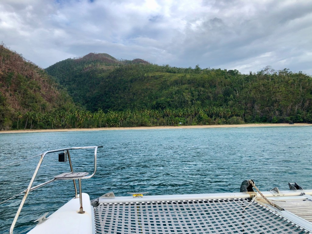
We started in the Berry Islands, Bahamas, on January 8th. After that we went to Turks & Caicos, Dominican Republic, Puerto Rico, U.S. Virgin Islands, St. Martin (both the French and Danish sides), St. Bart’s, and ended at St. Kitt’s. We stayed in 46 different anchorages, 6 different mooring fields and 6 different marinas. We took road trips with friends to Santo Domingo, DR and Old San Juan, PR. We made overnight passages from Rum Cay to Mayaguana; from Turks & Caicos to Luperón; from Luperón to Rio San Juan; from Escondido to Puerto Real, PR; and from the USVI to St. Martin.
We did a lot more “making miles” than I would have liked, but we did finally get to the actual Caribbean Sea, which was our target this year. Next season we plan to confine our travels to the area between St. Kitt’s and the Spanish Virgin islands. It will be lovely to spend multiple weeks in each country next.
Thanks for following my adventures. I will post about our coast of Maine travels this summer, but perhaps not as frequently as I typically do.
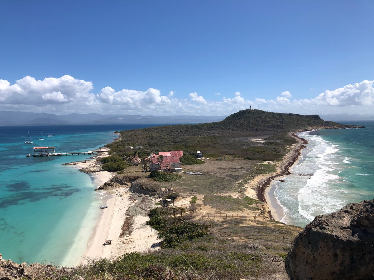
The Spanish Virgin Islands (SVIs) are part of the commonwealth of Puerto Rico and are located off its east coast. The two main islands are Vieques, the largest, and Culebra. There are several smaller islands that are also included as part of the SVIs. Over the course of eight days, the three buddy boats visited four of the SVIs, starting with Vieques. But first, some history.
A little history
If you want the pre-Columbian, or Spanish history, you can check out the Wikipedia links below. I’m starting with the U.S. gaining control of these islands, along with Puerto Rico, at the end of the Spanish-American War in 1898. In 1903, The U.S. established a naval reserve on Culebra for the South Atlantic fleet. In 1911, the U.S. reduced the size of its forces there (because we started leasing Guantanamo in Cuba) and started using it for training maneuvers and later gunnery and bombing practice. In 1975, due to protests by residents of Culebra, these practices stopped and moved to Vieques. In 1941, the U.S, purchased or seized nearly 80% of the land of Vieques as an extension to the Roosevelt Roads Naval Station on mainland PR. It became a bombing range of live munitions for more than 60 years, including depleted uranium bombs starting in the 1970s. Yes, while several thousand people still inhabited the island. Military exercises, munitions testing, and firing range practice continued until protestors in 1999 managed to get the military to cease, but only until April of 2001. Further protests finally resulted in the Navy withdrawing entirely from Vieques in May of 2003. At that time, much of the island was named a National Wildlife Refuge, and the island was placed on the National Priorities List for hazardous waste cleanup. No idea how much “cleanup” has actually occurred. Parts of the wildlife refuge are open to the public, but some are closed due to contamination and unexploded ordinances. [More Culebra history in Wikipedia][More Vieques history in Wikipedia]
Our time in the SVIs
On April 28th, we and our two buddy boats, Caretta and Wild Horses, made the 45 nm trip from Salinas to the Green Beach anchorage on the NW end of Vieques. It was a fine cruise, but even a calm eight-hour cruise is tiring. Dave and Barry each caught a cero (painted mackerel), so they were quite pleased. Fresh fish! After Ocean was taken ashore, we all gathered on Wild Horses for drinks and to plan our next stop. It was early to bed for most of us that night.
The next day, Saturday the 29th was overcast and sprinkling. Just as Dave and Barry were getting into the dinghy for a 9am snorkel, the skies opened up! Oh well, they were going to get wet anyway, so off they went. They found so-so snorkeling, but not at the official Department of Natural Resources (DRNA) mooring ball, but rather at the opposite end of the anchorage. [See my aside about the quality of our snorkeling experiences this season, below.] Fortunately, we’d planned a late morning departure for our three-hour trip to Cayo Icacos, because the rain didn’t let up until after 10am. When it did stop, we all hauled anchor and arrived shortly thereafter into the weekend fray that is Cayo Icacos. This is the largest island of the Cordillera chain off the NE point of Puerto Rico and it’s a popular weekend hangout spot for locals and for day-charterers on vacation. It was hopping! Fortunately, it cleared out around sunset both nights we stayed and we were the only three boats at anchor both nights. Then it was peaceful and lovely. While there, we walked the beach, had a fish taco potluck (courtesy of the fresh mackerels), had another disappointing snorkel at a DRNA dive mooring, then a less than disappointing snorkel near Cayo Ratones where dive boats don’t go. The coral was still mostly dead, but there was more multi-leveled structure and many more, varied fish.
From Cayo Icacos, we and Caretta moved to Lana Cove at Cayo Luis de Pena off the west coast of Culebra while Wild Horses continued on to Ensenada Honda. Mike had pulled his back that morning wrangling the dinghy onto the beach to walk Ocean, and he needed a couple of days of dock landings to nurse it (and that worked). We dove and Caretta snorkeled the south end of the reef in the anchorage. It was the healthiest we’d seen yet, though it is probably slowly dying. Who knows, maybe it’s slowly coming back to life. At any rate, there was quite a bit of pretty, live hard and soft corals and a ton of fish. Well worth breaking out the hookah equipment! We had a lovely, quiet night at anchor. The next morning, Dave & Barry dove the other end of the anchorage, which they said was even better. After cleaning up, we moved the boats a few miles north to the area of Carlos Rosarino Beach, above Punta Grande, on the west coast of Culebra. Our friends on Seas the Moment had messaged us that they had had a great dive from one of the DRNA mooring balls on a reef wall that went from 5-45 feet. It did not disappoint! The four of us used our hookah and dove off from Indigo Lady. It was even better than the spot at Luis de Pena and we were down for about 50 minutes. After cleanup and lunch, we hauled anchor to join Mike, Victoria and Ocean in Ensenada Honda, arriving by mid afternoon. We all went for dinner ashore at the Dinghy Dock Restaurant.
Ensenada Honda is the bay on the east side of Dewey, the only town on the island of Culebra. On our first full day there together, everyone piled into Indigo Lady and we cruised up to the north anchorage of Culebrita off the east coast of Culebra. We hiked up to the light house ruins from which you can see the USVIs, then over to “The Baths” on the other side of the island. “The Baths” are a natural pool fed by surge from the ocean. It was a bit crowded when we got there, but we soaked in it for a bit before heading back to the beach and then back to Lady for the return trip to Ensenada Honda. The next day we rented two golf carts and took off for world-renowned Flamenco Beach where we basked in the refreshing water and gawked at the graffitied U.S. WWII tanks left there decades ago. Then we found lunch and then tooled around the island from end to end before returning the golf carts. Our last day at Dewey, everyone piled back into Indigo Lady and we all went back to that awesome spot at Punta Grande so Mike & Victoria could enjoy a snorkel there, which they did, each taking turns onboard to entertain Ocean by throwing one of her toys in the water for her to retrieve. Dave, Barry, Andrea and I got on the hookah and dove the wall again. Still awesome! We were back at Dewey by 4pm, in time to shower and rest a bit, before heading to the Dinghy Dock Restaurant for dinner.
It was a lovely time in Culebra, and that stop concluded our time in Puerto Rico. We all needed to move on. So, on Saturday, May 6th, we again hauled anchor and headed for the US Virgin Islands, which I will tell you about next time. Until then, stay safe and take care of each other!
[Aside: Despite what the tour companies and DRNA say in their ads or pamphlets, if tour boats go there, it will likely not be a “pretty” snorkel site. Yes, you may see fish, even many colorful ones, and if you’ve never snorkeled a healthy reef before, this may be fine for you. I have snorkeled and dived healthy reefs, and the majority of those we’ve seen so far this season are not pretty. The coral is mostly dead. It’s depressing. Still, we keep hoping and diving/snorkeling.]
El Yunque National Forest, located in the municipality of Río Grande in the NE portion of Puerto Rico, is one of our smallest forest at around 29,000 acres, but the only tropical rainforest in our National Forest system. It is part of the Sierra Luquillo Mountains. The area was formally set aside as a reserve in 1876 by King Alfonso the XII of Spain, in order to preserve the area against the rapidly growing population, and at the time, poor agricultural practices. The U.S. acquired Puerto Rico in 1898 and in 1903, President Theodore Roosevelt established the Luquillo Forest Reserve. It became a National Forest in 1906. It was renamed the Caribbean National Forest in 1935, and renamed El Yunque National Forest in 2007. There was timber and other military use during World Wars I & II, but also reforestation efforts. There has been ongoing scientific and conservation research in several dedicated areas of the forest since 1956. Most of the recreational infrastructure was built in the 1980s. The forest and infrastructure has been assaulted and heavily damaged by hurricanes Hugo (1989), George (1998), and Irma & Maria (2017). It is home to the critically endangered Puerto Rican Parrot (we did not see any). [Wikipedia][Forest Service]
Our day in the forest
The main recreation area along Route 191 is the primary attraction. You drive along the road and make stops at designated parking areas to view the scenery and make hikes of various lengths. As of our visit, there was still damage from the 2017 hurricanes, so some trails are closed, including the one to La Mina Falls, which is typically a popular hike. We arrived around 9am, presented our tickets at the entry point, then drove on in. [Tickets must be booked in advance. If you have more time to read, see my anecdote, and additional information about the park, below the slide show.]
We stopped at several key points. Here are the highlights. Baño Grande was built in the late 1930s by the Civilian Conservation Corps (CCC), as part of the New Deal era. It’s formed by a stone and masonry dam and arched bridge with cobblestone path. It even had a restroom at one point (now a ruin). The 18-foot deep pool is fed by the La Mina River watershed. It served as a public swimming pool from 1936-1968 when it was then closed due to safety concerns. Now it’s just a scenic spot.
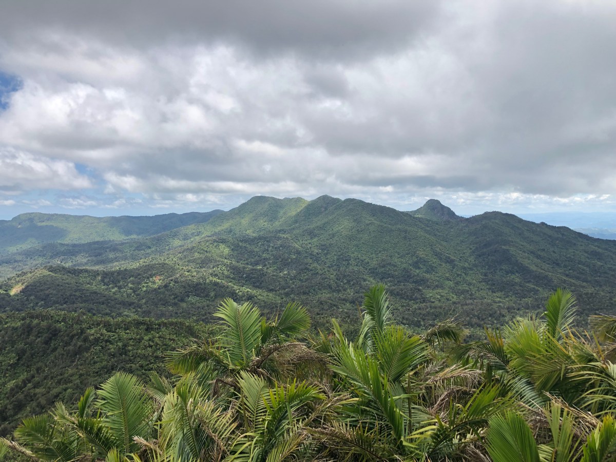
Our main hike of the day was up to the Mt. Britton Tower. This was another New Deal era construction of stone and masonry, built by the CCC in 1937-38 as an observation tower. The hike took us through a palm forest and cloud forest. The views from the top were marvelous! As we descended and got back to the intersection with the El Yunque Peak Trail, we decided we were pretty hot and tired and opted not to pursue that peak. So we returned to our cars and started to head back down toward the entrance, but with a couple of more stops planned.
La Mina Falls may have been closed, but the Juan Diego falls were open to hikers, and it was only about a half mile, mostly flat. Doable for tired footsies and a tired, hot pooch. We followed the Juan Diego Trail to the falls. We were not prepared for swimming, but Ocean had no qualms about laying down in the water, away from the natural pool formed by the falls, where several people were enjoying the cool, refreshing waters. Next time, I’m packing my swimsuit.
Our final stop on the way down was a the Yokahú Tower. It’s a 69-foot tower that was built by a former Forest Supervisor in the early 1960s. From its top, one can view four forest types in the National Forest area. Wish I’d read about it before hand. I just stood up there and thought, “Great views!”
After the Yokahú Tower, we headed out of the forest in search of lunch in the town of Río Grande. We ended up at a lovely roof-top restaurant for a late lunch. We got back to our apartments around 5pm for rest and showers. Around 7pm we were starting to get hungry, so we all ordered pizza from a place in Old San Juan that delivers and chowed down in Mike & Victoria’s digs. We were all beat, but in that “we’ve been enjoying the outdoors all day” kind of way.
Enjoy the slide show of El Yunque. As you read in my post last week, we returned to Salinas the following day after a ton of shopping. Our next stop would be the Spanish Virgin Islands, which is what I will tell you about next time.
Until then, stay safe and take care of each other!
Additional information about the park:
Entering the main area on route 191 requires a ticket, and those reservations are made online through the Forest Service for just $2/car. They control how many vehicles, private and tour, enter the park each day. If you just showed up, it’s highly likely you’d be turned away. Sometimes tickets are available weeks in advance, but most often they’re made available only 24 hours ahead of time, and they go fast! We did not know this in advance, so it was lucky that Dave decided to book our planned Tuesday excursion early Monday morning before we even left Salinas. He went online around 7:30 am and learned that you need to set up an account first, so he did that. At 8am, tickets for the 8-11am entry time became available. It took Dave only 15 minutes to purchase our tickets and by the time he was done, half the slots were gone. He checked about 15 minutes after that, just out of curiosity; there were only 9 slots left. Phew, that was close!
There’s also an 11am-1pm entry option and those tickets become available at 11am. Regardless of entrance time, once you’re in the park you can stay until it closes at 5pm.
The Visitor Center does not require a reservation to enter, but it does incur a fee of $8/person, payable at the gate. We did not visit this.
There are a couple of other roads that go through lesser traveled parts of the forest and do not require tickets. There are trails and scenic drives/stops, but some are closed, so check the website first.
We three buddy boats had a lovely cruise from Caja de Muertos to Salinas on April 22nd. Caretta even put up sails for a while. We were anchored in the spacious bay by 10:30am. Although our boats were anchored in the bay for six nights, we were onboard for only four of those. The other two nights we spent in San Juan.
Salinas Bay and surrounding mountains
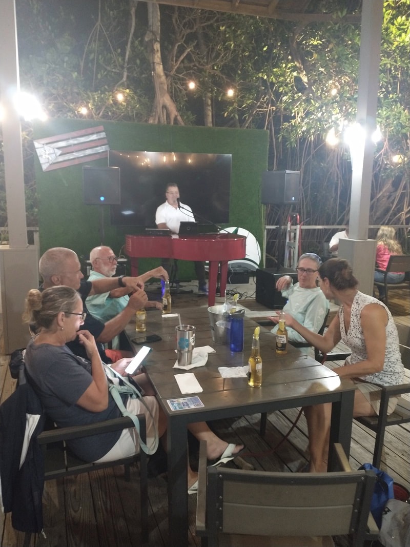
Salinas Bay is surrounded by lots of small restaurants and local shops, including a small marine store, all within easy walking distance. There are three marinas around the bay, the largest being Marina de Salinas. This area is really the outskirts of the town, which is about 1.5 miles away. Salinas is one of those stops cruisers make because it is a large bay with easy access to provisions and other boating needs. The marina is friendly and for a $50/month “bay membership” from Marina de Salinas, cruisers may receive shipments there, as well as use the facilities (though not the pool). Being centralized along the south coast of an island that is not particularly large, it’s also easy to rent a car to travel to other parts of Puerto Rico while one’s boat remains safely anchored in the bay. The three of us buddy boats took advantage of all of this. We enjoyed use of their showers, dinghy dock and dumpsters. Our friends had their new Starlinks shipped to the marina office. Our last night there, we enjoyed dinner and some fabulous live music at the marina’s restaurant. The live music was the playlist from every middle and high school dance I ever attended. We were all singing along. So much fun!
enjoying live music by Manolo Mongil
The best part of our stop in Salinas, however, was that we rented cars for a trip to Old San Juan and El Yunque National Park.
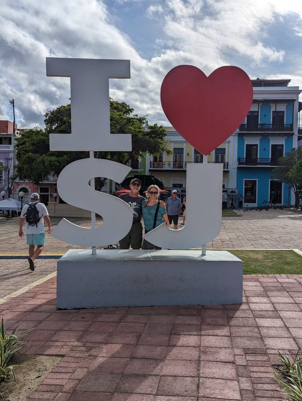
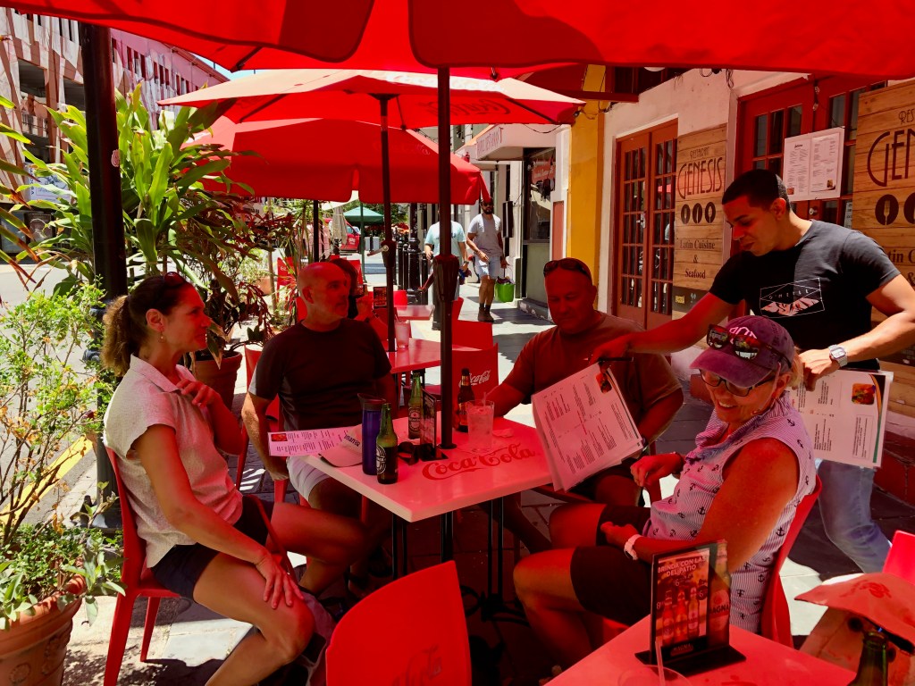
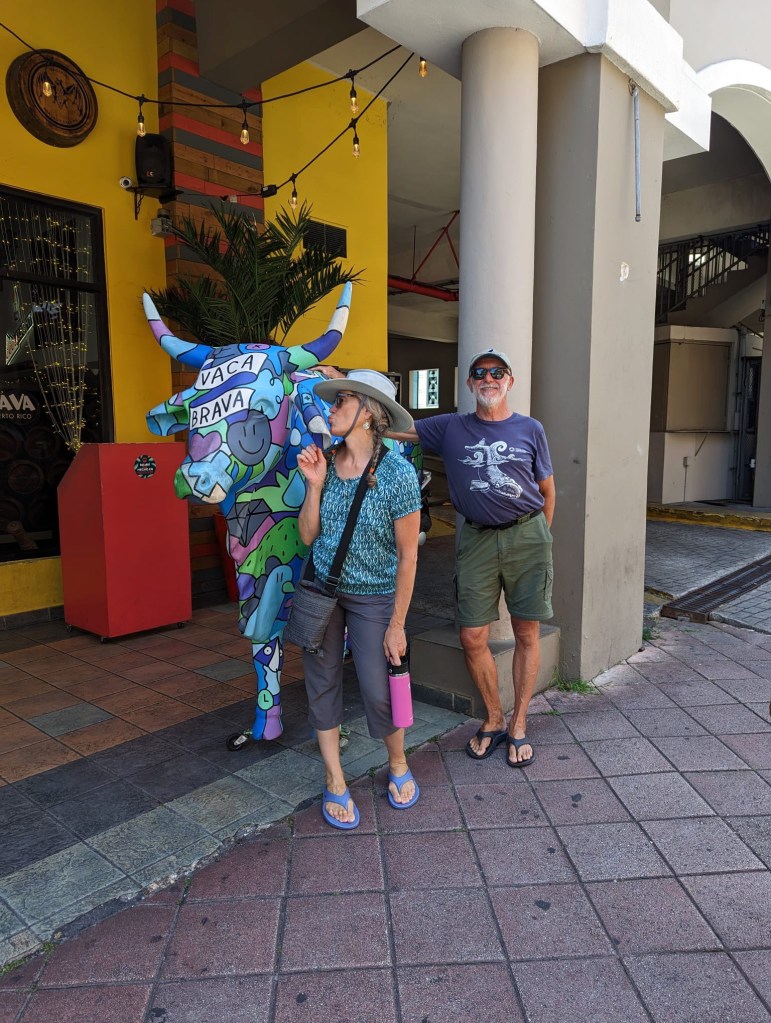
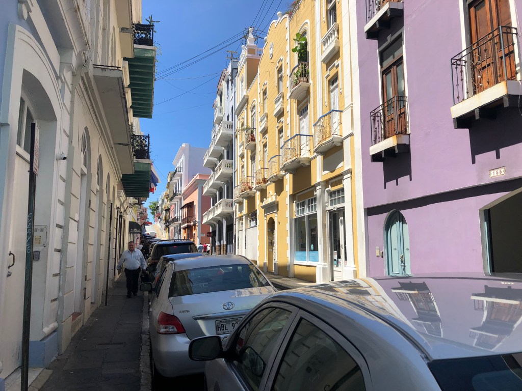
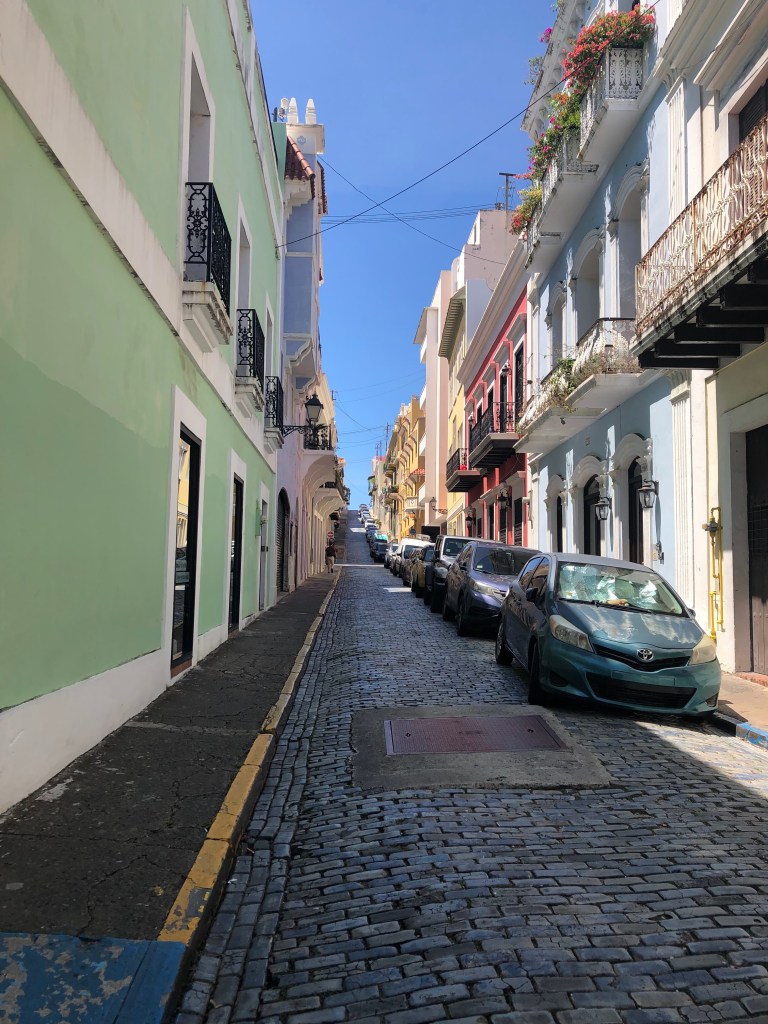
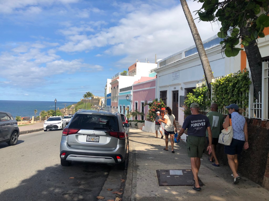
Monday, April 24th, we all piled into two rental cars and headed north for Old San Juan. The drive was easy and just over an hour long, and the mountainous scenery was beautiful. Once in Old San Juan, it took us 20 minutes to find parking, which we eventually did, three parking garages later. It was past lunch time by then, so we took care of that first. Then we started wandering around the cobblestone streets of the old town enjoying the architecture and lovely colors of the buildings.
lunch
kiss the colorful cow
streets of Old San Juan
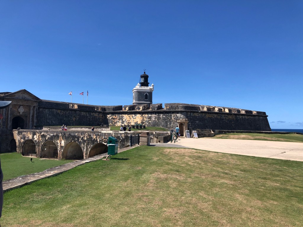
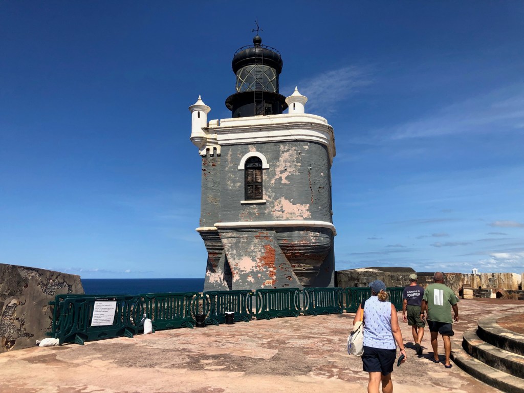
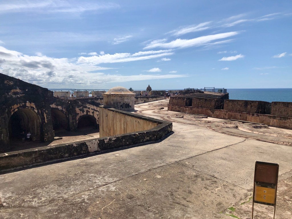
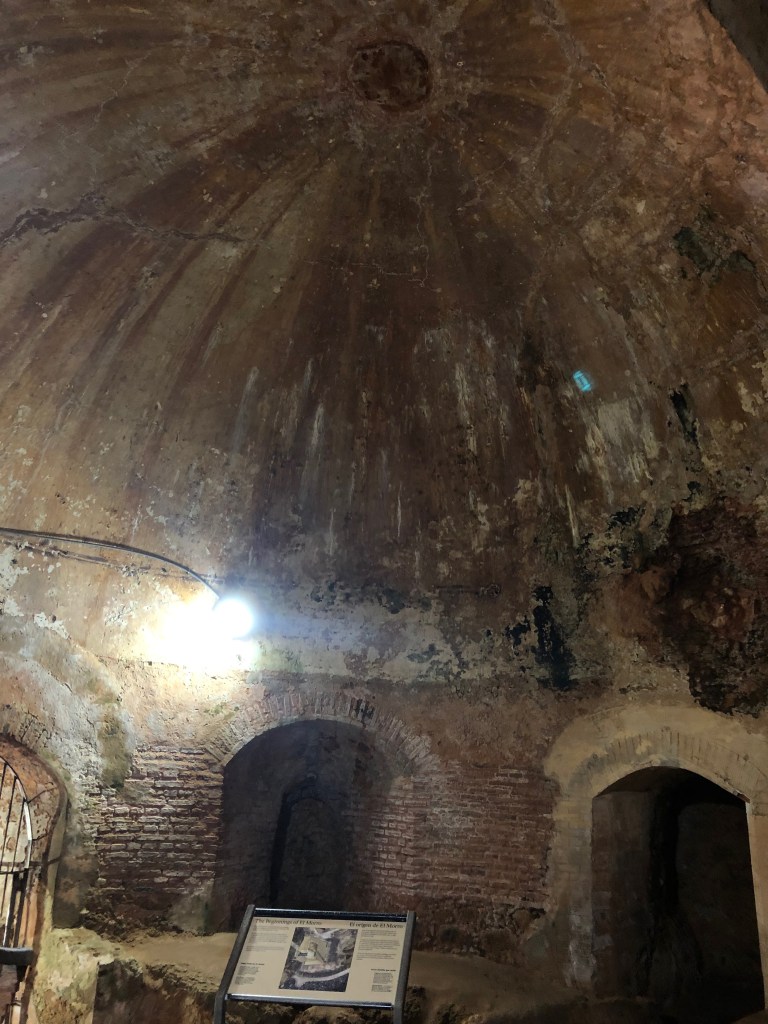
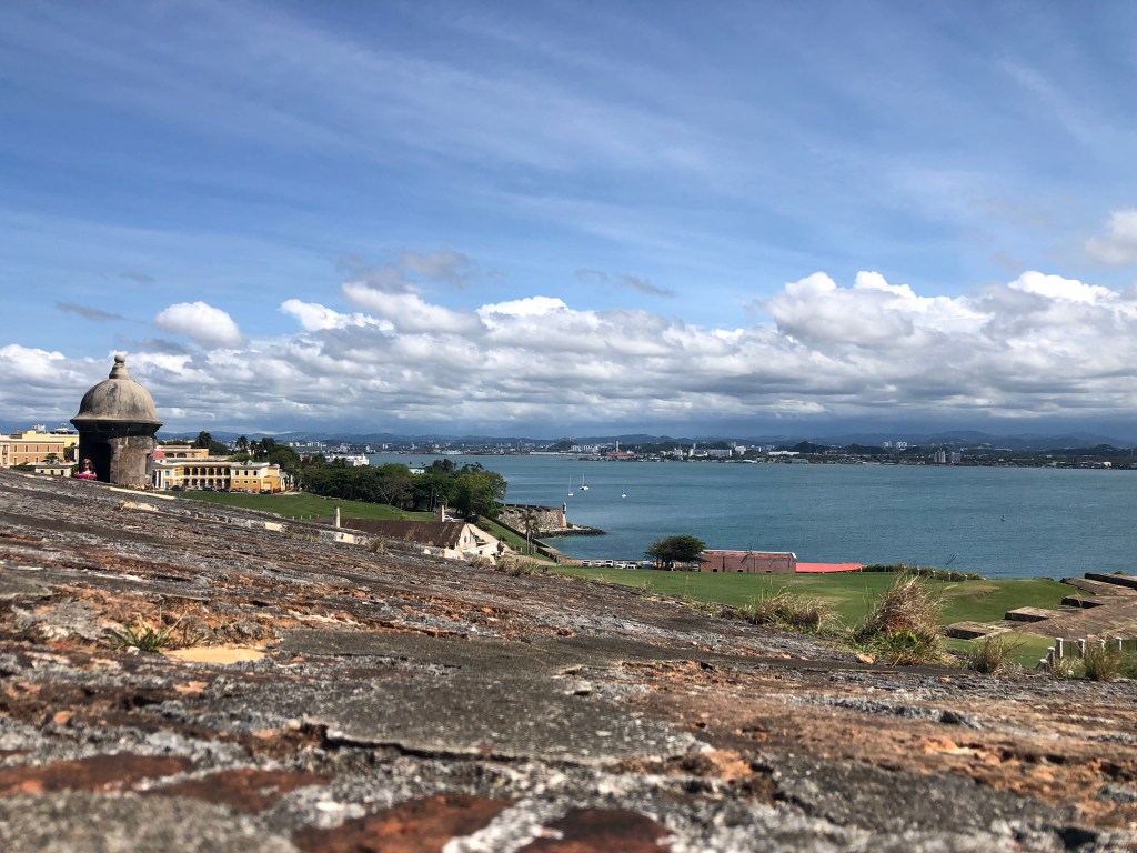
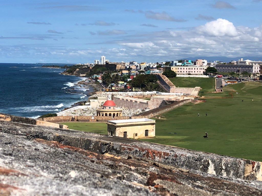
Eventually we found our way to the northeast point of San Juan Bay and El Morro (Castillo San Felipe del Morro), which is now a National Park. Dave, Barry, Andrea and I toured inside El Morro, while Mike, Victoria and Ocean explored the substantial grounds; they don’t allow dogs inside. This was the second fort build in what is now Old San Juan, with construction lasting from 1539-1790, resulting in a six-level fortress. It was under Spanish rule until 1898 when the United States won the Spanish-American war and Spain ceded Puerto Rico to the U.S. (along with Cuba, Guam and the Philippines). From then until 1961, El Morro became part of a larger U.S. Army post called Fort Brooke. The U.S. Army retired the fort in 1961, turning it over to the National Park Service to preserve as a museum. In 1983, the Castillo and city walls, many of which are still standing, were declared a World Heritage site. It’s expansive and the views from the highest level are amazing! We didn’t have much time to read placards, so this little history lesson comes from Wikipedia and the National Park Service.
from the grounds outside the main fortress
the lighthouse
the dry moat (it’s a thing)
used to be cannons here
there’s one!
only remaining original section from 1539
stunning views!
We continued our fortress tour by walking over to Castillo San Cristóbal. In 1625 the Dutch took San Juan by land. This takeover only lasted two months before they were driven out, but it prompted the Spanish to construct a fortress for protection of San Juan by land. They constructed a tiny redoubt in 1634, but it wasn’t until 1766 that the current structure was started. This one only took 17 years to build. It was even larger than El Morro, but in 1897 a large portion of it was taken down to allow the city to expand because it had been busting at the seams. We toured what’s left, but even faster than El Morro. This structure had cisterns for water storage; clever. Otherwise, it was like most fortresses we’ve visited from that time period. It was part and parcel of the larger fortress system in San Juan, so its timeline after the Spanish-American War is the same as that of El Morro. [Wikipedia][National Park Service]
Castillo San Cristóbal
plaza de armas
barracks
to the dungeon
water cistern
Tuckered out from walking around in the heat, and being almost 5pm, we decided it was time to check into our hotel. Actually, we had booked in at the San Augustin Apartments about ½ mile from the eastern end of Old San Juan. The apartments were very nice and reasonably priced when booked through bookings.com. There were two bedrooms, one twin bed and one queen bed, plus a pull-out sleep sofa in the living area. The smallish bathroom had a very nice shower. The living/dining area had the pullout sofa, a TV and table/chairs. There was also a kitchenette with a ¾ fridge, 2-burner conduction stove, sink, coffee maker, and everything you’d need to make and eat your own meals if you felt so inclined. Except the food, of course. They even have parking about half a block down the street. The apartments are gated with a code, so it felt safe. It’s in a blue-collar part of town, not pretty, but friendly. Most of the inhabitants work in Old San Juan, where it is too expensive to live. If I ever go back for a longer visit to Old San Juan, I would stay here. At any rate, we showered and rested and then went in search of dinner, which we found about ½ mile away and on the water. It was beautiful and delicious.
San Augustin Apartments
pizza after El Yunque
street art across from the apartments
da crew (couples left to right)- Victoria & Mike (s/v Wild Horses), me & Dave, Andrea & Barry (s/v Caretta)
The following day we went to El Yunque National Park, but that deserves its own blog post, so I’m skipping it for now. Moving on…
Our final morning in San Juan, Wednesday April 26th, we walked to the edge of the old city to a waffle/tea house. They had waffles topped with anything from eggs benedict to granola and fruit. We ate heartily. Our waitress is a part time singer. When she learned we were staying in Salinas on our boats, she told us about a musician we had to try to listen to if we had the chance. His name is Manolo Mongil. Guess who provided the live music I mentioned above, that we rocked out to our last night in Salinas. None other. Small world.
After breakfast we checked out of the apartments, bundled into the cars, and commenced with the shopping. We hit West Marine, Wal Mart, Costco, Petco, and an auto parts store in a huge shopping plaza just outside of San Juan. With our trunks packed full, we headed back to Salinas to unload our purchases onto our boats. Then we bundled back into the cars and headed to the nearby Econo Supermarket to finish off our provisioning, which for Dave and I was for the final portion of our trip through mid-June. It was already late when we got to the supermarket, and we all smelled the rotisserie chickens they cleverly placed at the front of the store near the checkouts. Guess what we all bought for dinner that night? It was a long, tiring, but productive day for us all.
The following day was low key. Then we went ashore to the marina restaurant for drinks, dinner, trip planning, and that awesome live music by Manolo Mongil. This wrapped our stay in Salinas, as we would depart early the following morning for the Spanish Virgin Islands.
My next post will circle back to our trip to El Yunque. I took so many pictures that I need to sort through first before putting together a slide show, and El Yunque definitely warrants a slide show. So next week El Yunque and after that, the Spanish Virgin Islands.
Until then, stay safe and take care of each other!
We and s/v Caretta arrived at Caja de Muertos early on the morning of April 19th. It’s a beautiful island about 5 nm south of the Ponce area. Nobody really knows how it got its name, but it’s had that name for a couple hundred years at least. The name translates to either “Dead Man’s Chest,” likely due to its association with pirates back in the day, or more commonly as “Coffin Island.”
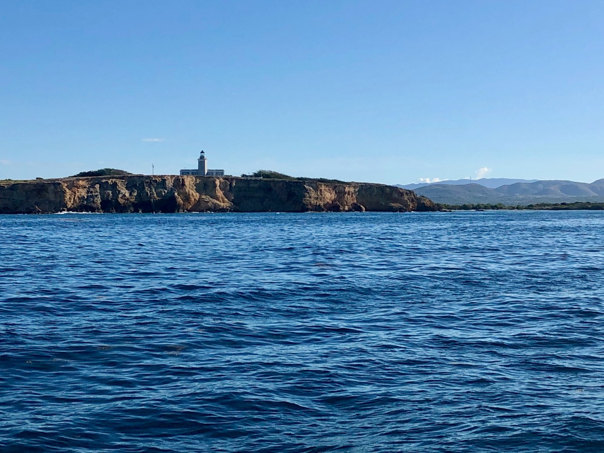
Caja de Muertos is about 2 miles long and ½ mile wide. The old Spanish-built lighthouse, constructed from 1885-1887, sits atop a 170-foot hill on the NE end. There is a lovely shallow, clear sand swimming beach called Pelícano on the SW end of the island on the Puerto Rico side. The beach on the Caribbean side is a turtle nesting site and therefore closed to humans, not that you’d want to attempt walking it the days we were there. Oh the crashing waves! The island was designated a Nature Reserve in 1980 and placed under the administration of the Department of Natural Resources (DRNA). They received approval in 1985 to develop the island as a center for tourism. A large cement ferry dock was built, plus covered, cement cabanas with picnic tables, a small museum, restrooms, a service building, and a residence/office for the DRNA rangers who lived there. Ferries and local private boats arrived daily from the mainland. We hear the island was heavily visited and quite the hangout for locals on the weekends.
If you’ve been keeping up with my Puerto Rico posts, you may notice that I’m speaking in the past tense again. Like Gilligan’s Island, this Nature Reserve is now officially closed to the public; “enter at your own risk” and with your own transportation. Although Hurricane Maria in 2017 closed the island for almost a year, it was the January 2020 earthquake that led to the current damage that has yet to be repaired. The DRNA residence/office is in a shambles. The museum is damaged and has been emptied but for some posters on the wall and some bits and bobs lying around. The ferry dock is heavily damaged. We explored the ruins to the extent we felt was sufficiently safe. We do enjoy exploring ruins. We heard that private boats still come out on the weekend to anchor in the shallows and enjoy the swimming beach, which is still marked off with floats. Cruisers still stop here, too. It shortens the trip between Ponce and Salinas, not to mention it’s too beautiful to miss.
We hiked up the small hill on the SW end of the island and discovered a shrine to the Madonna under a rocky overhang. The next day we hiked up the taller hill to the lighthouse ruin. Since the island was closed, nobody has officially kept the trail cleared so the cacti and thorny bushes were encroaching. We were only able to do the hike because Andrea (s/v Caretta) dropped off Barry with his machete at 7am. He whacked his was up to the lighthouse, clearing the trail of the worst thorny offenders. We picked up Andrea at 9am and started up the trail to meet Barry. We still had to pick our way carefully along the often narrow path, but thanks to Barry’s efforts, we made it unscathed to the top. The lighthouse sits atop the former keeper’s house, long since abandoned for that purpose when the light was automated in 1945. The quarters are said to have briefly housed a museum a number of years back. Now it’s just the damaged remains due to time and earthquake. We climbed the metal spiral staircase to the cement platform just below the actual light. Those views were stunning, but then we continued our climb up to the light itself and braved the narrow exterior platform, briefly, for photo ops. The wind that high made it challenging to hold the camera steady, but the views were totally worth it!
Our friends on Wild Horses arrived from the Ponce anchorage pretty early on Friday the 21st. The gang was together again! They explored the island, though not the lighthouse (the trail would not have been safe for their dog, Ocean) and hung out on the beach with Caretta. Dave and I explored a couple of spots along the NE end that Barry & Andrea had explored previously. There were piles upon piles of conch shells of varied types. We found a lovely Helmet Conch shell to bring back to Indigo Lady. We all gathered on Indigo Lady that afternoon for some trip planning and socializing. Sometime after 5:30pm we got a text that s/v Happy Jack was coming our way, about 10 minutes out. None of us had actually met them, but they had been part of the Easter Rebels WhatsApp group started back in Luperón when we were all looking for a weather window to head to Puerto Rico. We invited Brent and Andrea to join us once they’d anchored, which they did. So we all finally got to meet in person and hang out for a bit.
The next morning, we, Caretta and Wild Horses hauled anchor and set off for Salinas back on the mainland of Puerto Rico. From there we would be taking a road trip together to Old San Juan, which is what I will tell you about next time. Until then, stay safe and take care of each other!
Okay, the Gilligan’s Island we went to has nothing at all to do with the famed TV series. Its real name is Cayo Aurora and it is one of three islands that make up the Cayos de Caña Gorda, managed by the Department of Natural Resources (DRNA). It’s about 1 nm off the coast of Guánica. I think I read somewhere that the person who named it sort of looked like Bob Denver (that’s the actor who played Gilligan), but I can’t confirm that.
Gilligan’s Island is a small mangrove island. It used to be quite the weekend hotspot for locals and tourists alike. There was a long dock where the hourly ferry from the mainland would drop off day trippers. Tourists at the resort in Guánica could rent kayaks and paddle over. Locals would bring their own boats over on the weekends to pick up a mooring ball and spend the day enjoying the water in the mangrove creeks or at the tiny beaches tucked among the mangroves. There were covered picnic areas with brick fire pits, changing huts, and a bathroom facility.
I’m writing in the past tense because that was all destroyed during an earthquake in January of 2020, and it hasn’t been repaired or replaced yet. The quake also caused some sinking of the land and the mangroves have filled in. The park is officially closed, so visiting is at one’s own risk and with one’s own means of transportation; the ferries don’t go there anymore. We dinghied over and landed on a couple of very tiny sandy spots to walk what remains of trails we could find. We dinghied partway through one of the mangrove creeks and saw lots of fish. Dave and I snorkeled part of the reef on the south side of the island. The first dive mooring we picked up was in a field of sea grass overgrowing tumbled, dead coral, but we had more luck on the other ball closer to the breaking part of the reef. The hard coral was mostly dead, but its structure remained. It must have been amazing when it was alive. There was new coral growth, which is encouraging. We saw a small, healthy elkhorn coral and some fire coral, as well as some other hard corals for which I don’t know the names. We saw the usual suspects of small fish. It wasn’t a great snorkel, but it is a pretty little island.
Gilligan’s Island
mangrove creek on Gilligan’s Island
Ocean playing fetch with Dave
Dinghy landing on one of the “beaches”
Barry & Andrea of s/v Caretta
remains of a fire pit
Gilligan’s Island ruins
remnants of the dock at Gilligan’s Island
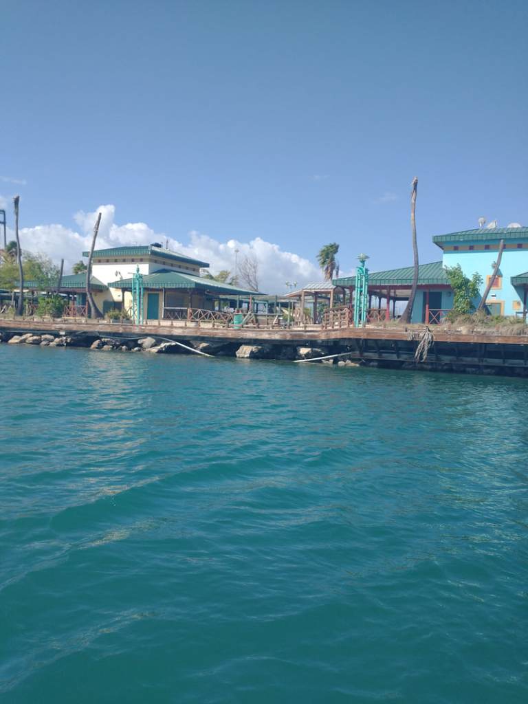
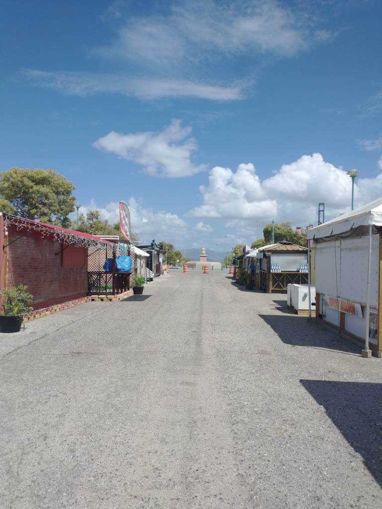
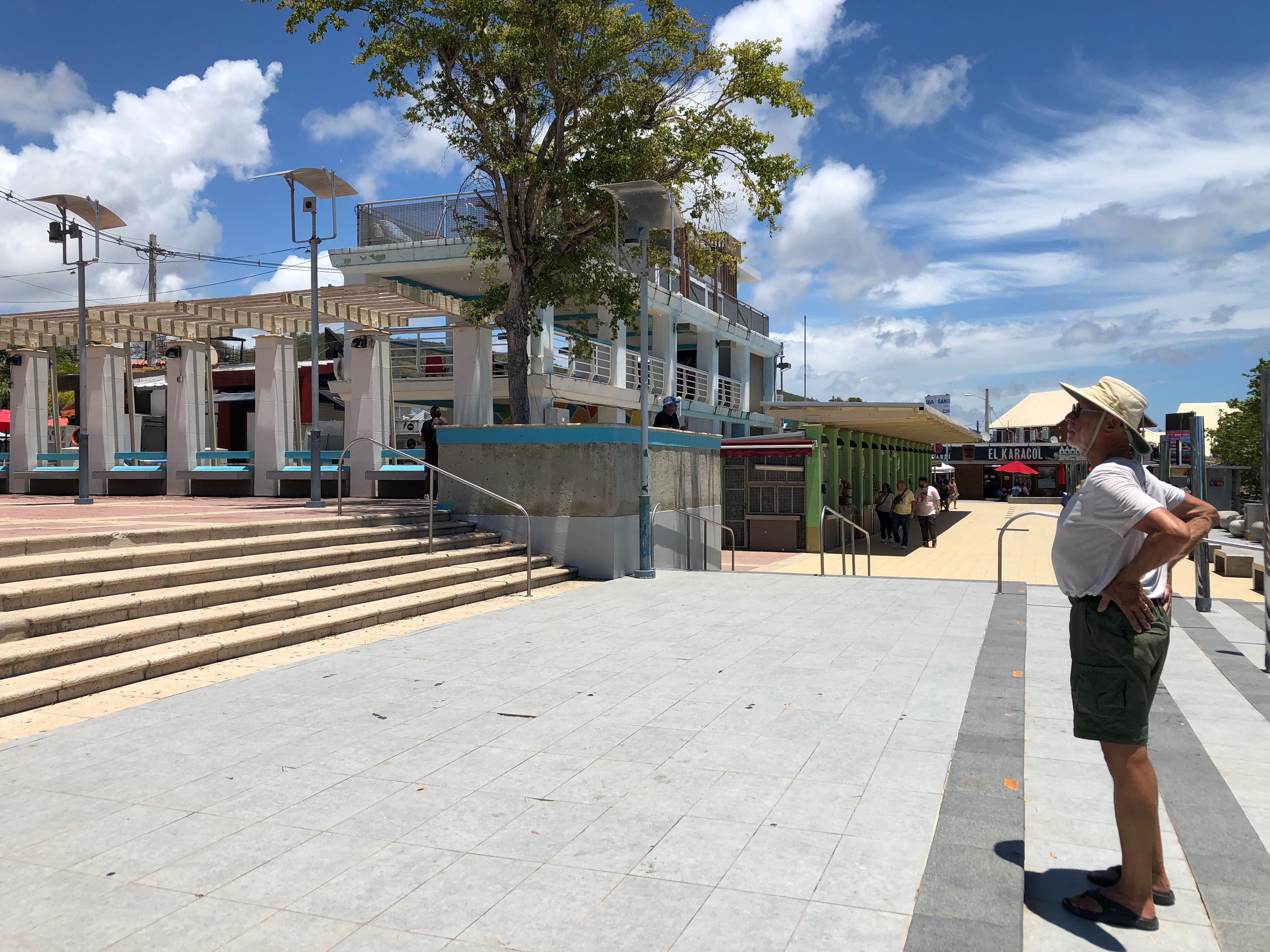
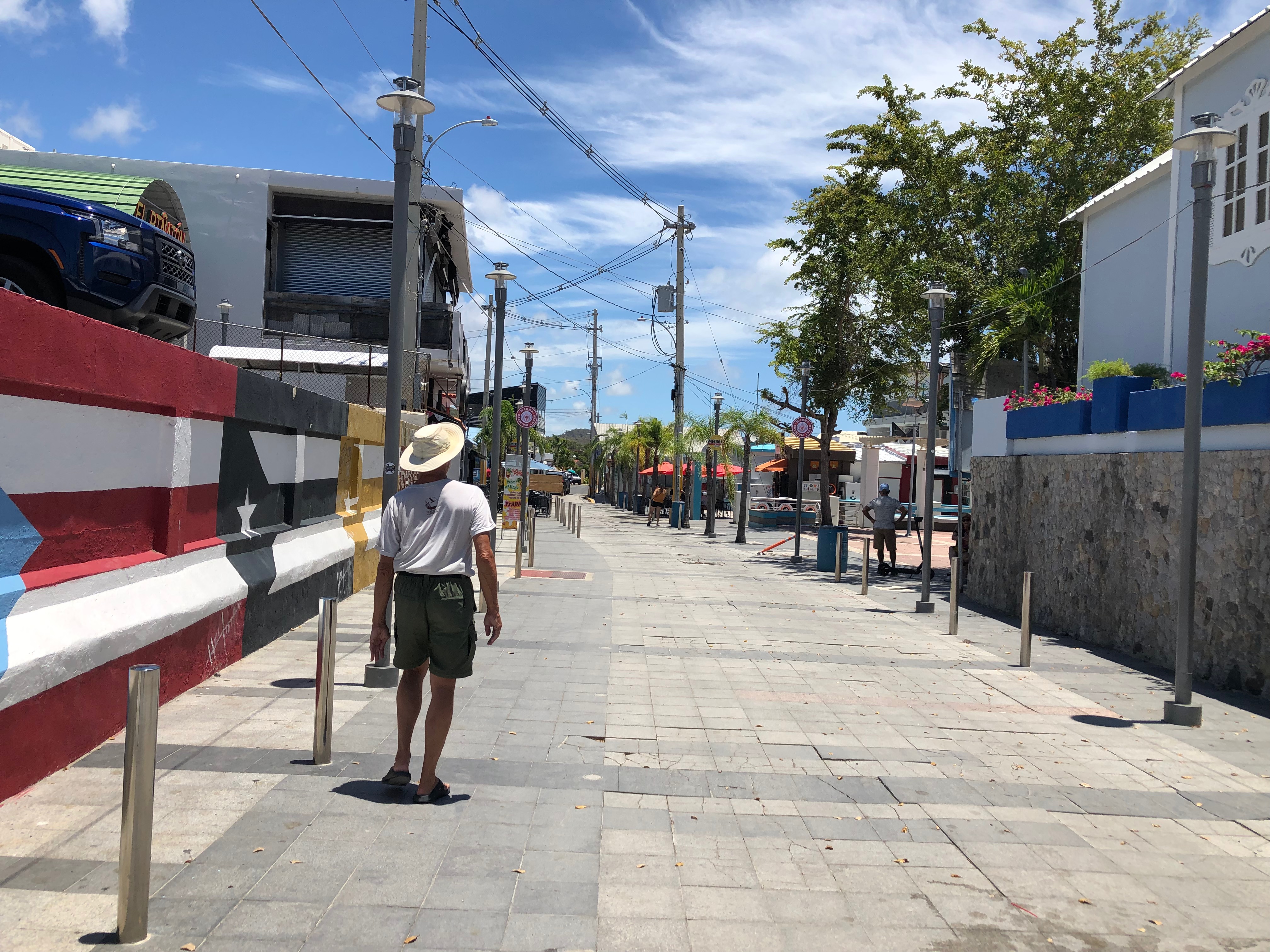
The next day was Tuesday, April 18th and we moved with our buddy boats the short distance east to Ponce. The preferred anchorage is near the Yacht Club. It’s a small area and not very pretty, not to mention crowded with the mooring balls and anchored boats. It’s the first time we put out our typical 5:1 scope to set the anchor, but then drew it in to a 3:1 scope. (Scope is the ratio of water depth to length of anchor line/chain put out. If the water is 10’ deep, we would put out 50’ of anchor chain for a 5:1 scope, 30’ for 3:1.) Sometime in the late 1990s, the La Guancha Boardwalk here was opened to the public. It was a hot spot on the weekends, especially at night. The waterfront was lined with shops, restaurants and bars. Again, past tense. It was heavily damaged by Hurricane Maria in 2017, and before any repairs were started it was damaged further by the January 2020 earthquake. There is a fishing cooperative at one corner of the anchorage that allows dinghies to tie up (the Yacht Club does not). So we went ashore and wandered a bit. About ¼ mile from the original boardwalk we encountered a park with food trucks lined up along the way. It’s a makeshift replacement for the boardwalk, but being a Sunday, the trucks were closed, except for a couple that sold drinks and hot dogs. We wanted a more substantial lunch and there was nothing within walking distance. One of our group had seen another dinghy dock at another fishing cooperative about a mile up into the bay. So we dinghied up and asked the fishermen and the DRNA officials (there was an office there) if we could leave our dinghies for a couple of hours while we got lunch. They put us all into an empty slip and recommended a restaurant about ½ mile down the road. It was a yummy lunch!
La Guancha ruins from the water
…and from land
Area where the temporary “La Guancha” is
Some of the food stalls
I had mofongo, and it was very tasty!
That was the sum total of our time in Ponce, at least for us and Caretta. Wild Horses stayed another two night and took care of some provisioning. Wednesday morning, we and Caretta headed 5.5 nm southeast to Isla Caja de Muertos, which is where I will pick this up next time. Until then, stay safe and take care of each other!
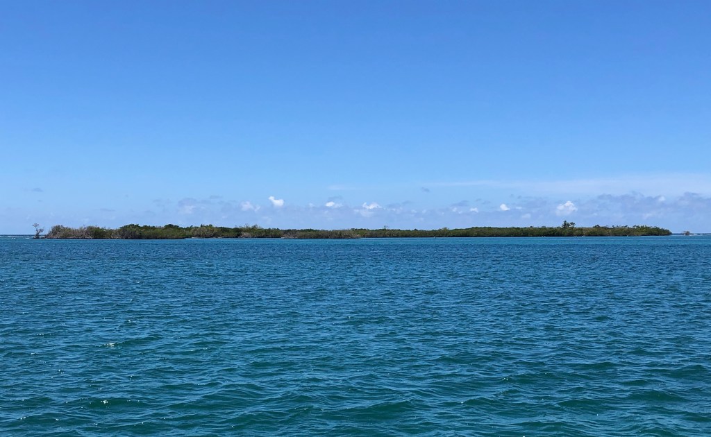
On Saturday, April 15th, we finally made it officially to the Caribbean Sea!!! We and our buddy boats, Wild Horses and Caretta, set out that morning to rejoin Bitty Rose at La Parguera on the south coast of Puerto Rico. We and Caretta anchored in Bahía Fosforescente (Phosphorescent Bay), while Wild Horses anchored at Punta Montalva where they could get Ocean (their dog) ashore for her needed walks. Bitty Rose joined us and Caretta in the bay that afternoon, having initially been anchored near the town of Parguera.
Bitty Rose in Bahía Fosforescente
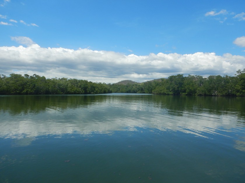
Mangrove creek off Bahía Fosforescente
Just after sunset, the tour boats started arriving and asked us to turn off all our lights, even our anchor lights. They brought people to snorkel amidst the phosphorescent dinoflagellates. We waited until most of the tour boats had gone before getting into the water ourselves around 9pm. Initially I wasn’t expecting much. Dave had gotten in and agitated the water, but I saw nothing of note from my vantage point on Lady’s stern. I was used to seeing phosphorescent critters glow from above. Dave assured me that if I got in the water with my mask on and stuck my face in, I’d be amazed. He was right! We spent about 20 minutes in the water just off our swim ladder, kicking our fins and swirling our arms through the water to make the dinoflagellates glow. I felt like I was doing magic. It looked like a night scene from Avatar, with the floating tufts of light, only these were roundish and in the water. It was amazing! (Unfortunately, my underwater camera could not pick up these balls of light so the images live on only in our memories.)
After breakfast the next day, Sunday, we moved Lady a couple of miles to anchor off Cayo Carocoles, a bit north of Cayo Enrique, which was supposed to have the best snorkeling. We dinghied around a bit, with me occasionally sticking my masked face in the water to find “the good stuff.” We eventually picked up a mooring ball further from the island and closer to the edge of the reef near the channel, where it’s a bit deeper. We got in the water and swam in a westerly direction toward another mooring ball at the edge of the channel. The hard coral was still predominantly dead, but there were healthy patches of soft corals, some rather tall and bushy. There were plenty of fish.
Caribbean reef squid
magnificent feather duster (a worm)
long-spiced urchins
After our snorkel, we dinghied to town to check it out. It used to have a dinghy dock, but that was destroyed by a hurricane or earthquake, or both. Fortunately, our friends on s/v Guajira had been there a couple of weeks ahead of us and provided intel from a local liveaboard for how to get ashore. The de-facto “dinghy dock” was now a pair of beached sport fishers between two dive boat businesses. We tied our dinghy to the bow of one, carefully climbed over its partially attached bow railing, stepped across to the other boat to its transom, stepped off the transom into shin-deep water, waded a few feet toward land, and climbed a metal rail fence. 😅 Ta-da, town! We weren’t there more than 30 minutes, since there wasn’t much of interest to see, for us, anyway. It’s a tourist waterfront with dozens of small restaurants and food windows, and souvenir shops selling mostly kitsch. We walked up a road more into town to a little convenience store/market to see about getting some fresh produce, but they didn’t have much. We returned to Lady, ate lunch, then dinghied over to Punta Montalva to join Wild Horses and Caretta. Bitty Rose joined later. Dave & I had everyone over to Lady for a couple of hours just for drinks and conversation.
“Dinghy Dock”
Streets of Parguera
Streets of Parguera
The next morning, Bitty Rose set out in the wee hours heading for Ponce. The rest of us set off about 8:30am for Gilligan’s Island. Gilligan’s Island?! Yeah, you’re gonna have to wait to get more about that. 😁 Until then, stay safe, and take care of each other!
We’ve been in Puerto Rico since April 11th and enjoying a lot of exploring. Exploring takes up a lot of time, so blogging is taking a back seat. I think at this point I need to do this in smaller chunks so I can keep you all entertained and informed, but so that I don’t spend hours writing an entry.
As I described in my post on April 15th, we arrived in Puerto Real around 1:30pm on April 11th. Our friends on Wild Horses and Caretta had arrived that morning, and our friends on Bitty Rose had arrived the day before. Upon our arrival, we pulled up to the fuel dock to fill up, and while Dave was doing that, I ran up the Q-flag and started the check-in procedure on the CBP Roam app. Within an hour we were fueled up and had our call from US Customs to clear us into the country. Easy peasy checking into the US and its territories using the app. We had secured a slip for two nights, which ended up being the far end of the fuel dock. That made it easy to do laundry in the marina facilities. It also meant a short walk for land showers- woo hoo! After our first two nights in Puerto Real, we left the dock and anchored off with our friends for two more nights.
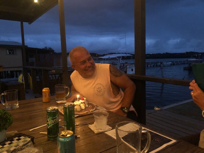
Puerto Real is a cute little village about two-thirds of way down the west coast of Puerto Rico. Being on foot, we only wandered about a mile in each direction, but this was definitely a bigger town than many on the out islands of the Bahamas, though not as big as Luperón. It had a couple of small markets, one even had a bakery. Of course we sampled the local, flaky pastries filled with jam. Yum! We sampled the fish tacos at the little, outdoor marina restaurant our first night there. For lunch one day, we picked up some empanadas from a street vendor a few hundred feed from the marina. Indigo Lady, Wild Horses and Caretta celebrated Barry’s birthday at the restaurant 9 Barrios, also only a few hundred feet from the marina. They had delicious wood-fire pizzas and locally brewed, canned beer. Mike & Victoria surprised Barry with a dessert pizza topped with ice cream for all of us to share. Delicious!
Streets of Puerto Real
Streets of Puerto Real
the birthday boy
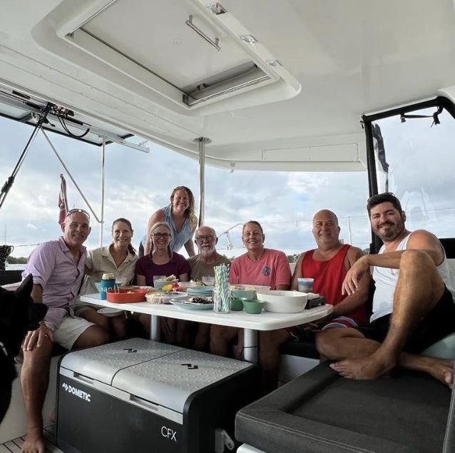
Da crew
Our third night in Puerto Real was Bitty Rose’s last. They invited us, Wild Horses, and Caretta over for drinks and “snacks.” We all brought gourmet “snacks” such that nobody needed dinner. That was a good thing, too, because the party didn’t break up until around 9pm! Bitty Rose left early the next morning for La Parguera, while the rest of us stayed another night in Puerto Real before rejoining Bitty Rose.
Sundowners on Biddy Rose, with Wild Horses, Indigo Lady and Caretta
And that’s where I’m going to leave this for now. I’ll pick up in La Parguera next time. FYI- it involves phosphorescence. Until then, stay safe and take care of each other!
We interrupt the chronology of our trip to notify you that we made it to Puerto Rico. Sound the horns! Ring the bells! Huzzah!
Here’s the story…
In case you missed it, we arrived in Luperón on March 13th. We were there for 25 days waiting for a weather window to continue east. The first potential weather window presented itself for March 27th, but we didn’t take it for various reasons I may describe at another time; it turned out to be a good decision. We had our eyes on a potential second window for the following week, but it didn’t pan out. Our chance finally arrived Easter weekend and it was going to be a good one. We would get our despacho (departure papers) on Saturday and head out either that night or the wee hours of Sunday morning to start our direct shot to Puerto Rico. Silly us!
Easter is a BIG deal in the DR. We didn’t understand how big until we learned Thursday morning that Customs & Ports was closing at noon that day and wouldn’t reopen until Monday morning. In the DR, one checks out with Customs & Ports first, then goes to the Armada for the official despacho. With Customs & Ports closing Thursday, there would be no despachos until Monday morning. The other thing you need to know about DR despachos is that the day you get it is the day you leave port. Yikes! The conditions would not be good to depart until late Saturday night, and there was no guarantee that the weather window would hold long enough if we waited until Monday. What to do?
Several boats were in the same situation, so we created a WhatsApp group to discuss strategy. Four of us (Indigo Lady, Wild Horses, Caretta, and Bitty Rose) decided to get our despachos Thursday, leave the harbor anchorage and stage in the little Pinzon anchorage just outside the official harbor and hope the Armada ignored us for the holiday weekend.
The Armarda did not ignore us.
At 2pm on Friday, I got a call from a representative of the Armada. They wanted to know why the four of us were still there, and threatened to take our despachos if we didn’t leave right away. I begged a little time to confer with our buddy boats and said I’d call back to let them know of our decisions. After some texting amongst the group members, and a call to Chris Parker (the human weather router we use), we all decided to leave, but really wanted to wait until midnight once the seas and winds had settled. I called the Armada representative and explained that midnight was the safest time to leave and if we were forced to leave earlier, the Armada may have to come rescue a boat or two (perhaps a slight exaggeration). Irritated, he finally told me that if anyone was there in the morning he was taking our despachos, and he hung up.
So…at 12am Saturday morning we all hauled anchor and had a very decent passage to Río San Juan, 52 nm east of Luperon. We dropped anchor for the day, when the winds & seas pick up, and rested until 12am Sunday morning when we all hauled anchor again and headed for Escondido another 55 nm east. It was a good passage and we brought up the rear, anchoring around 10am or so. We passed a quiet Easter Sunday in the shadow of some mighty fine mountains, with a little village barely visible just beyond a beach. Our next stop would be Puerto Rico. Bitty Rose left just after 5pm Easter night while the rest of us waited until 4am Monday morning. It was a quiet, calm cruise of about 15-20 nm around Cabo (Cape) Cabron and Cabo Samaná. As we were passing the mouth of Bahía Samaná (Samana Bay), Dave & I took a different route than the others, so at this point our stories diverge for about 24 hours.
Escondido beachEscondido beach & villageOur buddy boats at EscondidoWild Horses & Caretta at sunrise
Our friends on Wild Horses and Caretta went north of what’s called the Hourglass Shoals. Dave and I opted to continue down along the DR east coast to near Punta Cana (Cana Point) before turning into the Mona Passage south of Hourglass Shoals. The first 7 hours from Escondido around the capes and across the mouth of Samaná Bay were wonderfully calm. Then, around 11am, the wind and seas started picking up a bit. Then they started picking up a lot. It was a very bumpy, wet ride for the next 3-4 hours as we hobby-horsed and took water over both bows. Good thing Dave installed and deployed the wind/rain shield or he would have been soaked! We slowed to 3 kts and started talking about bailing out at Punta Macao to wait until the seas subsided. The wind and seas started calming a bit, but we were still only making 3 kts. Hmmm… We’ve been in worse seas making better time, so Dave suspected that something wrapped one or both of our propellers. Now we had two reasons to stop at Punta Macao. We’d lost radio contact with our buddy boats not long after we learned they were experiencing the same bumpy conditions (too far away), but we picked up another sailboat that hailed us. We both decided to stop at Punta Macao and did, in fact, meet there.
I started to get a little nervous because our despacho was for Samaná; it was not an international despacho to clear out of the country. We had read that most folks who stop in Punta Macao get a visit from the Armada, who would want to see our despacho and would ask why we had not stopped in Samaná. Why didn’t we get an international despacho? From what we had read, most boats that set out from Luperón end up stopping in Samaná anyway because the weather window doesn’t hold. If we had officially cleared out of the country with an international despacho, and then had to stop in Samaná, we would have had to pay to check back into DR. We wanted to avoid that, so we took a gamble. Turns out I worried needlessly.
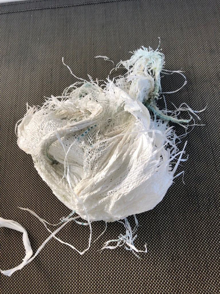
We set anchor at Punta Macao around 5:30pm and immediately started pulling out snorkel gear and tools for Dave to check our props. We had something wrapped around the shaft of our port prop, but starboard was clear. Dave had to launch the hookah so he didn’t have to keep coming up for air while he worked. I sat in the sugar scoop and handed him tools and took what he handed me. He removed the prop and was then able to remove the wrapped stuff quickly and reassemble the prop. Turns out it was not a fish net, as we had anticipated, but was one of those synthetic burlap type bags. While he cleaned gear, I warmed our dinner. We ate quickly and then hauled anchor, along with our new buddy boat. Maybe the Armada saw that we were making a repair and decided to hold off visiting until they knew whether or not we would leave. Maybe they were recovering from the busy holiday weekend and had no intention of visiting us at all. Regardless, they did not visit us and we did not need to defend our travel plans. Phew!
This is what wrapped our prop
The seas had calmed and our passage continued smoothly but for a couple of hours during one of Dave’s wee hour watches when it got a bit bumpy again, but not as bad as the afternoon. It was nice having a buddy boat in sight and in radio communication, especially during the night watches. I saw sunrise over the Mona Passage in calm seas. We learned to stop the boat and clear our propellers of accumulated sargassum seaweed occasionally, by pulsing them in reverse, to keep up our speed. Seas were glassy for a bit, then a bit bumpy about 10 nm out from Puerto Real until we were close enough to be in the lee of the island. We arrived in port around 1:30pm. Wild Horses and Caretta had arrived about 8am, and Bitty rose the day before. Hail, hail, the gang’s all here!
Sunrise over the Mona Passage
Now we are at our second Caribbean island and one step closer to the Caribbean Sea. By the time you read this, we’ll actually be there, because as I type, we are en route to our first anchorage on the south coast of Puerto Rico, the northern border of the Caribbean sea.
Next week I’ll probably wrap up our stay in Luperón and then after that, pick up with our Puerto Rico adventures. Until then, stay safe and take care of each other!