Bahamas, Present Day…

I’m actually writing this today. I’m skipping the northern Exumas post for now, to bring you up to our present. We are back in the Berry Islands, enjoying our final few days before we start the process of closing up Indigo Lady for the season. 

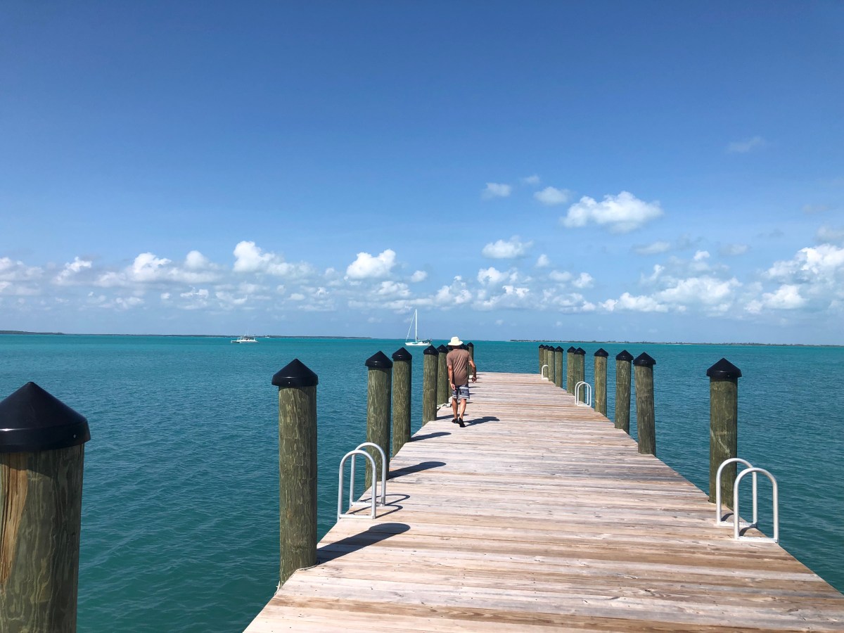
We arrived at Alders Cay on Sunday the 19th. Alders Cay and nearby (almost attached) High Cay are one island group further south in the island chain than we got last year. We spent the night and the following morning walked the beaches on Alders Cay and Bonds Cay (one island south of Alders). Funny story from our one morning at Alders Cay. Dave enjoyed his morning coffee in the water sitting on one of our floaty seats. As always, he rinsed it and laid it out after he was done with it. Shortly after breakfast, a rain shower popped up with a gust of wind that blew the floaty overboard. It would have landed on the beach we were going to explore, but instead of waiting, Dave donned fins, mask and snorkel (and nothing else!) and swam out to rescue it. With floaty safely stowed, we went for our beach walks, then returned to Lady for lunch and shortly afterward set out for our old stomping grounds at Hoffman’s Cay.

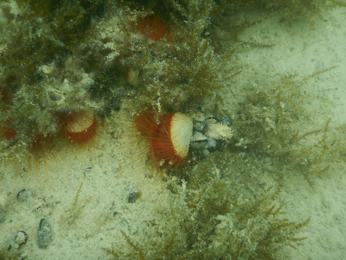
I refer to Hoffman’s Cay as our “old stomping grounds” because this is the third year in a row that we’ve been here. It’s interesting how familiar it feels here now. We were here in March of 2020 with my folks (before heading back to the US due to the pandemic), in late July/early August of 2021, and now June of 2022. Yesterday morning we walked the mile-long beach (at low tide) on the north end of Hoffman’s and saw our familiar friends the rays, sea turtles and trigger fish in the shallows, plus various seabirds and some lizards on shore. This year, in addition to gulls, terns and osprey, we saw a gorgeous heron. Yesterday afternoon on the rising tide we dingied over to Turtle Bay and up the mangrove creek. We weren’t able to get as far up the creek as in the past because the mangroves have encroached on it a little more. We saw the largest variety and quantity of fish and other sea life in 2020 with my folks. Last year we saw hardly any sea life there; this year was somewhere in between. This morning we walked the trail across to the Atlantic side beach and saw that the wreck of Low n’ Slow is still high and dry. I need to verify it from last year’s photos, but I believe it’s in the same spot as last year, but last year we noted that Mother Nature had moved it quite a distance from where we’d first seen it in 2020. I wonder how long it will be before she batters it beyond recognition. This year we saw three seaturtle nests on the beach (see the picture above)! Every year there has been a different experience. Tomorrow we may revisit the Blue Hole, or opt to walk the long beach again, or maybe snorkel the ledges. Regardless of our decision, we will enjoy the beauty of this island. 

Our time here in this remote part of the Berry Islands is short this year. By Saturday night we want to be anchored back in Bullocks Harbor at Great Harbor Cay. Last year we took two days at anchor there to start cleaning and prepping Lady for closeup, then spent two more days in the marina finishing up, staying at the nearby guest inn those final two nights. That plan worked very well, so we are repeating it this year. Tomorrow we will likely head a few miles north to Soldiers Cay and either stay there a couple of nights or move Friday up to Great Harbor, behind the Stirrup Cays, and then continue to Bullocks Harbor on Saturday. Why gun it when we can dub our way back slowly? We’re hoping to catch up with our friends on Wildly Intrepid somewhere between here and Great Harbor Cay, but those kinds of things are so weather dependent. Our fingers are crossed.

It’s been a short season, but enjoyable. We’re on the cusp of pleasantly warm and unbearably hot; not a bad time to head back to New England where we will cruise the Gulf of Maine on Dumbledore. New adventures await!h

On Friday I will post about our time in the northern Exumas. That will probably be my last post from here in the Bahamas, since next week will be quite busy with closing up the boat. So check back on Friday. Until then, stay safe and take care of each other.

Rock Sound via South Palmetto Point

Settle in; this one’s a bit lengthy…

Our last morning at Governor’s Harbor we went ashore early to avail ourselves of the laundromat to wash our sheets. We can and have washed them aboard Indigo Lady, but it’s challenging, so we hold out for laundromats when we can. Going ashore also afforded us the opportunity to get some gas for dingy, a couple of bottles of wine for Dave, a coffee from Da Perk for me, and some cinnamon rolls from the local bakery. We were back on Lady and underway by 10:30 am, enjoying those fresh and still warm cinnamon rolls!

It was a quick trip to anchor off South Palmetto Point, a stop I wanted to make because I’d heard about the amazing Island Farm with fresh produce, honey, jams & jellies, baked goods, etc. We were just preparing to go ashore to the Farm when @sailingseadragon dingied over to say hello. We’d met them back in Alabaster Bay. They were heading to Rock Sound. We arranged to meet up there the following day and spend some time together. Dave and I went ashore and walked the mile to Island Farm. We missed out on the baked goods, but we stocked up on fresh produce, including locally grown bananas, plus local honey, cheese and fresh salami. We also sprung for a Bahamian rum cake, commercially baked, but at least in the Bahamas. 

About 6:00 am the following morning, we woke to a few mosquitoes buzzing around our heads. After swatting a couple of them, we decided it was best to just get up and get underway for Rock Sound, though earlier than we’d planned. As soon as Dave got to the salon, he discovered that our magnetic screen door had blown open along 5” or so, which is what let in the mosquitoes. Dang! 

We had a quick breakfast of fresh, local sugarloaf pineapple that we’d bought in Governor’s Harbor, along with half each of the third cinnamon bun we’d bought there as well the morning we left. Double yum! We were underway by 7am. This was a longer, 23 nm trip, so I had a few hours to get ahead on blog entries and periodically go cabin to cabin rousting and killing mosquitoes. By the end of the evening we’d collectively killed about 3 dozen of the blighters, at least half of which had already bitten one of us.

At one point about halfway through our trip, a fish hit the line Dave had out trawling, but it got off before he could see what it was. We told ourselves it was just a barracuda, which we would have thrown back anyway. About a mile from the anchorage, in about 10 feet of water, we hit another fish. This time Dave landed a 25” black grouper! He dispatched it and put it in the bucket to clean after we’d anchored a few minutes later. Our new friends on Sea Dragon had passed us as the fish hit. As soon as our anchor was down, their nine-year-old son was on the radio excitedly hailing us to find out what we’d caught and how we’d caught it. He loves fishing and is learning how to spear fish this season. We invited them over for drinks and snacks for later in the afternoon. Dean and Sarah came over for some adult time, leaving the kids on board for some solo time of their own. We had a lovely chat for 3 or so hours and then they left for the very short dingy ride back to their boat and kids. 

We went ashore shortly after breakfast the next morning and headed about three quarter of a mile south to Cathedral Cave, also known locally as Spider Cave. The local nickname of Spider Cave is due to the numerous webs stuck to the rocks. They reminded me of Halloween decorations. The cave itself has lots of openings in the ‘ceiling’ allowing in sufficient light from above to not require flashlights. It was fun to poke around the nooks and crannies in this spacious cave. Lots of tree roots reached down from above seeking the cave’s floor. There were also lots of bats, lots more than we’d seen in Hatchet Bay Cave. This also meant lots of bat guano in some places, so we had to be careful where we put our hands. There are, of course, pictures and video of the caves and bats in the slide show below. 

We walked back into town looking for a place for lunch. Rock Sound Harbor is a large, well-protected harbor about 1.75 miles wide and 4 miles long. Their public dock is huge and new with at least a dozen ladders to climb up. Impressive. There is an airport at the north end of the harbor. So I expected there to be more in town, but there wasn’t much, which surprised both of us. Most of the stores and restaurants mentioned in our 8-year-old chart books no longer exist. Not sure what happened over those 8 years, but there’s not much here anymore. If the shiny new public and government docks are any sign, perhaps the town is working on building itself up again.

We had heard about Wild Orchid’s, however, through the Bahamas Land & Sea Facebook group, and that’s where we ended up for lunch. They are extremely boater friendly with both street side and dock side signs welcoming boaters. They let cruisers tie up to their dingy dock and even drop off their garbage. Lunch was really good, too, and the staff friendly. It was slow, only one other couple there. The bartender noticed a dingy drifting off and once she established it didn’t belong to either couple present, she drove Dave down to the town dock where our dingy was tied, and Dave zipped out to tow it to and tie it off to Wild Orchid’s dock. Great teamwork! Later in the afternoon the owners of the dingy stopped by to thank us with a bottle of wine.

We returned to Lady to pick up our snorkel gear, then headed back to shore to visit the famed Ocean Hole. It was green, and not a healthy green. But we bought a few slices of bread to feed the fish and I got in the water with the camera to document it. Then Dave came in and we swam for about 5 minutes before deciding there was nothing to see because (a) the fish hang out where they get fed, and (b) the visibility was abysmal. We later found out the hole used to be crystal clear and a place locals hung out on the weekends to swim and play in the park on the south end. I fear the feeding of the fish to draw in tourists was the demise of the ocean hole. So sad. Before heading back to Lady, we dingied around the ample harbor looking for the in-water, small blue holes (ranging from 24’ to 45’ or so) we’d seen on the charts and stopped to snorkel at one. That one was shallow enough to almost see bottom, but the visibility wasn’t great. Still, we felt cleaner after the swim in the green hole.

The next morning I made a final shopping list and we headed to Wild Orchid’s dingy dock to drop off garbage and walk to the supermarket for a final provisioning run. We were followed by a dog we’d met the prior day. He actually followed us all the way to the market, waited for us while we were inside, and followed us all the way back to our dingy. Dave had given him a small piece of bread the prior day when we were feeding the fish. No wonder the pooch followed us. 

Later that afternoon Dean, Sarah and the kids from Sea Dragon joined us aboard Lady for drinks and homemade pizzas. They brough cookies for dessert. We talked nonstop for several hours, adults and kids alike, with our evening winding down on the tramps gazing at the stars with an astronomy lesson from Dave. Alas, the following day we would part ways, but have been keeping in touch through texting and social media. 

I’ve said this before and I’ll say it again (and again, and again), but one of the most enjoyable parts of cruising for me is meeting other cruisers. Dave and I both love spending time with other adventurers of all ages and backgrounds, who are each exploring this world from the sea. Our time together may be brief, but each meeting leaves and indelible imprint on our lives- a new friendship, a new perspective, a new way to think about life aboard, or life in general. To each of you who have touched our lives while cruising and who may be reading this now- thank you!

Thus concludes our exploration of Eleuthera. From Rock Sound we headed to the northern Exumas for some diving until it’s time to head back to Great Harbor Cay at the end of June. I will start to tell you about this part of our adventure next time. Until then, stay safe and take care of each other.

Governor’s Harbor part 2- Some History and the Leon Levy Native Plant Preserve

Governor’s Harbor was the first permanent European settlement in the Bahamas. Technically, the main settlement was on Cupid’s Cay, connected to Governor’s Harbor by a causeway, with a minor settlement in Governor’s Harbor, then called Colebrook Town. The settlement was created by a British group from Bermuda, seeking religious freedom, that wrecked on the Devil’s Backbone reef and sought refuge for several months in Preacher’s Cave (see my prior post that includes this). It’s the center of Eleuthera, both physically (pretty close, anyway) and governmentally. It’s less touristy than Spanish Wells, but it was a bustling little town with all the essentials, including two good-sized grocery stores, two liquor stores, a hardware store, automotive services, banks, an historic library (that I unfortunately did not get inside), a new laundromat (score!), and even a movie theater. As I mentioned in my last post, we enjoyed the Friday night Fish Fry when we were there, and we explored the Club Med/French Leave ruins. I had a delicious, fresh made lemonade at The Tea Kettle on Cupid’s Cay during our first walk about. We had lunch twice at The Buccaneer Club, itself formerly a resort and now simply a restaurant. Just outside of town is the Leon Levy Native Plant Preserve.

We visited the Leon Levy Native Plant Preserve on our second full day in town. There’s a sign near where we parked our dingy stating that it is 2 miles to the preserve. That was a bit optimistic; they rounded down from the actual 2.6 miles. We were prepared for this, however, because we cheated and used Google Maps before setting out on the trek. We like to be mentally prepared for long, hot walks.

Leon Levy was an American investor and mutual fund manager. He and his wife, Shelby White, had a house in Eleuthera and became very attached to the island, its culture and its people. After his death in the early 2000s, his wife wanted to do something in his name that would also benefit Eleuthera. The Preserve was born of her working with the Bahamas National Trust. The preserve serves as an educational center, a place for propagation of indigenous plants and trees, and a research center for traditional bush medicine. We walked their well groomed 1.5 miles of trails and even climbed the wooden tower that grants panoramic views of the island. It was post spring bloom, so I didn’t take pictures of all the green shrubs, just stuff that particularly caught my eye. We enjoyed ourselves thoroughly, almost as much as the mosquitoes enjoyed us. 

After hiking the 2.6 miles back to town under the hot noon sun, we opted for another lunch at The Buccaneer Club. We’d had lunch there the day before and had planned to eat aboard after the Preserve, but we were too hot and tired to face putting together even something as simple as a sandwich. So we sat in the breeze and shade on Buccaneer’s deck and indulged. Totally worth it!

You can learn more about the preserve by clicking the hyperlink in the second paragraph, and please do enjoy the slide show below.

We made two more stops on Eleuthera, which I’ll tell you about next time. Until then, stay safe and take care of each other.

Governor’s Harbor part 1- Fish Fry & Club Med Ruins

May 20th we headed to Governor’s Harbor from Alabaster Bay. It was short, 5.5 nm cruise in good conditions, though overcast. Still did it on just battery and solar, though. We’d heard there is much debris and general poor holding in this harbor, so we spent 15-20 minutes tooling around the anchorage with the side scan sonar on and me looking down from the bow. We wanted to be sure to avoid the remnant mooring blocks and other debris on the bottom. Our reconnaissance paid off, because when we finally dropped anchor, it set the first time. Dave dove the anchor and our swing area to ensure we wouldn’t snag any debris if we swung; he declared us well set and all clear. Yay. 

We went ashore to check out the town, noting the locations of the liquor and grocery stores, as well as the location of the Friday night Fish Fry we’d heard about (it was Friday night, after all). This is the first big town (big for this island) with wet entry only; there was no dingy dock. On top of that, it’s too shallow for a dingy out as far as a couple hundred feet from the cement stairs or ramp. So we anchored dingy where she would still float and waded to the ramp. It was either that or drag her back to deeper water when she grounded, and she’s a bit heavy. 

We returned to Lady not long afterward for a bit of relaxing, followed by virtual sundowners with our boating club before heading back ashore for the Fish Fry at 6pm. The Fish Fry is a weekly fundraising event for the town. It was busy with locals and tourists alike. Dave got us some conch fritters as an appetizer from one of the nearby stands while I stood in line to order our main meal- two orders of fried fish, each with two sides; we both got the peas & rice, then I had the coleslaw while Dave had the mac n’ cheese. We also each had a Bahama Mama- very strong with the rum. Since it was a fundraiser, we opted to follow up with dessert (like we needed an excuse). Dave had chocolate chip cookies and I had a piece of homemade Bahamian rum cake. I think the cake was stronger than my rum drink, and it was delicious! We enjoyed listening to the DJ get the crowd doing line dances and then a limbo contest. We left the party around 9:30 and it was still going strong until almost 11. Fortunately we could barely hear it from the anchorage even though it was right down near the water.

The next morning, about mid-morning, we headed ashore for the ¾ mile walk to the Club Med ruins on the Atlantic side of the island. I did a little online research about the place, which was spotty, and at times inconsistent. Best I could figure out, the location was originally the French Leave Resort in the 1960’s and was sold to Club Med in the latter part of that decade. Club Med was heavily damaged by Hurricane Floyd in 1999 and never reopened. Sometime in the early 2000s many of the structures were bull dozed in preparation for a new entity named French Leave to rebuild on the site. The rebuild never happened, although there is a small French Leave resort not far from the ruins. One of the structures still standing appeared to be an office, one room of which contained one of those blueprints cabinets with wide, shallow drawers. Only the drawers were all empty and the contents strewn about the floor. They appeared to be plans for the new resort that never materialized; one was dated 2006, so the timeframe fits. I’ll let the pictures in the video slideshow linked below speak for the rest of what we saw. I also found this link that includes several ca. 1960s post cards from when it was French Leave Resort (and one from Club Med).

When we returned to town we stopped for lunch at The Buccaneer Club, which we’d heard was good. It was. Got a few grocery items and some liquor; scored a whole case of Kalik Radlers Mango (hard to find) at half the price of buying the things individually. Kalik is a local beer; the flavored Radlers barely qualify, though. They’re mostly hummingbird nectar with 2% alcohol. No wonder I like them. The rest of our day was spent on Lady and very low key.

Our excursion the following day was to the Leon Levy Native Plant Preserve, but I’ll tell you about that one in the next post. I took lots of photos! Until then, stay safe and take care of each other. 

Alabaster Bay

We left Hatchet Bay on May 18th right after my nephew’s livestreamed graduation from New Hampshire Technical Institute (his Associate’s degree in Animation & Gaming; I paraphrase the title). It was only a 2.5 hour cruise to Alabaster Bay and we had lunch after anchoring. There was only one other boat there. We got some hammock time before the rain started. It wasn’t heavy, but it kept us indoors the rest of the evening. Over dinner we had a video call with my family to celebrate Gabe’s graduation. It was so good to see their faces!

We’d come to Alabaster Bay because it was a lovely anchorage, it broke up the trip to Governor’s Harbor (the next major town) and we wanted to see the US Navy Experimental facility/Auxiliary Air Force Base ruins, which we did the day after we arrived at the anchorage. Mid-morning we parked dingy at the little beach and made the 1.5 mile trek to the ruins. You can click on the link for some more in depth background (that includes additional links). The basic timeline, however, is that the base was started in 1950 as a Navy test facility for a sound surveillance system for tracking Soviet subs in the Atlantic. The Auxiliary Air Force Base commenced operations in 1957 as part of the Air Force Missile Test Center’s Atlantic Missile Range. The base was decommissioned in March of 1980 because the US couldn’t secure favorable lease renewal terms from the Bahamian government. So, of course, we left everything to rot on someone else’s land. Back to the ruins…

There were mostly ruins of old housing, gate and guard houses, and huge oil storage tanks rusting. Near the latter the Bahamians have constructed what appeared to be a water treatment facility of some kind. It was posted “No Trespassing,” which we honored, so we could only see what we could from a distance. We didn’t spend too much time, but I did take quite a few pictures, which I’ve posted below as a link to a YouTube video (slideshow, really).

From one part of the ruins we walked down to the famed pink sand beach, which only looked pink where the water washed over it, otherwise it looked pretty white to me. We walked north a bit and encountered a fresh sea turtle nest, which I do not have pictures of because I’d left my camera with our stuff at our entry point to the beach. I had enough picture of beaches and figured I wouldn’t need it. So of course we saw something cool. A man we met on the beach told us of a beach bar/restaurant about a mile south with great burgers and cool vibe. So we headed south. En route we encountered the family from @sailingseadragon, whom we’d met earlier in the anchorage. We had a chat with them, then left them to continue their water play while we headed for lunch. We were greeted at The Deck by the friendly owner/cook. He does make an amazing cheeseburger and mahi burger. We ordered one of each and split them. He also makes a great rum punch with fresh coconut, mango, pineapple and orange to top it off. The place really does have an awesome island vibe (pictures included in the video below). You can snorkel the reef in front of the restaurant and he has a fresh water shower at the foot of the stairs for folks to rinse off before going up to sit. There is both completely outdoor and under-roof seating, but all open to the luscious breezes, with wooden shutters placed to block, if necessary, rain that may pass through. The décor is all tastefully recycled flotsam and jetsam (picture in the slideshow). We were the only ones there at the time and enjoyed ourselves. We later learned that he’s a pariah on the island, and had we known then what we learned later, we would not have ventured there. Nonetheless, we seemed to have caught him a good day and enjoyed the food and atmosphere.

On our walk back up the beach we met the family of Sea Dragon again and stopped to chat some more. They directed us to a path that took us past a part of the ruins we would have otherwise missed (largely the barracks I mentioned earlier). By the time we got back to Lady we were hot and tired, so we floated for a bit in the shade of Lady’s hulls and had a light, late dinner because we were still full from lunch.

The next morning we had some chores to do before setting out for Governor’s Harbor, and we wanted to snorkel around Alabaster Bluff a bit. After the snorkel we noticed the skies darkening to the south of us and our radar showed quite a mass of rain. We made lunch and waited. We were hailed by SV Sea Dragon during lunch. They had set out for an anchorage just south of Governor’s Harbor and hailed us to let us know a big squall had kicked up and they’d ducked into Governor’s Harbor to wait it out, suggesting we delay our departure if we hadn’t already left. So we decided to stay put for another night. 

Next stop, and next post- Governor’s Harbor! Until then, stay safe and take care of each other.

Back to Spanish Wells

We left the Glass Window anchorage on May 3rd and retraced our steps through Current Cut back to the Spanish Wells area where we would stay through May 12th. We returned to this area for several reasons. First of all, Peter, whom we’d met just before my folks left, was returning to the area with some friends and we wanted to spend some time with them snorkeling the reefs near Gun Point because, and this is reason #2, the seas were going to be calm enough to snorkel these Atlantic-side reefs. The third reason was that we had ordered a part for our failed starboard generator and were waiting for it to arrive.

Our first night back in the area we anchored off a small island called Meek’s Patch, located between St. George’s Cay (Spanish Wells is the town on that island) and North Eleuthera. Peter and crew arrived just after us and we spent the afternoon and evening onboard getting to know his friends Michael, Nila and Wendy. We had a great time and they fed us freshly caught mahi! Who knows how long we would have stayed chatting if the thunderstorm hadn’t threatened and sent us scurrying back to our boat. It ultimately amounted to only a sprinkle.

Over the following five days we did some snorkeling together, took Nila to Preacher’s Cave with us, and shared dinner with First Edition four more times. It was usually them providing us with freshly caught fish from that day’s spearfishing. We contributed potato salad once. On our final night together, I made a chicken stew in our slow cooker and we brought it to their boat. After dinner we got to spend a mosquito-free night hanging out in the bow on Peter’s big boat bean bags, chatting the hours away. As always, it was a bittersweet farewell with the promise of seeing each other next season. We know we’ll connect with Peter at least, because he’s usually stationed in Georgetown and we will be heading there next season. Dave & I were up the morning they started their trek back to Georgetown, so we got to bid them fair winds and following seas with air hugs one more time. 

I mentioned Preacher’s Cave. The reef on the north side of North Eleuthera that wraps around toward Harbor Island to the east is called Devil’s Backbone. Many ships have wrecked there. In 1684, a group of British from Bermuda set out seeking religious freedom in the Bahamas. Their ship wrecked on the reef. Everyone survived and they slogged their way ashore and found refuge for many months in this cave and the surrounding area. One of their members salvaged their boat (or maybe it was their equivalent of a tender) and sailed to the Carolinas area of the US, got provisions and made it back safely to the Cave. These folks eventually created a settlement in the area. I find cruising challenging enough in this modern era; I can’t imagine leaving one’s home for foreign, unsettled areas like they did!

When we weren’t hanging out with the First Edition crew, Dave and I did some solo snorkeling, renewed our cruising permit at the Spanish Wells Customs office, got one of our propane tanks refilled, got some groceries and more liquor, used the WiFi at Wrecker’s (restaurant at Yacht Haven Marina) for Dave’s STEM Guitar meeting when the cell service went down on the island one afternoon, listened to a couple of Bruin’s playoff games, and I rested my back. I did a little too much snorkeling and my back was horrible for about 3 days (had to resort to taking Flexeril). Once First Edition left, we moved to an anchorage on the south side of Russell Island just outside the entrance to the Spanish Wells harbor (about a ½ mile dingy ride into the public dock). We were there for four days1h5 v doing boat chores, running errands ashore when necessary, had a lot of hammock time, ran into some friends we met in Bimini last season, and were constantly checking on the status of our generator part. It finally arrived the afternoon of the 12th! We picked it up, ran some final errands, returned to Lady and hauled anchor around 3:30 to head back to the anchorage above Current Cut. Anchored by 5:30pm and Dave installed the new part. It did not solve the problem. Damn! A whole bag of Doritoes and a movie in the hammocks as consolation. The next morning, Friday the 13th, we headed to Hatchet Bay. 

That wraps up Spanish Wells, and since I’ve already written about Hatchet Bay, my next post will probably pick up with the stop after that, which was Alabaster Bay, unless something else comes to mind. Until then, stay safe and take care of each other.

Egg Island, Queen’s Bath and Glass Window Bridge

I’m bombarding you with posts this season! I’ve been in the mood and have had the time. It’s a good use of passage-making time. Most of our passages have been 2-3 hours with an occasional longer one. Today we are cruising from South Palmetto Point to Rock Sound Harbor, about 23 nm and 6 hours. It’s a good time to get ahead.

I’m going to back up to late April/early May when we were still in the Spanish Wells area. If you’ve been following us this season, you know my folks left on April 26th to return home. After we saw them off, we dropped the dock lines at Yacht Haven Marina and cruised to the Atlantic side of Egg Island to do some snorkeling because the seas were actually calm on the ‘outside.’ We snorkeled a couple of times on our own. After our second day of snorkeling we stopped by a new catamaran in the anchorage, SV Breathe, and chatted with Jason & Monica for a bit, arranging to join them for appetizers and sundowners on their boat later in the day. We did do that, and had a great time with them and their buddy boat friends, Cindy & Ron on @SV Reef’n It! 

The next day we all snorkeled together. There was a bit more swell and lower visibility, but we still saw some great stuff. Jason takes amazing underwater photos; check out his web page or Facebook page @BreatheSailDive. That evening we had them all over to Indigo Lady for appetizers and drinks and a tour of our boat. They were also able to give us some intel about things to see and do on our way along Eleuthera, which has paid off in spades. We exchanged social media contacts so we could stay in touch, and they headed back to their boats a little after 8pm. Cruisers lament- meet cool people and then have to part ways (I’m sure I’ve said that before). They were heading off for the Abacos the following morning. Sigh. Hopefully our paths will cross next season.

On the last day of April, we moved to anchor off Current Settlement on the southern end of North Eleuthera. This put us in position to pass through Current Cut, between North Eleuthera and Current Island, with the proper tide because it can have a wicked current a boat like ours doesn’t want to go against. We walked through the tiny settlement to sit outside their library, closed that day, to use their WiFi. We were still having data issues at the time, so we took any chance at free WiFi we could get. 

Passing through the cut the next morning was smooth, but the cruise to the Glass Window anchorage was a bit bumpy; not horrible, just not comfortable. It was a nice, calm anchorage though and we arrived in time for lunch followed by a walk ashore. We landed the dingy on the beach and followed a short trail to Queens Hwy to find we were directly across from one of the natural wonders we wanted to see- Queen’s Bath. This is a large area of basically very large tide pools carved out of the limestone from years of bashing by the sea. One can only go down into the baths at low tide and as long as the waves aren’t still crashing and spraying. We got the low tide, but the sea was quite active and we didn’t have the best footwear to climb down anyway, so we appreciated the beauty and awesome power of nature from the top. 

We next walked a little further north to Glass Window Bridge. This is a very narrow isthmus just north of Gregory Town and east of Lower Bogue where you can see simultaneously the Atlantic on one side and the Bight of Eleuthera on the other. The Atlantic side sports 80-foot cliffs. In the 1800s it was topped by a rocky ledge (Winslow Homer painted this), which has long since been destroyed by hurricanes. The succession of manmade bridges haven’t fared much better over time. There is no reef to break the waves from the Atlantic side, so storms at sea often create waves that funnel themselves into the narrow Atlantic-side cliffs throwing up waves that wash over the bridge to the Bight of Eleuthera on the other side. Over the years they have occasionally taken an unsuspecting car and/or person over with them (here’s one such story). We were fortunate to see it on a calm day, so we could safely walk across it to take pictures from both sides. My pictures don’t do it justice.

After Glass Window we started our walk back to dingy but decided to go a little past it to see if we could find the restaurant/bar rumored to be nearby. Half a mile later we were sitting at Daddy Joe’s enjoying conch fritters and mac ‘n cheese sticks, along with a drink called a Kerpunkle, which we learned is Bahamian slang for shit-faced. Aptly named, because the drink was strong with rum. Yum! Our ‘snack’ was large and late in the afternoon, so dinner on board was cheese and crackers and fruit.

We’d planned to go back to Queen’s Bath the next day, but dingy needed a patch repair and we wanted to give it a solid 24 hours to set before using it again. So we stayed aboard all day. I made English muffins and did three loads of laundry while Dave patched dingy and did some other stuff. We lazed away the afternoon in the hammocks. The following day, May 3, we moved back through Current Cut to the Spanish Wells side. More about that in my next post. For now, enjoy this video slideshow of the sights described here, stay safe and take care of each other.

Sweetings Pond

Our final excursion at Hatchet Bay was to Sweetings Pond, location of the proposed Seahorse National Park. It is a land-locked pond up to 45’ deep in some places, connected to the ocean somehow underground. It has a diverse array of sealife, minus the predators, which makes it an important refuge for the resident species, especially the seahorses. I found a 2020 Discover article about it that you can read if you like. It’s encouraging to know that the Bahamians are planning to protect this sensitive area and its life, while still allowing eco-sensitive use of it.

Thank you to SV Breath and SV Reef’n It for the intel on how to find this place and what to expect when we got there. There is no signage for Sweetings Pond on the main road and they gave us landmarks to look for. They also told us about the snorkeling rules we couldn’t have known about otherwise until it was too late and we were on site.

We walked the 1.5 miles to the pond, read the rules, then carefully got in. It was not the best day to snorkel due to the solid overcast, but it was still quite enjoyable. We spent about 40 minutes tooling around along the edges where it was shallowest, about 10’ (Dave went a little deeper). We saw one seahorse. Technically, Dave saw it. Despite his shining the dive light on it and pointing at it, I couldn’t discern it as a seahorse separate from the plant life it was hiding in. Alas! We did see numerous fish like we’ve seen diving some of the reefs; bivalves with bright orange, feathery mantles; fast-moving brittle stars; lovely, white nudibranchs; large crabs hiding under the overhangs; good-sized gastropods. A very worthwhile trip!

Every once in a while, we’d poke our heads above the surface to track the dark clouds that had been fairly far off when we started. They got closer, kicking up the wind and creating a bit of chop on the surface, the darker clouds reducing visibility. We got out of the water, put all our wet gear in the canvas bag we brought, stowed anything we wanted to keep dry in the drybag, donned our coverup gear, and then it started raining just as we set off back toward town. We knew this was a possibility when we set out on this adventure and decided that getting caught in the rain before or after snorkeling wasn’t a bad thing. In fact, we appreciated the free fresh-water rinse. Two very kind people stopped to ask if we wanted a ride, but we declined. No sense soaking their car when it was a fairly short walk. It only rained for about half of the walk back and started again just as we reached the dingy, a sprinkle really. We rinsed our gear and the rain got heavier, so I stayed out to hang our salty clothing and sandy towels and got my hair good and rinsed of the salt. 

When I was done, I dried off, changed and Dave made us hot cocoa with dark rum, which we enjoyed while munching on banana bread and playing cribbage. It rained most of the rest of the evening, so we spent it inside playing cribbage, listening to the news, eating yummy pizza, and watching a movie.

I got a handful of decent pictures and put them in this slide show. I struggle with free-diving, so my photos are all from the surface, which limits what I can capture. Enjoy, stay safe, and take care of each other.

Hatchet Bay Cave (and a little more)

First, the ‘little more’…

We spent the equivalent of four days anchored in Hatchet Bay. The surrounding settlement is Alice Town. It is a calm anchorage with all around protection from big winds and seas. Aside of the loud music on the Friday we arrived, it was also a peaceful anchorage. 

The afternoon of the rotten potatoes (see my last post), Saturday the 14th, we made our first excursion into Alice Town. Our goal was to walk the town a bit and find the farm ruins rumored to be about 2/3 of the way across the island toward the Atlantic side. It’s a good-sized town with a lovely public dock in front of Farrington’s Boat Haven (bar, restaurant, convenience store) on the SW side of the bay, and a big cement government dock on the NE side where the Island Link ferry pulls up occasionally (we saw it just the Friday night). There’s a big sandy beach about mid bay on the N side where Masters Marine Boatyard is located. It looks fairly new, I’m glad we didn’t try to land our dingy on that beach, though, because the entire plot is surrounded by high chain link fencing with razor wire on top. Guess they take their security seriously.

Alice Town was hit hard by Hurricane Andrew, and many ruined buildings remain- most abandoned, some patched a bit and still inhabited. Many buildings were either rebuilt or replaced, because overall the town looks good. We found the road leading toward the farm ruins. In 2005 the remaining farm buildings were torn down to discourage the squatters who had taken up residence, mostly Haitian illegal immigrants. All that is left are a bunch of overgrown cement silos and a few metallic and cement odds and ends visible from the road. We’d read that there are still foundations and remnants of other farm equipment, but we were not interested in bushwhacking through the extensive growth to see those. (Thanks to our friends on SV Seas the Moment, who turned us onto the Project Eleuthera website that provided this information.) It was a lovely walk, nonetheless, and we were accompanied by a cute female pooch who’d greeted us as the dock when we first got ashore. She stayed with us until we got back into town.

Now for the cave part…

Sunday afternoon was overcast; a perfect time for the 3-mile walk to Hatchet Bay Cave. We packed our dry bag with a towel, water bottles, granola bars, 3 headlamps and a hand-held flashlight, donned our sneakers, and set out. A little over an hour later we saw the sign for the cave on Queens Highway and turned down the wide dirt road. Ten minutes after that we arrived at a clearing with a short, narrow stone wall with a gap and what looked like the head of a railing. We’d found the nondescript cave entrance. Before we got to it, we were greeted by…puppies! They’d come out of the cave. We counted 8 healthy-looking puppies, but no sign of their mother. We carefully dodged puppies as we walked down the steps into the cave and came to a wooden ladder that led down into the abyss. Fortunately, the puppies didn’t follow us this far; they stayed near the entrance. We spent the next 45 minutes ‘ooh-ing’ and ‘ahh-ing’ our way through the approximately ½ mile of cave. It was the most amazing cave I’ve been in that I didn’t have to pay an entrance fee for. The main portion of the cave would be difficult to get lost in, still, someone had left a long line from one end to the other; comforting as a ‘just in case.’  There was an abundance of stalactites (coming down from the ceiling) and stalagmites (coming up from the ground), and often they joined to form pillars. From the shiny damp surfaces, it was clear that more of these structures are in the process of being built. We found a larger cavern with an even higher roof filled with tiny bats (I read later that they are probably leaf-nosed bats). At one point we turned off all our lights to experience the total blackness of the cave. Impressive! We’ve read that there are other branches to explore, but it looked like they would have required a fair amount of crawling, and the main portion was plenty for us. There was lots of graffiti, which is a bit sad, but the geology was awesome! I want to find more information about the cave’s formation and discovery. 

We were very glad Dave brought the high-powered hand-held flashlight, because our headlamps wouldn’t have done the cave justice. We produced just enough light for me to capture some decent photos which I’ve put in this album for you to view. Eventually we saw the proverbial light at the end of the tunnel. Dave followed the light to find a rope ladder leading out, but he said it would be a muddy climb, so we decided to go back the way we came. Besides, we had no idea where the back entrance would put us and the walk from the primary entrance was long enough. The rear entrance was just after a large hole with another ladder. Before heading back, Dave looked down into the hole and wiggled the sketchy ladder, but we decided that since it was just the two of us it wasn’t worth the risk. (I read later that it can be very muddy down there and that water comes in depending on the tide, so really good decision on our part.) It took all of 10 minutes to get back to the main entrance. We stopped to love on the puppies once more, then headed back out into the fresh air. We got out just in time to help a couple of carloads of people with some information about what they’d find inside, then we set off on the long walk back. At this point, the skies had cleared and the sun was out, so it was a hot walk, but the 6 mile round trip was totally worth it!!!

By the time we got back to the boat we were exhausted, sweaty and our clothes were filthy. We showered, changed, made fruity rum drinks and zoned out in the hammocks until we decided to dingy to Boat Haven for dinner where we enjoyed delicious conch burgers and hand-cut French fries, plus another drink each (okay, Dave had two more). When we returned from dinner, we crawled back into the hammocks to listen to Tom Waits’ Nighthawks at the Diner before bed. We slept really well that night!We made one more excursion while at Hatchet Bay, but this post is already long enough, so I’ll leave Sweetings Pond for next time. Until then, enjoy the slide show, stay safe and take care of each other.

Rotten Produce and Other Disagreeable Things

Although I’m sure you prefer reading about the beautiful side of our liveaboard experience, I feel an occasional dose of the messy side is warranted. So today I will regale you with rotten potatoes and some other recent unpleasantness. I may as well condense the recent sob stories into a single post and get it all done at once.

The potato saga…

Dave mounted five wire baskets in the starboard, forward companionway to allow for more food storage. I refer to this as our ‘pantry.’ Three of these baskets are dedicated to produce that keeps well without refrigeration. This includes citrus, apples, potatoes, cabbage, and an occasional butternut squash or underripe tomatoes. The wire bottoms are padded with a piece of foam from some part we had shipped once, and the sides are lined with that cheap shelf liner stuff people use in drawers or to prevent items from sliding around on counters. This prevents produce from becoming damaged from the pressure of the wires, especially if we’re under way and bouncing around. While at home on land I will buy less than beautiful produce- a bruise or blemish here or there, but that won’t do onboard if I want it to last as long as possible. I wrap each piece of citrus in aluminum foil. I cover other produce with a light cotton towel, and I have mounted a small fan over the baskets that I can use to circulate air every once in awhile. I keep apples, citrus and potatoes in separate baskets so they don’t impact each other’s ripening. I check and rotate individual pieces, though probably not as frequently as I should. Yet despite all these efforts, something still goes bad on occasion, like the two red potatoes this past week. 

Saturday morning, May 14th, Dave was working on troubleshooting the starboard generator and asked me to get a tool for him in the workshop. As I passed the ‘pantry’ to do this, I smelled something off. That can’t be good. I delivered the tool then checked the baskets. Yup, two red potatoes had started oozing to the point where some of it dripped down onto the packaged items in the two baskets below. It stunk! Over the next 1.5 hours I emptied out the potato basket, putting the two offending spuds in the sink and checking the others for contamination then set them aside. I dutifully chopped the rotten spuds into tiny bits, rinsing the gooey parts down the drain (and therefore overboard) but put the diced bits in our compost container. We dump that when we’re offshore, not in enclosed bays like the one we were in. I then proceeded to empty the two lower baskets, spraying each package with a vinegar-water solution then wiping them down and laying them aside to completely dry. I removed the basket liner and soaked it in soapy water in the sink, then hung it on the lifelines to get a few days of rain/sun before seeing if they’re usable because they still smelled after their soapy soak. Then I sprayed and wiped each of the three impacted baskets plus the surrounding wall and floor and let them air dry before returning items to them. The potato basket is temporarily lined with towels until I can reclaim or replace the other lining material. And just like that- poof- a good portion of the morning lost to rotten potatoes. 

Now for the additional unpleasantness… 

The above happened the morning after we arrived in Hatchet Bay, Eleuthera. Just before sunrise the prior morning, Friday the 13th, we departed our quiet anchorage on the west side of Current Settlement on the south end of North Eleuthera to pass through Current Cut to the sound beyond and a 17 nm trek to Hatchet Bay. It wasn’t pretty. The seas were much worse than forecast. This happens to us a lot when we’re traveling on inner, shallow bays like this part of Exuma Sound. It doesn’t help that wave forecasts are really meant for open ocean, but one has to add local conditions to the estimates and we’re still not good at that. We were in mostly 6’ seas just off our starboard bow with very short period. Read that as very bumpy. Our bows were washed over many times. The wind was also pretty much just off our nose at about 17-20 kts. We were making about 3 kts of speed. Dave changed our course to bring us within ¼ mile of shore where the water stayed deep right up to the rock cliffs and closer to the point we were heading for. This cut down the seas to about 4-5’ feet and gave us a slightly better angle so we were bouncing around less and not washing our bows for about 1/3 of the trip. We were about 1.5 nm from the entrance to Hatchet Bay and had to turn into those seas and winds to get around the point that precedes the entrance. At the same time, a rainless squall kicked up the winds to about 30 kts and the seas to 6-8’. Now we were making about 2 kts. Two catamarans passed us en route to the same safe haven of Hatchet Bay. Dave was very glad they did, because he got to watch them maneuver to enter the very narrow, 50-60’ wide, cliff-lined cut into the bay. Following their example, he passed the entrance a bit, turned to line us up with it, and slowly steered us through with the seas pushing us from behind. As soon as we were through the cut, the bay was practically flat. Salvation! We were anchored by around 12:30pm and were thinking about lunch when we realized we had a mess to clean up. We had forgotten to close the portholes! The rough seas from starboard splashed water all over the aft cabin on that side. So we spent 45 minutes removing, drying, rinsing, wiping. Ugh! We were beat! We had a simple lunch of sandwiches and spent the rest of the afternoon in the hammocks; rum was involved, and a virtual (Zoom) sundowner meeting with our boat club. We had leftovers for dinner and managed a movie before crashing for the night. Only we didn’t sleep well…

First of all, the restaurant/bar we were anchored in front of played loud music until well after midnight. On top of that, the wind was very gusty. A nice steady wind makes for comfortable, peaceful sleeping, but gusts interrupt our sleep by triggering the part of our boater brains that registers changes that may need our attention. Then, at some point in the wee hours of the morning it started raining. I think I got up 3 or 4 times that night to check our anchor circle and the boats around us, closing hatches, lowering our hatch a bit to cut down on the gusts, closing it for rain, reopening it for airflow. So much for sleep! 

I’ll end this diatribe by bringing it full circle. To do that, I need to back up to Thursday the 12th. After one and a half weeks of delay in Spanish Wells and over $400 in shipping fees, the generator part we had been waiting for finally arrived. Dave installed it Thursday evening at our Current Settlement anchorage, the day before we left for Hatchet Bay. The part did not solve the problem, so we still have a non-functioning starboard generator. Dave was troubleshooting the wiring of said generator Saturday morning when he asked for that part that led me to discover the rotten potatoes. There you go, full circle. 

I promise my next post will be about something more pleasant. We did a couple of very fun things while at Hatchet Bay, so stay tuned!

Until then, stay safe and take care of each other.